Darton in the Domesday Book (1086)
The settlement of Darton is recorded in William I’s Domesday survey of 1086, entered under the hundred of Staincross in Yorkshire.
Other Settlements in Staincross
- Adlingfleet
- Barnby [Hall]
- Barnsley
- Barugh
- Brierley
- Carlton
- Cawthorne
- Chevet
- Clactone
- Clayton [West]
- Dodworth
- Hemsworth
- Hoyland [Swaine]
- Hunshelf [Hall]
The Meaning of the Name
The name Darton is of Anglo-Saxon origin. Its final element derives from the Old English word tūn, a farmstead or village. The first element is most likely a personal name or an early descriptive term, now difficult to recover with certainty. Taken together the name probably meant something close to ‘a farmstead’.
Remarkably, the name has changed little since 1086, when the Domesday scribes wrote it as Darton.
Listed Buildings Near Darton
Historic England records 27 listed buildings within about a mile of Darton. Listing protects structures of special architectural or historic interest, graded I (exceptional), II* (particularly important) and II.
Grade I
- Church of All Saints - 0.66 km
Grade II
- Barugh Bridge - 0.57 km
- Three Grave Slabs (Cudworth, Cudworth, Hirst) Approximately 20 Metres South of South Porch of Church of All Saints - 0.65 km
- Cross Base and Shaft Approximately 20 Metres South of South Aisle of Church of All Saints - 0.65 km
- Traviss Graveslab Approximately 15 Metres South of Porch of Church of All Saints - 0.65 km
- Three Hemingway graveslabs approximately 2 metres south of east end of south chapel of Church of All Saints - 0.65 km
- Audin graveslab approximately 20 metres south of south aisle of church of All Saints - 0.65 km
- Clarke Graveslab Approximately 20 Metres South of South Porch of Church of All Saints - 0.66 km
- Hobson Graveslab Approximately 12 Metres South of Porch of Church of All Saints - 0.66 km
- Two graveslabs (Dury and unnamed) approximately 10 metres south of south porch of Church of All Saints - 0.66 km
- Raised Graveslab (Beaumont) Approximately 3 Metres East of South Porch of Church of All Saints - 0.66 km
- Mabson Graveslab and Footstone Approximately 5 Metres South East of South Aisle of Church of All Saints - 0.66 km
- Milns Graveslab Approximately 5 Metres South of Porch of Church of All Saints - 0.66 km
- Webster Graveslab Approximately 10 Metres South East South Aisle of Church of All Saints - 0.66 km
- Brown Graveslab Approximately 15 Metres South West of South Porch of Church of All Saints - 0.68 km
- Pair of Raised Graveslabs (Denton) Approximately 4 Metres South West of Tower of Church of All Saints - 0.68 km
- Carr Graveslab Approximately 30 Metres West of South Porch of Church of All Saints - 0.69 km
- Swift graveslab approximately 20 metres west of south porch of Church of All Saints - 0.69 km
- Greaves Graveslab Approximately 20 Metres West of South Porch of Church of All Sanits - 0.69 km
- Gibson Graveslab Approximately 30 Metres West of South Porch of Church of All Saints - 0.69 km
- Pollard Graveslab Approximately 30 Metres West of South Porch of Church of All Saints - 0.69 km
- Footstone Approximately 20 Metres West of South Porch of Church of All Saints - 0.69 km
- 17, 19 and 21, Church Street - 0.74 km
- Sunday School - 0.74 km
…and 3 more listed structures in the area.
Darton Today
Today Darton lies within the administrative area of Barnsley, and the settlement recorded a population of 21,345 at recent figures. Nine and a half centuries separate that figure from the small rural community the Domesday survey recorded here in 1086.
Read more about modern Darton on Wikipedia .
Nearby Domesday Settlements
Other places recorded in the 1086 survey within a few miles:
Heritage Around Darton
Photographs of churches, listed buildings and monuments in the vicinity, contributed by volunteers to the Geograph project and reused here under a Creative Commons licence.
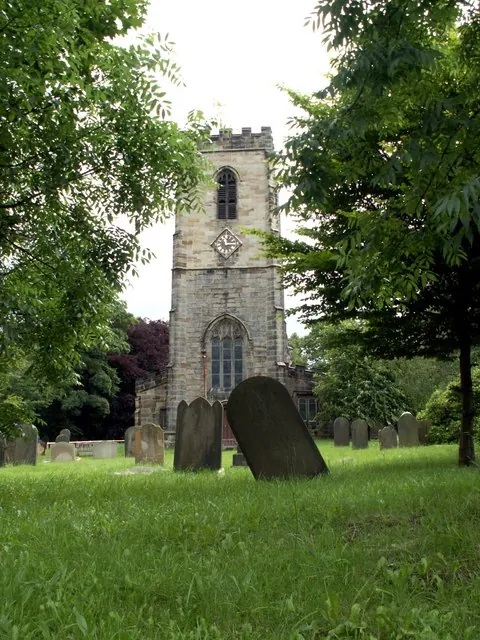
© John Fielding · Geograph · CC BY-SA 2.0
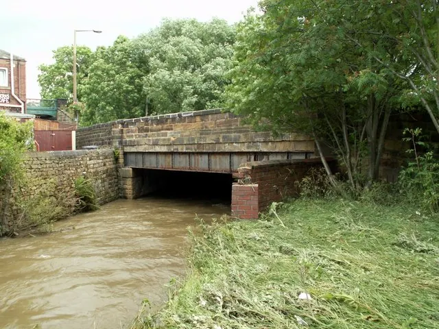
© John Fielding · Geograph · CC BY-SA 2.0
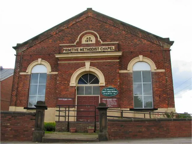
© Roger May · Geograph · CC BY-SA 2.0
Images © their respective photographers, licensed under CC BY-SA 2.0 and reused here with attribution. Photographs depict listed buildings, churches and monuments near this settlement and may show neighbouring villages.
Data derived from the Open Domesday project (opendomesday.org), based on the Domesday Book dataset compiled by Professor J.J.N. Palmer and team. The Domesday Book (1086) is in the public domain.
Found an inaccuracy? [email protected]