Darfield in the Domesday Book (1086)
The 1086 Domesday survey records the settlement of Darfield, entered under the hundred of Strafforth in Yorkshire. The survey assessed Darfield at 5.5 carucates of taxable land.
At the time of the survey, Darfield supported a recorded population of 4 villagers, 4 smallholders, 2 slaves, working 2 ploughs between them.
The drop in value is hard to miss. Before 1066, Darfield was worth 5.5 shillings; by 1086 that had dropped to 3.5 shillings – a fall of 36%. Most Yorkshire villages that lost value on this scale were swept up in the Harrying of the North – William’s scorched-earth campaign of 1069–70.
The survey lists 2 manors at Darfield under different lords. Splitting a single settlement between multiple tenants was common across the North – Saxon estates broken up and handed to William’s followers after 1066.
Resources Recorded at Darfield (1086)
- Meadow: 13 acres
Other Settlements in Strafforth
- Adwick [le Street]
- Adwick [upon Dearne]
- Armthorpe
- Aston
- Attercliffe
- Auckley
- Aughton [Hall]
- Austerfield
- Balby
- Barnbrough
- Barnby [Dun]
- Bentley
- Bilham [House]
- Billingley
The Meaning of the Name
The name Darfield is of Anglo-Saxon origin. Its final element derives from the Old English word feld, open country. The first element is most likely a personal name or an early descriptive term, now difficult to recover with certainty. Taken together the name probably meant something close to ‘a open land’.
Remarkably, the name has changed little since 1086, when the Domesday scribes wrote it as Darfield.
Listed Buildings Near Darfield
Historic England records 12 listed buildings within about a mile of Darfield. Listing protects structures of special architectural or historic interest, graded I (exceptional), II* (particularly important) and II.
Grade I
- Church of All Saints - 0.32 km
Grade II
- Garland House Surgery - 0.16 km
- Thornhill House - 0.18 km
- 2, Vicar Road - 0.23 km
- Gravestone to Robert Millthorp Approximately 3 Metres to West of Tower of Church of All Saints - 0.3 km
- Remains of Cross Approximately 7 Metres South of Porch of Church of All Saints - 0.32 km
- Milepost Opposite Junction With Little Houghton Lane - 0.33 km
- Grave of Ebenezer Elliot, Situated Approximately 40 Metres to South East of South Porch of Church of All Saints - 0.35 km
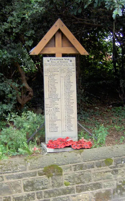
- Monument to Victims of Lundhill Colliery Explosion, Situated Approximately 55 Metres to South East of Church of All Saints - 0.37 km
- Middlewood Lodge - 0.43 km
- Middlewood Hall - 0.6 km
- Milepost on East Side of Short Link Road Approximately 150 Metres East of Junction With Barnsley Road - 1.26 km
Scheduled Monuments Near Darfield
Scheduled monuments are nationally important archaeological sites given legal protection. 1 lies within roughly a mile of Darfield:
Darfield Today
Today Darfield lies within the administrative area of Barnsley, and the settlement recorded a population of 10,685 at recent figures. Nine and a half centuries separate that figure from the small rural community the Domesday survey recorded here in 1086.
Read more about modern Darfield on Wikipedia .
Nearby Domesday Settlements
Other places recorded in the 1086 survey within a few miles:
- Little Houghton - 1.4 km NE
- Billingley - 2.0 km E
- Toftes - 2.2 km SW
- Wombwell - 2.2 km SW
- Great Houghton - 2.8 km NE
- Brampton Bierlow - 3.0 km S
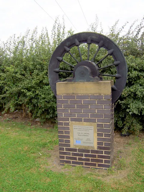
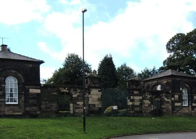
Heritage Around Darfield
Photographs of churches, listed buildings and monuments in the vicinity, contributed by volunteers to the Geograph project and reused here under a Creative Commons licence.
© Steve Fareham · Geograph · CC BY-SA 2.0
© Steve Fareham · Geograph · CC BY-SA 2.0
© Pat Cresswell · Geograph · CC BY-SA 2.0
Images © their respective photographers, licensed under CC BY-SA 2.0 and reused here with attribution. Photographs depict listed buildings, churches and monuments near this settlement and may show neighbouring villages.
Data derived from the Open Domesday project (opendomesday.org), based on the Domesday Book dataset compiled by Professor J.J.N. Palmer and team. The Domesday Book (1086) is in the public domain.
Found an inaccuracy? [email protected]