Danby in the Domesday Book (1086)
The settlement of Danby is recorded in William I’s Domesday survey of 1086, entered under the hundred of Langbaurgh in Yorkshire.
Other Settlements in Langbaurgh
- Acklam
- Airy [Holme]
- Aislaby
- Arnodestorp
- Baldebi
- Barnaby
- Barwick
- Battersby
- Bergolbi
- Berguluesbi
- Blaten [Carr]
- Borrowby
- Breck
- Brotton
The Meaning of the Name
The name Danby is of Scandinavian origin. Its final element derives from the Old Norse word bý, a farmstead or village. The first element is most likely a personal name or an early descriptive term, now difficult to recover with certainty. Taken together the name probably meant something close to ‘a farmstead’.
Names of this type are a fingerprint of Scandinavian settlement: they cluster across the old Danelaw, where Norse-speaking settlers renamed or founded villages from the late 9th century onward.
Remarkably, the name has changed little since 1086, when the Domesday scribes wrote it as Danby.
Listed Buildings Near Danby
Historic England records 19 listed buildings within about a mile of Danby. Listing protects structures of special architectural or historic interest, graded I (exceptional), II* (particularly important) and II.
Grade II*
- Church of St Hilda - 0.17 km
Grade II
- Wall, Gate Piers, Gates and Stable to North of Church of St Hilda - 0.15 km
- Mackwood Headstone at North-east Corner of Nave of St Hilda’s Church - 0.18 km
- Agar Tomb to East of Tower of St Hilda’s Church - 0.18 km
- Prudom headstone and stone to north, 0.5 metres,south of St. Hilda’s church tower - 0.19 km
- Churchyard Cross 10 Metres South of Tower of St Hilda’s Church - 0.19 km
- Barn to South West of Lumley House - 0.85 km
- Lumley House - 0.87 km
- Barn to South-east of Crag House - 0.96 km
- Byre to South of Crag House - 0.98 km
- Byre to South-west of Crag House - 0.99 km
- Crag House and Barn Attached - 0.99 km
- Outbuildings to North of Crag House - 1.0 km
- The Vicarage - 1.02 km
- Wall and Outbuilding to West of the Vicarage - 1.03 km
- Cart Shed to South-east of Forest Lodge Farmhouse - 1.08 km
- Threshing barn to east of Forest Lodge Farmhouse, and barn attached - 1.09 km
- Stable and Byre With Loft to North-east of Forest Lodge Farmhouse - 1.11 km
- Forest Lodge Farmhouse and Attached Byre - 1.12 km
Scheduled Monuments Near Danby
Scheduled monuments are nationally important archaeological sites given legal protection. 2 lie within roughly a mile of Danby:
- Danby Rigg cairnfields, cross dykes, funerary monuments and associated features - 1.29 km
- Cairnfield on The Howe, Danby Low Moor, 330m north west of Howe Farm - 1.44 km
Nearby Domesday Settlements
Other places recorded in the 1086 survey within a few miles:
- Crunkly Gill - 6.1 km E
- Hangton Hill - 7.0 km E
- Lealholm - 7.1 km E
- Stainton - 7.3 km N
- Hangton - 7.6 km SE
- Moorsholm - 8.1 km N
Heritage Around Danby
Photographs of churches, listed buildings and monuments in the vicinity, contributed by volunteers to the Geograph project and reused here under a Creative Commons licence.
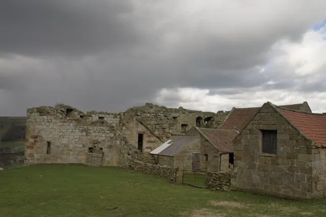
© Colin Grice · Geograph · CC BY-SA 2.0
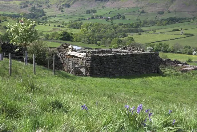
© Colin Grice · Geograph · CC BY-SA 2.0
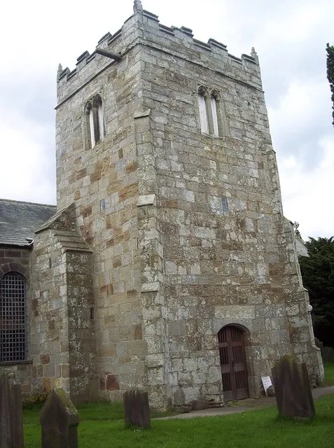
© Maigheach-gheal · Geograph · CC BY-SA 2.0
Images © their respective photographers, licensed under CC BY-SA 2.0 and reused here with attribution. Photographs depict listed buildings, churches and monuments near this settlement and may show neighbouring villages.
Data derived from the Open Domesday project (opendomesday.org), based on the Domesday Book dataset compiled by Professor J.J.N. Palmer and team. The Domesday Book (1086) is in the public domain.
Found an inaccuracy? [email protected]