Dacre in the Domesday Book (1086)
Dacre appears in the Domesday Book of 1086, entered under the hundred of Burghshire in Yorkshire. The survey assessed Dacre at 3 carucates of taxable land.
At the time of the survey, Dacre supported a recorded population of 1 villager.
The numbers record a sharp fall. Before 1066, Dacre was worth 1 shilling; by 1086 that had dropped to 2d – a fall of 90%. Most Yorkshire villages that lost value on this scale were swept up in the Harrying of the North – William’s scorched-earth campaign of 1069–70.
Resources Recorded at Dacre (1086)
- Meadow: 4 acres
- Woodland: 0.5 league * 4 furlongs mixed measures
Other Settlements in Burghshire
- Addlethorpe
- Aismunderby
- Aldfield
- Allerton [Mauleverer]
- Arkendale
- Askwith
- Azerley
- Barrowby [Grange]
- Beckwith [House]
- Besthaim
- Bestham
- Bewerley
- Bilton
- Birstwith
The Meaning of the Name
The origin of the name Dacre is not securely established from its modern form alone; like many settlement names in the North it likely combines an Old English or Old Norse personal name with a landscape term.
Remarkably, the name has changed little since 1086, when the Domesday scribes wrote it as Dacre.
Listed Buildings Near Dacre
Historic England records 23 listed buildings within about a mile of Dacre. Listing protects structures of special architectural or historic interest, graded I (exceptional), II* (particularly important) and II.
Grade II*
- Doughill Hall - 1.29 km
Grade II
- Pyefield House - 0.38 km
- Barn and Attached Hay Barn Approximately 5 Metres North East of Pyefield House - 0.39 km
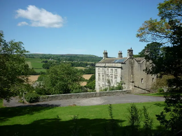
- Dacre Hall - 0.43 km
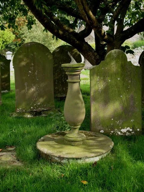
- Sundial in Graveyard Approximately 15 Metres South of Providence Chapel - 0.55 km
- Providence Chapel - 0.56 km
- Manor House Farmhouse - 0.7 km
- Barn Approximately 15 Metres East of Manor House - 0.73 km
- Darley Mill With Attached Chimney - 0.79 km
- Darley Mill House - 0.82 km
- Low Hall - 0.87 km
- Laburnum House and Barn - 0.93 km
- Quaker Burial Ground Approximately 300 Metres North-west of Beasting Farm - 0.93 km
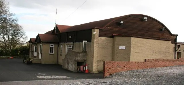
- Wesleyan Chapel - 0.94 km
- Stocks - 0.97 km
- Stable, Cartshed and Hay Loft Range 10 Metres South West of Dowgill Farmhouse - 1.07 km
- Dowgill Farmhouse - 1.09 km
- Throstle Nest - 1.09 km
- Farm Building Approximately 20 Metres South of Throstle Nest - 1.09 km
- Farmbuilding Approximately 100 Metres South West of Dougill Hall - 1.22 km
- Barn and Byre Range Approximately 100 Metres West of Dougill Hall - 1.24 km
- Garden Walls With Gate Piers and Gates to South and North of Dougill Hall - 1.27 km
- Sundial Approximately 15 Metres South of Dougill Hall - 1.28 km
Dacre Today
Today Dacre lies within the administrative area of North Yorkshire, and the settlement recorded a population of 764 at the 2021 census. Nine and a half centuries separate that figure from the small rural community the Domesday survey recorded here in 1086.
Read more about modern Dacre on Wikipedia .
Nearby Domesday Settlements
Other places recorded in the 1086 survey within a few miles:
- Brimham Hall - 3.6 km NE
- Birstwith - 4.1 km E
- Wilsill - 4.1 km N
- Bewerley - 5.6 km NW
- Felliscliffe - 5.6 km SE
- Besthaim - 6.0 km S
Heritage Around Dacre
Photographs of churches, listed buildings and monuments in the vicinity, contributed by volunteers to the Geograph project and reused here under a Creative Commons licence.
© David Rogers · Geograph · CC BY-SA 2.0
© Ian S · Geograph · CC BY-SA 2.0
© Gordon Hatton · Geograph · CC BY-SA 2.0
Images © their respective photographers, licensed under CC BY-SA 2.0 and reused here with attribution. Photographs depict listed buildings, churches and monuments near this settlement and may show neighbouring villages.
Data derived from the Open Domesday project (opendomesday.org), based on the Domesday Book dataset compiled by Professor J.J.N. Palmer and team. The Domesday Book (1086) is in the public domain.
Found an inaccuracy? [email protected]