Cullingworth in the Domesday Book (1086)
The 1086 Domesday survey records the settlement of Cullingworth, entered under the hundred of Craven in Yorkshire.
Other Settlements in Craven
- Addingham
- Airton
- Anley
- Appletreewick
- Arncliffe
- Arnford
- Barnoldswick
- Bashall [Eaves]
- Battersby [Barn]
- Beamsley
- Birkby [Hall]
- Bogeuurde
- Bolton [Abbey]
- Bolton [by Bowland]
The Meaning of the Name
The name Cullingworth is of Anglo-Saxon origin. Its final element derives from the Old English word worð, an enclosure or homestead. The first element is most likely a personal name or an early descriptive term, now difficult to recover with certainty. Taken together the name probably meant something close to ‘a enclosure’.
Remarkably, the name has changed little since 1086, when the Domesday scribes wrote it as Cullingworth.
Listed Buildings Near Cullingworth
Historic England records 23 listed buildings within about a mile of Cullingworth. Listing protects structures of special architectural or historic interest, graded I (exceptional), II* (particularly important) and II.
Grade II
- 37, Manywells Brow - 0.17 km
- Cullingworth Baptist Church - 0.27 km
- Boundary Wall Railings and Gates at Cullingworth Baptist Church - 0.29 km
- The Nook - 0.35 km
- 14 and 14A, Station Road - 0.36 km
- 17 and 19, Station Road - 0.37 km
- 16 and 18, Station Road - 0.37 km
- Cullingworth War Memorial - 0.37 km
- 26 and 28, Station Road - 0.38 km
- 30, Station Road - 0.39 km
- Town End Farmhouse - 0.4 km
- Manor Farm Cottage - 0.41 km
- Wesleyan Methodist Chapel - 0.41 km
- 5, Station Road - 0.42 km
- Barn to north of number 5 - 0.44 km
- Church of St John - 0.45 km
- Cullingworth Fields Farmhouse - 0.77 km
- Barn approximately 15 metres west of Cullingworth Fields Farmhouse - 0.79 km
- Cow House Farmhouse - 0.88 km
- Hallas Hall Farm Cottages - 0.93 km
- Hewenden Viaduct - 1.13 km
- Mill on the North Bank of Hewenden Beck - 1.16 km
- Laburnum Cottage - 1.28 km
Scheduled Monuments Near Cullingworth
Scheduled monuments are nationally important archaeological sites given legal protection. 1 lies within roughly a mile of Cullingworth:
Cullingworth Today
Today Cullingworth lies within the administrative area of Bradford, and the settlement recorded a population of 3,513 at the 2021 census. Nine and a half centuries separate that figure from the small rural community the Domesday survey recorded here in 1086.
Read more about modern Cullingworth on Wikipedia .
Nearby Domesday Settlements
Other places recorded in the 1086 survey within a few miles:
Heritage Around Cullingworth
Photographs of churches, listed buildings and monuments in the vicinity, contributed by volunteers to the Geograph project and reused here under a Creative Commons licence.
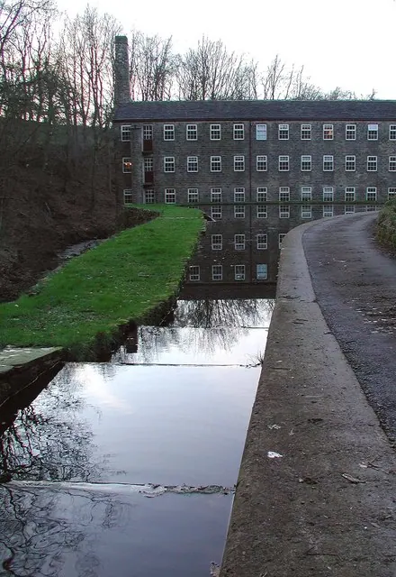
© Paul Glazzard · Geograph · CC BY-SA 2.0
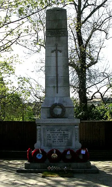
© Betty Longbottom · Geograph · CC BY-SA 2.0
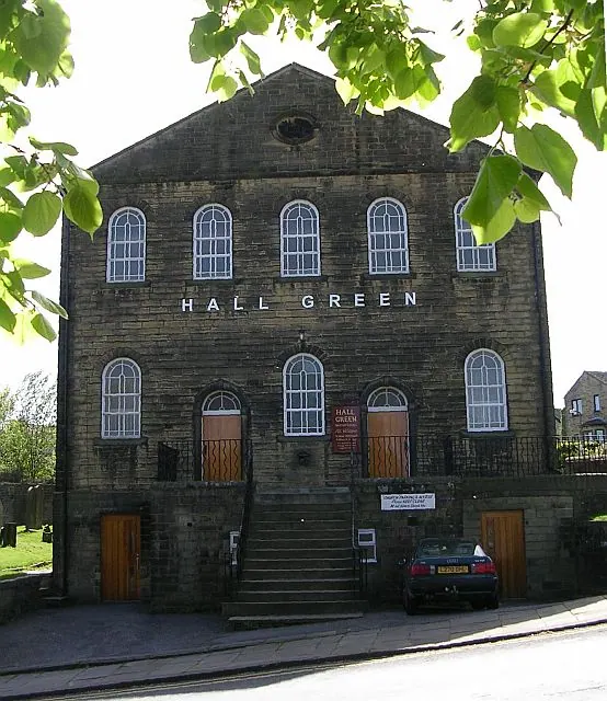
© Betty Longbottom · Geograph · CC BY-SA 2.0
Images © their respective photographers, licensed under CC BY-SA 2.0 and reused here with attribution. Photographs depict listed buildings, churches and monuments near this settlement and may show neighbouring villages.
Data derived from the Open Domesday project (opendomesday.org), based on the Domesday Book dataset compiled by Professor J.J.N. Palmer and team. The Domesday Book (1086) is in the public domain.
Found an inaccuracy? [email protected]