Crivelton in the Domesday Book (1086)
The settlement of Crivelton is recorded in William I’s Domesday survey of 1086, entered under the hundred of Amounderness in Yorkshire.
Other Settlements in Amounderness
- Aighton
- Aldcliffe
- Aldingham
- Arkholme
- Aschebi
- Ashton [Hall]
- Ashton [on Ribble]
- Austwick
- Barbon
- Bardsea
- Bare
- Barnoldswick
- Barton
- Beetham
The Meaning of the Name
The name Crivelton is of Anglo-Saxon origin. Its final element derives from the Old English word tūn, a farmstead or village. The first element is most likely a personal name or an early descriptive term, now difficult to recover with certainty. Taken together the name probably meant something close to ‘a farmstead’.
Remarkably, the name has changed little since 1086, when the Domesday scribes wrote it as Crivelton.
Listed Buildings Near Crivelton
Historic England records 34 listed buildings within about a mile of Crivelton. Listing protects structures of special architectural or historic interest, graded I (exceptional), II* (particularly important) and II.
Grade I
- Furness Abbey Wall - 0.69 km
- Furness Abbey, Including All Medieval Remains in Care of English Heritage - 0.82 km
- Capella Extra Portas With Attached Walls - 0.93 km
- West Gate to Furness Abbey, Remains of - 0.94 km
- Gateway Adjoining Capella Extra - 0.95 km
Grade II*
- Park House Farmhouse - 0.49 km
- Abbey House Hotel - 1.09 km
Grade II
- South Lodge at Abbotswood (Not Included) - 0.62 km
- Furness Abbey, Former Custodian’s Cottage - 0.65 km
- Kitchen Garden Perimeter Wall at Home Farm - 0.78 km
- Home Farmhouse and Attached Farm Buildings - 0.81 km
- Bridge Over Mill Beck and Attached Gateway at Abbey Vale - 0.88 km
- Abbey Vale - 0.88 km
- The Abbey Tavern - 0.92 km
- West Gate Cottage - 0.94 km
- Rose Cottage - 0.96 km
- Engine House at Ngr Sd 2325 7080 to North East of Glenfield House - 0.97 km
- Former Mine Building Immediately to North of Glenfield House - 0.97 km
- Entrance Gateways to Glenfield House Including Attached Side Gate to Rose Cottage - 0.97 km
- Furness Abbey Cottage - 0.98 km
- Glenfield House - 1.0 km
- Oaklands - 1.01 km
- Manor Farmhouse - 1.11 km
- West Lodge to Abbey House With Attached Gatehouse and Wing Walls - 1.13 km
…and 10 more listed structures in the area.
Scheduled Monuments Near Crivelton
Scheduled monuments are nationally important archaeological sites given legal protection. 2 lie within roughly a mile of Crivelton:
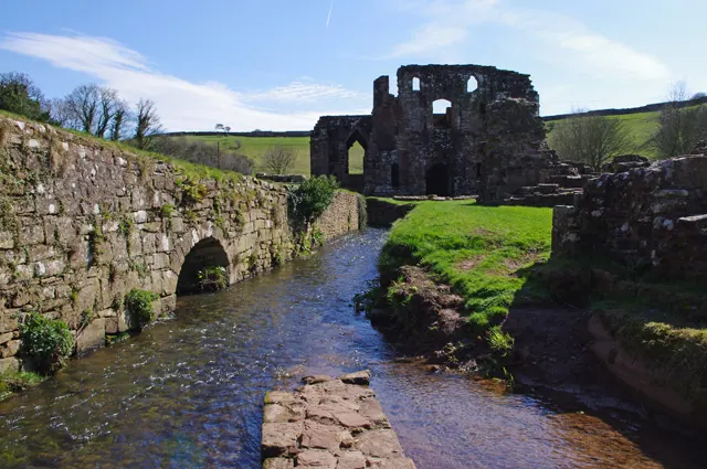
- Bow Bridge medieval multi-span bridge - 0.22 km
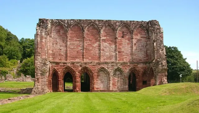
- Furness Abbey Savignac and Cistercian monasteries: precinct wall, great gatehouse, ‘chapel outside the gates’, south west gateway and earthworks. - 0.79 km
Crivelton Today
Today Crivelton lies within the administrative area of Dalton Town with Newton.
Read more about modern Newton on Wikipedia .
Nearby Domesday Settlements
Other places recorded in the 1086 survey within a few miles:
Heritage Around Crivelton
Photographs of churches, listed buildings and monuments in the vicinity, contributed by volunteers to the Geograph project and reused here under a Creative Commons licence.
© Stephen Middlemiss · Geograph · CC BY-SA 2.0

© George Hopkins · Geograph · CC BY-SA 2.0
© Ian Taylor · Geograph · CC BY-SA 2.0
Images © their respective photographers, licensed under CC BY-SA 2.0 and reused here with attribution. Photographs depict listed buildings, churches and monuments near this settlement and may show neighbouring villages.
Data derived from the Open Domesday project (opendomesday.org), based on the Domesday Book dataset compiled by Professor J.J.N. Palmer and team. The Domesday Book (1086) is in the public domain.
Found an inaccuracy? [email protected]