Coxwold in the Domesday Book (1086)
Coxwold is named in the Domesday Book, compiled by Norman commissioners in 1086, entered under the hundred of Yarlestre in Yorkshire.
Other Settlements in Yarlestre
- Arden [Hall]
- Asenby
- Bagby
- Baxby
- Bergebi
- Berghebi
- Bernebi
- Boltby
- Breckenbrough
- Carlton [Husthwaite]
- Carlton [Miniott]
- Catton
- Crakehill
- Crayke
The Meaning of the Name
The origin of the name Coxwold is not securely established from its modern form alone; like many settlement names in the North it likely combines an Old English or Old Norse personal name with a landscape term.
Remarkably, the name has changed little since 1086, when the Domesday scribes wrote it as Coxwold.
Listed Buildings Near Coxwold
Historic England records 26 listed buildings within about a mile of Coxwold. Listing protects structures of special architectural or historic interest, graded I (exceptional), II* (particularly important) and II.
Grade I
- Church of St Michael - 0.41 km
- Shandy Hall - 0.52 km
- Newburgh Priory - 1.21 km
Grade II
- Elphin House - 0.32 km
- Ivy House and Attached Railings - 0.35 km
- Alma House and Attached Railings - 0.35 km
- The Old Hall - 0.36 km
- Almshouses - 0.36 km
- Front Boundary Wall and Archway at the Old Hall - 0.37 km
- Hillcrest Maxwell House - 0.39 km
- Coxwold War Memorial Within the Churchyard of Saint Michael’s Church - 0.39 km
- Sterne Memorial in 4Th Bay on South Side of Nave of Church of St Michael - 0.41 km
- Entrance Gate Piers at Colville Hall - 0.43 km
- Colville Hall - 0.46 km
- The Manor House - 0.49 km
- Newburgh Mill - 0.86 km
- Barn at Home Farm - 1.03 km
- Newburgh House - 1.04 km
- Walls to Dog Kennel Garden With Attached Outbuildings to North - 1.11 km
- Stable Block Approximately 50 Metres North West of Newburgh Priory - 1.13 km
- Gates and Gate Piers on West Side of Road Opposite Main Gateway - 1.14 km
- North Lodge, South Lodge and Entrance Gates With Attached Railings to Newburgh Priory - 1.17 km
- Walls, Gate Piers, Gates and Bothy in Old Garden - 1.21 km
- Sundial Approximately 3 Metres South of South West Range of Newburgh Priory - 1.22 km
…and 2 more listed structures in the area.
Coxwold Today
Today Coxwold lies within the administrative area of North Yorkshire, and the settlement recorded a population of 184 at the 2021 census. Nine and a half centuries separate that figure from the small rural community the Domesday survey recorded here in 1086.
Read more about modern Coxwold on Wikipedia .
Nearby Domesday Settlements
Other places recorded in the 1086 survey within a few miles:
- Wildon Grange - 2.2 km NW
- Baxby - 2.8 km SW
- Kilburn - 2.8 km NW
- Oulston - 3.2 km S
- Carlton Husthwaite - 4.1 km W
- Thorpe le Willows - 4.1 km E
Heritage Around Coxwold
Photographs of churches, listed buildings and monuments in the vicinity, contributed by volunteers to the Geograph project and reused here under a Creative Commons licence.
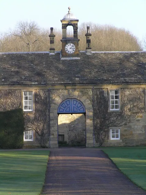
© Colin Grice · Geograph · CC BY-SA 2.0
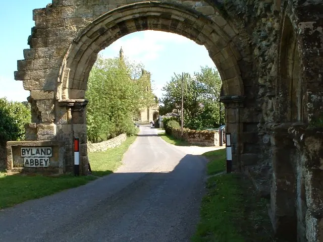
© Colin Grice · Geograph · CC BY-SA 2.0
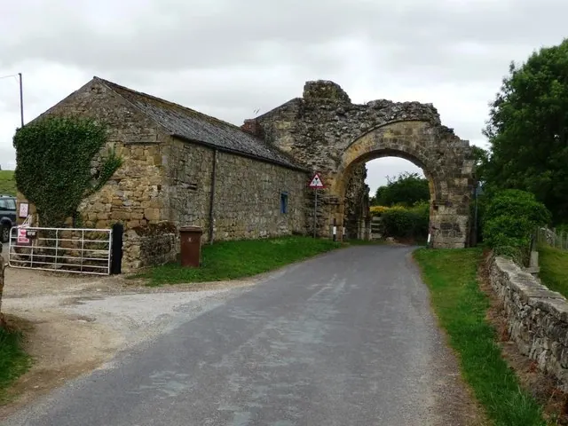
© Christine Johnstone · Geograph · CC BY-SA 2.0
Images © their respective photographers, licensed under CC BY-SA 2.0 and reused here with attribution. Photographs depict listed buildings, churches and monuments near this settlement and may show neighbouring villages.
Data derived from the Open Domesday project (opendomesday.org), based on the Domesday Book dataset compiled by Professor J.J.N. Palmer and team. The Domesday Book (1086) is in the public domain.
Found an inaccuracy? [email protected]