Conksbury in the Domesday Book (1086)
The settlement of Conksbury is recorded in William I’s Domesday survey of 1086, entered under the hundred of Blackwell in Derbyshire.
Other Settlements in Blackwell
- Abney
- Ashford [-in-the-Water]
- Aston
- Bakewell
- Bamford
- Baslow
- Beeley
- Birchills
- Birchover
- Blackwell
- Bradwell
- Bubnell
- Burley
- Burton
The Meaning of the Name
The name Conksbury is of Anglo-Saxon origin. Its final element derives from the Old English word burh, a fortified place. The first element is most likely a personal name or an early descriptive term, now difficult to recover with certainty. Taken together the name probably meant something close to ‘a stronghold’.
Remarkably, the name has changed little since 1086, when the Domesday scribes wrote it as Conksbury.
Listed Buildings Near Conksbury
Historic England records 40 listed buildings within about a mile of Conksbury. Listing protects structures of special architectural or historic interest, graded I (exceptional), II* (particularly important) and II.
Grade II
- Coal Pit Bridge Over the River Lathkill - 0.32 km
- Conksbury Bridge - 0.44 km
- Raper Lodge - 0.45 km
- Conksbury Farmhouse - 0.58 km
- Conksbury Hall - 0.65 km
- Garden Walls, Pergola and Gatepiers to Raenstor Close - 0.93 km
- Raenstor Close and Attached Garage - 0.94 km
- Lodge, Stableblock and Outbuilding to Raenstor Close - 0.94 km
- Rock House - 0.97 km
- Fern Glen - 0.97 km
- Riverside - 0.97 km
- Lathkill House Farmhouse - 0.99 km
- Haddonfields Farmhouse - 1.0 km
- Bridge 10 Metres North West of Alport Mill - 1.01 km
- The Cottage - 1.02 km
- Mill Cottage - 1.04 km
- Alport Mill - 1.05 km
- Hill View and Attached Barn - 1.06 km
- Rose Cottage Sunny View - 1.06 km
- Monks Hall and Cottage and attached garden walls and gatepiers - 1.06 km
- Bradford House the Cottage - 1.07 km
- Mill Bridge - 1.07 km
- All Saints School and School House - 1.1 km
- Linden Cottage - 1.11 km
…and 16 more listed structures in the area.
Scheduled Monuments Near Conksbury
Scheduled monuments are nationally important archaeological sites given legal protection. 6 lie within roughly a mile of Conksbury:
- Bowl barrow on Haddon Fields - 0.15 km
- Conksbury deserted medieval settlement - 0.53 km
- Bowl barrow on Haddon Fields - 0.73 km
- Alport smelt mill - 0.97 km
- Meadow Place bowl barrow - 1.33 km
- Nether Haddon medieval settlement and part of an open field system, Romano-British field system and lead mining remains, 600m south west of Haddon Hall - 1.36 km
Conksbury Today
Today Conksbury lies within the administrative area of Youlgrave.
Read more about modern Conksbury on Wikipedia .
Nearby Domesday Settlements
Other places recorded in the 1086 survey within a few miles:
Heritage Around Conksbury
Photographs of churches, listed buildings and monuments in the vicinity, contributed by volunteers to the Geograph project and reused here under a Creative Commons licence.
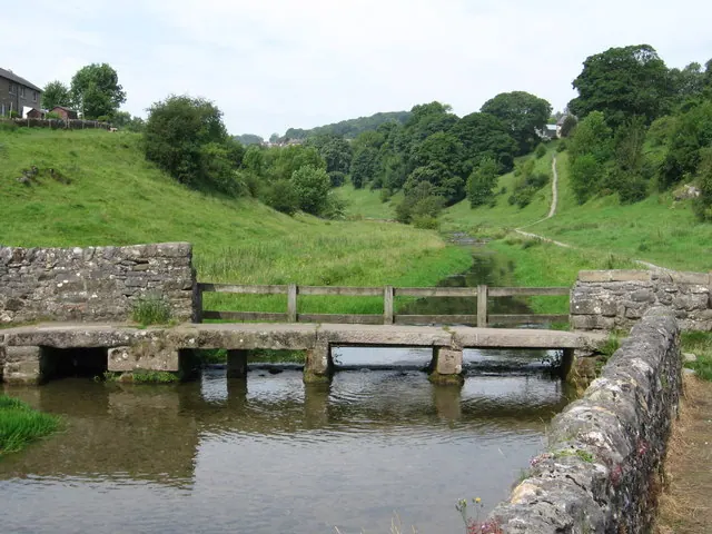
© Dave Bevis · Geograph · CC BY-SA 2.0
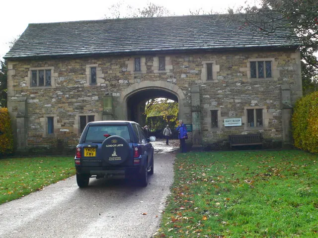
© Eirian Evans · Geograph · CC BY-SA 2.0
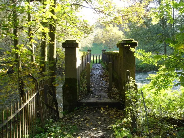
© Roger McLachlan · Geograph · CC BY-SA 2.0
Images © their respective photographers, licensed under CC BY-SA 2.0 and reused here with attribution. Photographs depict listed buildings, churches and monuments near this settlement and may show neighbouring villages.
Data derived from the Open Domesday project (opendomesday.org), based on the Domesday Book dataset compiled by Professor J.J.N. Palmer and team. The Domesday Book (1086) is in the public domain.
Found an inaccuracy? [email protected]