Conistone in the Domesday Book (1086)
Conistone is named in the Domesday Book, compiled by Norman commissioners in 1086, entered under the hundred of Craven in Yorkshire.
Other Settlements in Craven
- Addingham
- Airton
- Anley
- Appletreewick
- Arncliffe
- Arnford
- Barnoldswick
- Bashall [Eaves]
- Battersby [Barn]
- Beamsley
- Birkby [Hall]
- Bogeuurde
- Bolton [Abbey]
- Bolton [by Bowland]
The Meaning of the Name
The origin of the name Conistone is not securely established from its modern form alone; like many settlement names in the North it likely combines an Old English or Old Norse personal name with a landscape term.
Remarkably, the name has changed little since 1086, when the Domesday scribes wrote it as Conistone.
Listed Buildings Near Conistone
Historic England records 13 listed buildings within about a mile of Conistone. Listing protects structures of special architectural or historic interest, graded I (exceptional), II* (particularly important) and II.
Grade II
- The Old Hall With Boundary Wall to Front and Old Hall Cottage - 0.43 km
- Hemplands Farmhouse - 0.45 km
- Barn at Sd 9813 6744 - 0.46 km
- Maypole Cottage, Formerly Conistone Post Office - 0.49 km
- Two Chest Tombs Approximately 5 Metres South of the Church of St Mary - 0.5 km
- K6 telephone kiosk, Conistone - 0.5 km
- Renshaw Farm Cottage - 0.51 km
- Church of St Mary - 0.51 km
- Renshaw Farmhouse - 0.51 km
- Topham’s Farmhouse - 0.52 km
- Conistone Bridge Over River Wharfe - 0.65 km
- Angler’s Cottage - 1.17 km
- Crag Cottage - 1.27 km
Scheduled Monuments Near Conistone
Scheduled monuments are nationally important archaeological sites given legal protection. 9 lie within roughly a mile of Conistone:
- Enclosure S of Bull Scar - 0.37 km
- Enclosures 600yds (550m) SE of Wassa Hill - 0.58 km
- Hut circle, farm site and enclosures 340yds (310m) NE of Wassa Hill - 0.84 km
- Cairn on Old Pasture 885m NE of Little Lathe - 0.85 km
- Fields and hut circles SE of Scot Gate Lane - 0.88 km
- Enclosures on Old Pasture - 0.98 km
- Cairn on Old Pasture, 820m south east of Bull Scar - 0.98 km
- Enclosures and house sites NE of Hill Castles Scar - 1.09 km
- Cairns and settlements on Lea Green - 1.57 km
Conistone Today
Today Conistone lies within the administrative area of Conistone with Kilnsey.
Read more about modern Conistone on Wikipedia .
Nearby Domesday Settlements
Other places recorded in the 1086 survey within a few miles:
- Heuuorde - 0.0 km N
- Heuurde - 0.0 km N
- Kilnsey - 1.0 km W
- Grassington - 3.6 km SE
- Threshfield - 4.0 km S
- Hawkswick - 4.2 km NW
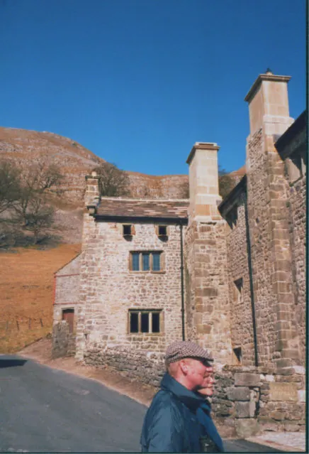
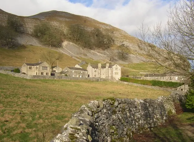
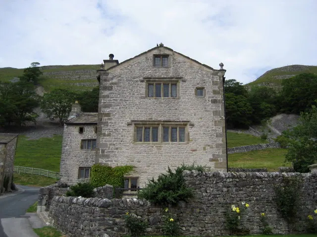
Heritage Around Conistone
Photographs of churches, listed buildings and monuments in the vicinity, contributed by volunteers to the Geograph project and reused here under a Creative Commons licence.
© Stephen Craven · Geograph · CC BY-SA 2.0
© Humphrey Bolton · Geograph · CC BY-SA 2.0
© Chris Heaton · Geograph · CC BY-SA 2.0
Images © their respective photographers, licensed under CC BY-SA 2.0 and reused here with attribution. Photographs depict listed buildings, churches and monuments near this settlement and may show neighbouring villages.
Data derived from the Open Domesday project (opendomesday.org), based on the Domesday Book dataset compiled by Professor J.J.N. Palmer and team. The Domesday Book (1086) is in the public domain.
Found an inaccuracy? [email protected]