Conisbrough in the Domesday Book (1086)
Conisbrough appears in the Domesday Book of 1086, entered under the hundred of Strafforth in Yorkshire. The survey assessed Conisbrough at 4.5 carucates of taxable land.
At the time of the survey, Conisbrough supported a recorded population of 4 villagers, 26 smallholders, 33 freemanmen, working 18 ploughs between them.
By 1086 Conisbrough was worth 4.77 shillings, up from 2.5 shillings before the Conquest – one of the few settlements in the area to hold its value through the upheaval.
The survey lists 2 manors at Conisbrough under different lords. Splitting a single settlement between multiple tenants was common across the North – Saxon estates broken up and handed to William’s followers after 1066.
Resources Recorded at Conisbrough (1086)
- Mills: 1 mills
- Churches: 2
- Sheep: 100
- Meadow: 5 acres
- Woodland: 27 None
Other Settlements in Strafforth
- Adwick [le Street]
- Adwick [upon Dearne]
- Armthorpe
- Aston
- Attercliffe
- Auckley
- Aughton [Hall]
- Austerfield
- Balby
- Barnbrough
- Barnby [Dun]
- Bentley
- Bilham [House]
- Billingley
The Meaning of the Name
The name Conisbrough is of Anglo-Saxon origin. Its final element derives from the Old English word burh, a fortified place. The first element is most likely a personal name or an early descriptive term, now difficult to recover with certainty. Taken together the name probably meant something close to ‘a stronghold’.
Remarkably, the name has changed little since 1086, when the Domesday scribes wrote it as Conisbrough.
Listed Buildings Near Conisbrough
Historic England records 15 listed buildings within about a mile of Conisbrough. Listing protects structures of special architectural or historic interest, graded I (exceptional), II* (particularly important) and II.
Grade I
- Conisbrough Castle - 0.46 km
- Church of St Peter - 0.48 km
Grade II
- Fountain and Lamp Standard at the southern entrance to Coronation Park - 0.31 km
- The Red Lion public house - 0.33 km
- War Memorial in Coronation Park - 0.33 km
- Conisbrough Wesleyan Methodist Chapel - 0.34 km
- Set of Stocks Resited in Coronation Park - 0.35 km
- The Priory (Offices of Local Authority Department) - 0.42 km
- 18 Church Street - 0.49 km
- The Old Priory Nursing Home and attached outbuilding - 0.52 km
- Well Cover Approximately 50 Metres North West of Junction With Church Street - 0.55 km
- West Portal - 1.12 km
- Milepost in Pavement to Front of Number 10 - 1.22 km
- Conisbrough Viaduct - 1.23 km
- Conisbrough Tunnel East Portal - 1.28 km
Scheduled Monuments Near Conisbrough
Scheduled monuments are nationally important archaeological sites given legal protection. 1 lies within roughly a mile of Conisbrough:
- Conisbrough Castle - 0.45 km
Conisbrough Today
Today Conisbrough lies within the administrative area of Doncaster, and the settlement recorded a population of 14,333 at recent figures. Nine and a half centuries separate that figure from the small rural community the Domesday survey recorded here in 1086.
Read more about modern Conisbrough on Wikipedia .
Nearby Domesday Settlements
Other places recorded in the 1086 survey within a few miles:
- Cadeby - 2.0 km N
- Clifton - 2.0 km S
- Old Edlington - 2.2 km SE
- Wildthorpe - 3.0 km N
- Hooton Roberts - 3.2 km W
- Denaby - 3.2 km W
Heritage Around Conisbrough
Photographs of churches, listed buildings and monuments in the vicinity, contributed by volunteers to the Geograph project and reused here under a Creative Commons licence.
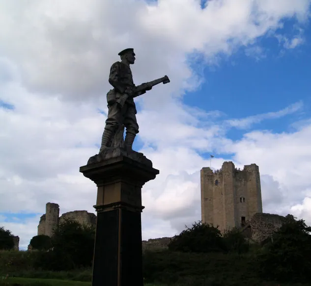
© Steve Fareham · Geograph · CC BY-SA 2.0
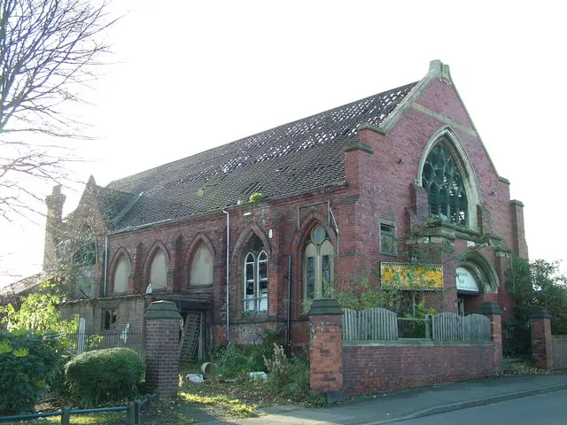
© stephen samson · Geograph · CC BY-SA 2.0
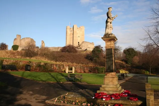
© Richard Croft · Geograph · CC BY-SA 2.0
Images © their respective photographers, licensed under CC BY-SA 2.0 and reused here with attribution. Photographs depict listed buildings, churches and monuments near this settlement and may show neighbouring villages.
Data derived from the Open Domesday project (opendomesday.org), based on the Domesday Book dataset compiled by Professor J.J.N. Palmer and team. The Domesday Book (1086) is in the public domain.
Found an inaccuracy? [email protected]