Codnor in the Domesday Book (1086)
Codnor appears in the Domesday Book of 1086, entered under the hundred of Morleystone in Derbyshire.
Other Settlements in Morleystone
- Bradley
- Breadsall
- Breaston
- Cellesdene
- Chaddesden
- Crich
- Denby
- Derby
- Draycott
- Duffield
- Hallam
- Heanor
- Herdebi
- Holbrook
The Meaning of the Name
The origin of the name Codnor is not securely established from its modern form alone; like many settlement names in the North it likely combines an Old English or Old Norse personal name with a landscape term.
Remarkably, the name has changed little since 1086, when the Domesday scribes wrote it as Codnor.
Listed Buildings Near Codnor
Historic England records 7 listed buildings within about a mile of Codnor. Listing protects structures of special architectural or historic interest, graded I (exceptional), II* (particularly important) and II.
Grade II
- 37, Nottingham Road - 0.45 km
- Home Farmhouse - 0.69 km
- Farm Building to South of Castle Farmhouse - 0.86 km
- Castle Farm - 0.89 km
- Remains of Codnor Castle - 0.92 km
- Church of St James - 1.03 km
- Codnor Gate Farm House - 1.27 km
Scheduled Monuments Near Codnor
Scheduled monuments are nationally important archaeological sites given legal protection. 1 lies within roughly a mile of Codnor:
- Codnor Castle - 0.9 km
Codnor Today
Today Codnor lies within the administrative area of Amber Valley, and the settlement recorded a population of 3,849 at the 2021 census. Nine and a half centuries separate that figure from the small rural community the Domesday survey recorded here in 1086.
Read more about modern Codnor on Wikipedia .
Nearby Domesday Settlements
Other places recorded in the 1086 survey within a few miles:
- Smithycote - 1.4 km SE
- Ripley - 3.2 km W
- Heanor - 3.2 km S
- Langley - 3.6 km SE
- Kidsleypark - 4.1 km S
- Denby - 4.2 km SW
Heritage Around Codnor
Photographs of churches, listed buildings and monuments in the vicinity, contributed by volunteers to the Geograph project and reused here under a Creative Commons licence.
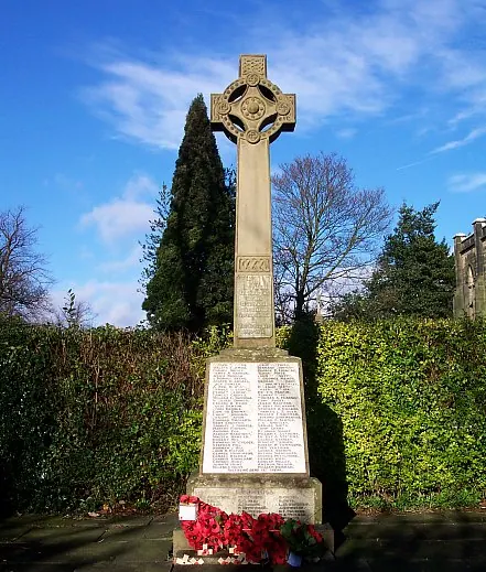
© Hugh McKenna · Geograph · CC BY-SA 2.0
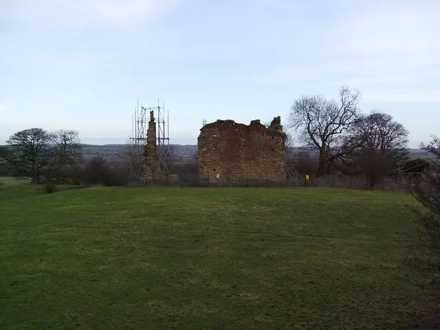
© peter skrobacz · Geograph · CC BY-SA 2.0
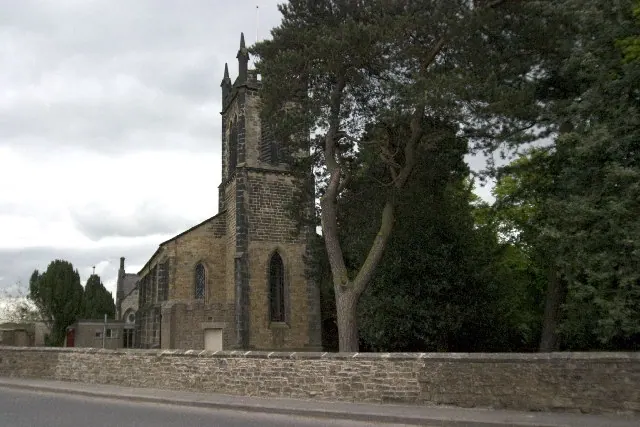
© Rob Bradford · Geograph · CC BY-SA 2.0
Images © their respective photographers, licensed under CC BY-SA 2.0 and reused here with attribution. Photographs depict listed buildings, churches and monuments near this settlement and may show neighbouring villages.
Data derived from the Open Domesday project (opendomesday.org), based on the Domesday Book dataset compiled by Professor J.J.N. Palmer and team. The Domesday Book (1086) is in the public domain.
Found an inaccuracy? [email protected]