Clifton in the Domesday Book (1086)
The 1086 Domesday survey records the settlement of Clifton, entered under the hundred of Morley in Yorkshire.
Other Settlements in Morley
- Allerton
- Armley
- Batley
- Beeston
- Bolton
- Bowling
- Bradford
- Bramley
- Calverley
- Carlton
- Chellow [Grange]
- Clayton
- Cruttonstall
- Dewsbury
The Meaning of the Name
The name Clifton is of Anglo-Saxon origin. Its final element derives from the Old English word tūn, a farmstead or village. The first element is most likely a personal name or an early descriptive term, now difficult to recover with certainty. Taken together the name probably meant something close to ‘a farmstead’.
Remarkably, the name has changed little since 1086, when the Domesday scribes wrote it as Clifton.
Listed Buildings Near Clifton
Historic England records 32 listed buildings within about a mile of Clifton. Listing protects structures of special architectural or historic interest, graded I (exceptional), II* (particularly important) and II.
Grade I
- Kirklees Hall Mansion and Attached Stables - 0.49 km
- Home Farm Building Number 9 Malthouse - 0.76 km
- Double Aisled Barn to North West of Kirklees Priory Gatehouse - 0.9 km
Grade II*
- Highley Hall and Barn - 0.82 km
- Home Farm Building Number 6 and 2 Cell House - 0.87 km
- Home Farm Building Number 7 L Shaped Aisled Barn - 0.9 km
- Single Aisled Cow House - 0.91 km
- Kirklees Priory Gatehouse - 0.92 km
Grade II
- Black Horse Hotel, 196, 198 and 200, Towngate - 0.28 km
- Gates and Gate Piers to Kirklees Hall - 0.41 km
- Lodge to Kirklees Hall - 0.42 km
- Kirklees Mill House and Kirklees Cottage - 0.62 km
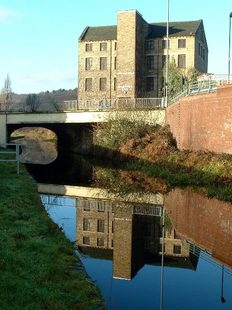
- Kirklees Mill - 0.65 km
- Calder and Hebble Navigation Kirklees Toplock Kirklees Cut Kirklees Top Lock - 0.72 km
- Calder and Hebble Navigation Brearley Bridge Kirklees Cut Brearley Bridge - 0.79 km
- Home Farm Building No 5, Two-storey gabled building - 0.86 km
- Calder and Hebble Navigation Milestone 100 Yards Upstream of Lower Kirklees Lock Kirklees Cut Milestone 100 Yards Upstream of Lower Kirklees Lock - 0.86 km
- 4 Bay Barn Barn to North West of Kirklees Priory Gatehouse Home Farm Building Number 4 - 0.86 km
- Cart Shed Home Farm Building Number 8 - 0.87 km
- 5 Bay Barn to North West of Kirklees Priory Gatehouse - 0.89 km
- Anchor Pit Lock - 0.93 km
- Boundary Stone 450 Yards West of Junction With Church Lane - 0.96 km
- Walls Which Enclose Former Orchard For Kirklees Priory 80 Metres East of Priory Gatehouse - 0.98 km
- The Nuns Grave - 1.0 km
…and 8 more listed structures in the area.
Scheduled Monuments Near Clifton
Scheduled monuments are nationally important archaeological sites given legal protection. 2 lie within roughly a mile of Clifton:
- Kirklees Priory, medieval nunnery - 0.95 km
- Castle Hill univallate defended settlement, Kirklees Park - 1.09 km
Clifton Today
Today Clifton lies within the administrative area of Calderdale.
Read more about modern Clifton on Wikipedia .
Nearby Domesday Settlements
Other places recorded in the 1086 survey within a few miles:
- Hartshead - 2.0 km E
- Bradley - 2.2 km SE
- Liversedge - 3.2 km E
- Rastrick - 3.2 km W
- Cleckheaton - 4.2 km NE
- Fixby - 4.2 km SW
Heritage Around Clifton
Photographs of churches, listed buildings and monuments in the vicinity, contributed by volunteers to the Geograph project and reused here under a Creative Commons licence.
© Nigel Homer · Geograph · CC BY-SA 2.0
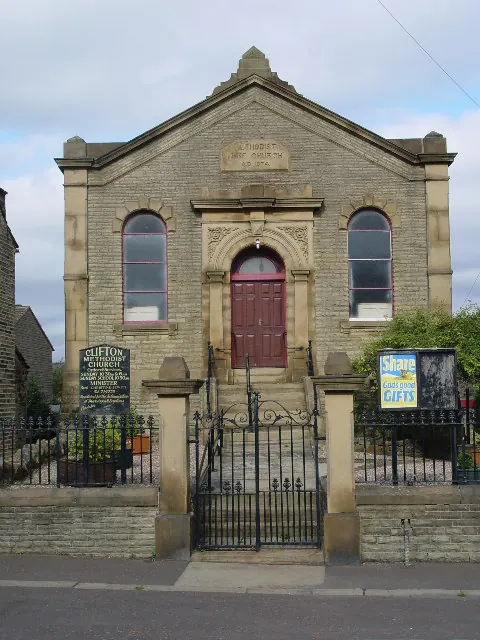
© Malcolm Street · Geograph · CC BY-SA 2.0
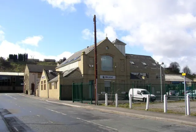
© Humphrey Bolton · Geograph · CC BY-SA 2.0
Images © their respective photographers, licensed under CC BY-SA 2.0 and reused here with attribution. Photographs depict listed buildings, churches and monuments near this settlement and may show neighbouring villages.
Data derived from the Open Domesday project (opendomesday.org), based on the Domesday Book dataset compiled by Professor J.J.N. Palmer and team. The Domesday Book (1086) is in the public domain.
Found an inaccuracy? [email protected]