Clifford in the Domesday Book (1086)
The settlement of Clifford is recorded in William I’s Domesday survey of 1086, entered under the hundred of Barkston in Yorkshire.
Other Settlements in Barkston
- Barkston
- Barlow
- Birkin
- Bramham
- Brayton
- Burton [Hall]
- Camblesforth
- Carlton
- Drax
- Fairburn
- Grimston [Grange]
- Hambleton
- Hazelwood [Castle]
- Hunchilhuse
The Meaning of the Name
The name Clifford is of Anglo-Saxon origin. Its final element derives from the Old English word ford, a river crossing. The first element is most likely a personal name or an early descriptive term, now difficult to recover with certainty. Taken together the name probably meant something close to ‘a ford’.
Remarkably, the name has changed little since 1086, when the Domesday scribes wrote it as Clifford.
Listed Buildings Near Clifford
Historic England records 51 listed buildings within about a mile of Clifford. Listing protects structures of special architectural or historic interest, graded I (exceptional), II* (particularly important) and II.
Grade II*
Grade II
- Nunnery House - 0.24 km
- Clifford War Memorial - 0.24 km
- Shamrock House, Drone House, Croft Cottage and Attached Cottages Known As Shamrock Cottage, Mya Cottage and Jemeal Cottage - 0.26 km
- Head’s House at Northways School and Disused Schoolroom Attached on Right - 0.28 km
- Baptismal Well and Flanking Walls - 0.3 km
- No. 36 High Street - 0.31 km
- Entrance Gateway to Church of St Luke With Attached Walls Lining North and East Sides of Churchyard - 0.33 km
- Church of St Luke - 0.35 km
- The Old Star Inn - 0.37 km
- 62, High Street - 0.45 km
- Outbuilding Approximately 10 Metres to South East of Number 62 - 0.47 km
- Laburnum Cottage - 0.52 km
- Clifford Moor Farmhouse - 0.95 km
- Ha-ha Situated Approximately 15 Metres to South of Clifford Moor Farmhouse - 0.96 km
- Oak Lodge - 1.04 km
- 200-204, High Street - 1.16 km
- Boston House and Attached Wing Wall - 1.16 km
- Boston Hall East Wing Mews Cottage West Wing - 1.16 km
- Boston Cottage - 1.17 km
- Jasmine Cottage and Attached Outbuildings Jasmine House and Attached Outbuildings - 1.17 km
- Stable Block to West of Number 212 (Listers Bedding Centre) - 1.17 km
- Rosemary Cottage - 1.18 km
- Manna Ash - 1.18 km
…and 27 more listed structures in the area.
Clifford Today
Today Clifford lies within the administrative area of Leeds, and the settlement recorded a population of 1,878 at the 2021 census. Nine and a half centuries separate that figure from the small rural community the Domesday survey recorded here in 1086.
Read more about modern Clifford on Wikipedia .
Nearby Domesday Settlements
Other places recorded in the 1086 survey within a few miles:
- Oglethorpe Hall - 2.0 km E
- Bramham - 2.0 km S
- Thorp Arch - 2.2 km NE
- Wothersome - 2.8 km SW
- Toulston - 3.0 km E
- Compton - 3.0 km W
Heritage Around Clifford
Photographs of churches, listed buildings and monuments in the vicinity, contributed by volunteers to the Geograph project and reused here under a Creative Commons licence.
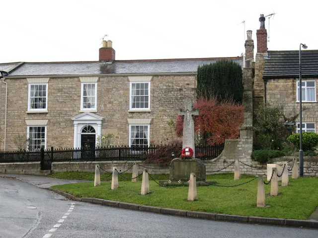
© Gordon Hatton · Geograph · CC BY-SA 2.0
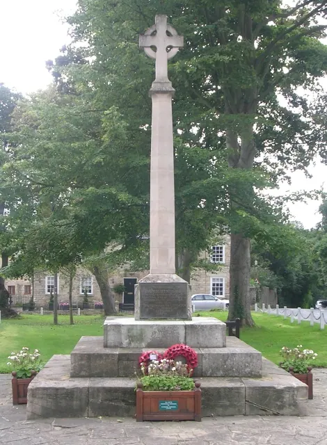
© Betty Longbottom · Geograph · CC BY-SA 2.0
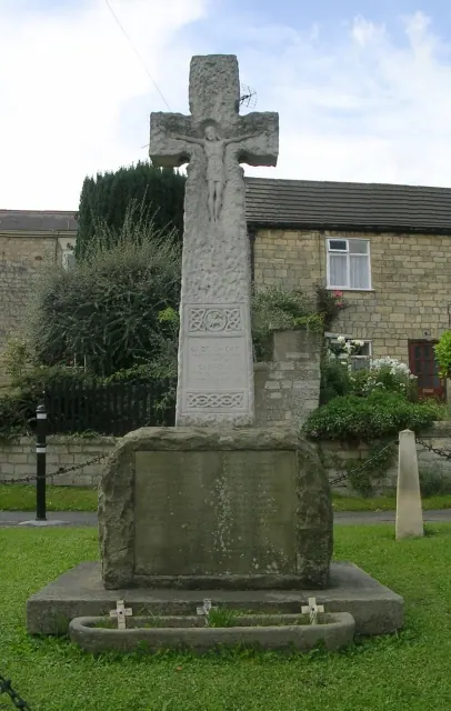
© Betty Longbottom · Geograph · CC BY-SA 2.0
Images © their respective photographers, licensed under CC BY-SA 2.0 and reused here with attribution. Photographs depict listed buildings, churches and monuments near this settlement and may show neighbouring villages.
Data derived from the Open Domesday project (opendomesday.org), based on the Domesday Book dataset compiled by Professor J.J.N. Palmer and team. The Domesday Book (1086) is in the public domain.
Found an inaccuracy? [email protected]