Cleckheaton in the Domesday Book (1086)
The 1086 Domesday survey records the settlement of Cleckheaton, entered under the hundred of Morley in Yorkshire.
Other Settlements in Morley
- Allerton
- Armley
- Batley
- Beeston
- Bolton
- Bowling
- Bradford
- Bramley
- Calverley
- Carlton
- Chellow [Grange]
- Clayton
- Clifton
- Cruttonstall
The Meaning of the Name
The name Cleckheaton is of Anglo-Saxon origin. Its final element derives from the Old English word tūn, a farmstead or village. The first element is most likely a personal name or an early descriptive term, now difficult to recover with certainty. Taken together the name probably meant something close to ‘a farmstead’.
Remarkably, the name has changed little since 1086, when the Domesday scribes wrote it as Cleckheaton.
Listed Buildings Near Cleckheaton
Historic England records 22 listed buildings within about a mile of Cleckheaton. Listing protects structures of special architectural or historic interest, graded I (exceptional), II* (particularly important) and II.
Grade II*
Grade II
- Spen Hall Including Adjoining Cottages - 0.11 km
- Cleckheaton Viaduct - 0.17 km
- Church of St John - 0.36 km
- Town Hall - 0.48 km
- Midland Bank - 0.48 km
- Warehouse at Ngr 1914 2530 - 0.49 km
- Old Post Office - 0.58 km
- War Memorial in King Edward Vii Memorial Park - 0.59 km
- George Hotel - 0.59 km
- Egypt - 0.71 km
- Barn to South West of Royds Farm - 0.81 km
- Lands Farmhouse - 0.88 km
- Sister’s Houses - 1.09 km
- Chapel at Cleckheaton Cemetery - 1.12 km
- Church of St Mary - 1.12 km
- Cleckheaton Library - 1.17 km
- Lower Blacup Farmhouse Including Numbers 2 and 3 - 1.25 km
- 179, 181 and 183, Quarry Road - 1.26 km
- 177, Quarry Road - 1.27 km
- 189, Quarry Road - 1.28 km
- Moravian Church - 1.28 km
Cleckheaton Today
Today Cleckheaton lies within the administrative area of Kirklees, and the settlement recorded a population of 16,622 at recent figures. Nine and a half centuries separate that figure from the small rural community the Domesday survey recorded here in 1086.
Read more about modern Cleckheaton on Wikipedia .
Nearby Domesday Settlements
Other places recorded in the 1086 survey within a few miles:
- Gomersal - 1.4 km NE
- Liversedge - 2.0 km S
- Hartshead - 3.2 km S
- Clifton - 4.2 km SW
- Wyke - 4.5 km NW
- North Bierley - 4.5 km NW
Heritage Around [Cleck]heaton
Photographs of churches, listed buildings and monuments in the vicinity, contributed by volunteers to the Geograph project and reused here under a Creative Commons licence.
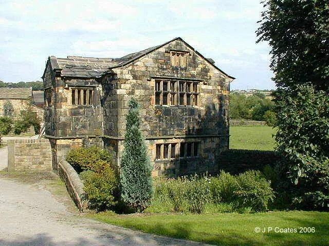
© John P Coates · Geograph · CC BY-SA 2.0
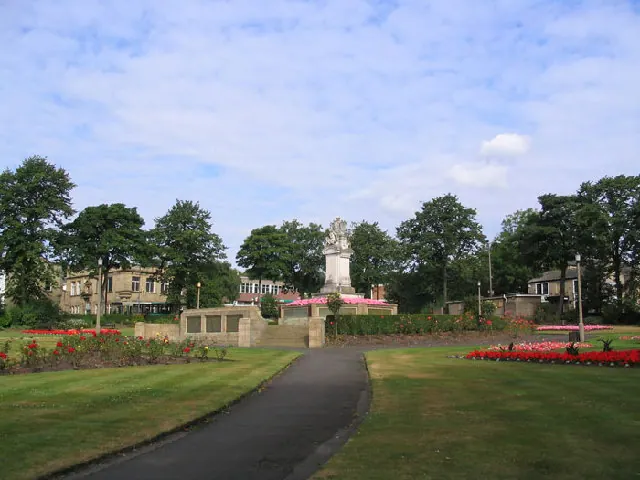
© Mick Melvin · Geograph · CC BY-SA 2.0
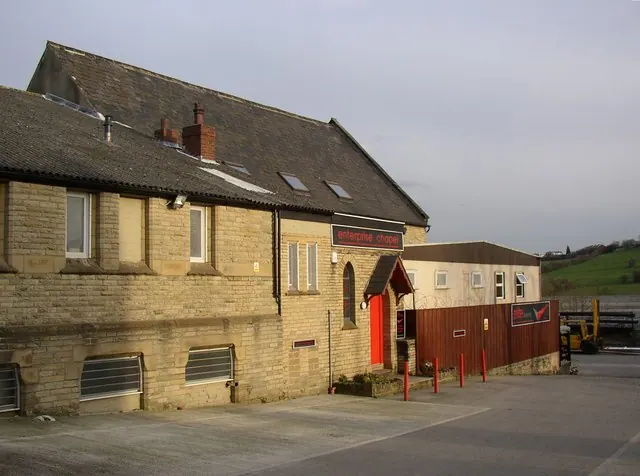
© Humphrey Bolton · Geograph · CC BY-SA 2.0
Images © their respective photographers, licensed under CC BY-SA 2.0 and reused here with attribution. Photographs depict listed buildings, churches and monuments near this settlement and may show neighbouring villages.
Data derived from the Open Domesday project (opendomesday.org), based on the Domesday Book dataset compiled by Professor J.J.N. Palmer and team. The Domesday Book (1086) is in the public domain.
Found an inaccuracy? [email protected]