Claughton in the Domesday Book (1086)
Claughton is named in the Domesday Book, compiled by Norman commissioners in 1086, entered under the hundred of Amounderness in Yorkshire.
Other Settlements in Amounderness
- Aighton
- Aldcliffe
- Aldingham
- Arkholme
- Aschebi
- Ashton [Hall]
- Ashton [on Ribble]
- Austwick
- Barbon
- Bardsea
- Bare
- Barnoldswick
- Barton
- Beetham
The Meaning of the Name
The name Claughton is of Anglo-Saxon origin. Its final element derives from the Old English word tūn, a farmstead or village. The first element is most likely a personal name or an early descriptive term, now difficult to recover with certainty. Taken together the name probably meant something close to ‘a farmstead’.
Remarkably, the name has changed little since 1086, when the Domesday scribes wrote it as Claughton.
Listed Buildings Near Claughton
Historic England records 10 listed buildings within about a mile of Claughton. Listing protects structures of special architectural or historic interest, graded I (exceptional), II* (particularly important) and II.
Grade I
- Claughton Hall - 0.76 km
Grade II*
- Claughton Hall Farmhouse - 0.07 km
Grade II
- Cross Base South of Church of St. Chad - 0.1 km
- Church of St Chad - 0.11 km
- Barn North-east of Claughton Hall Farmhouse, Adjoining Churchyard - 0.11 km
- The Old Rectory - 0.14 km
- Shaw House - 0.19 km
- Milestone - 0.22 km
- Farleton Farmhouse - 0.96 km
- Cross Base West of Turning to Farleton - 1.12 km
Scheduled Monuments Near Claughton
Scheduled monuments are nationally important archaeological sites given legal protection. 2 lie within roughly a mile of Claughton:
- Univallate prehistoric defended enclosure, hollow way and secondary enclosure 250m north of Claughton Hall - 0.7 km
- Camp House moated site, moated outwork and connecting channels - 1.24 km
Claughton Today
Today Claughton lies within the administrative area of Lancaster, and the settlement recorded a population of 126 at the 2021 census. Nine and a half centuries separate that figure from the small rural community the Domesday survey recorded here in 1086.
Read more about modern Claughton on Wikipedia .
Nearby Domesday Settlements
Other places recorded in the 1086 survey within a few miles:
- Farleton - 1.4 km NE
- Hornby - 2.8 km NE
- Gressingham - 3.2 km N
- Caton - 3.6 km SW
- Tatham - 5.0 km NE
- Nether and Over Kellet - 5.6 km NW
Heritage Around Claughton
Photographs of churches, listed buildings and monuments in the vicinity, contributed by volunteers to the Geograph project and reused here under a Creative Commons licence.
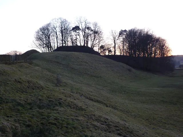
© Karl and Ali · Geograph · CC BY-SA 2.0
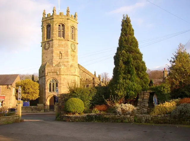
© Humphrey Bolton · Geograph · CC BY-SA 2.0
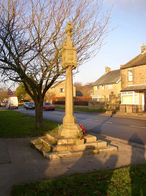
© Humphrey Bolton · Geograph · CC BY-SA 2.0
Images © their respective photographers, licensed under CC BY-SA 2.0 and reused here with attribution. Photographs depict listed buildings, churches and monuments near this settlement and may show neighbouring villages.
Data derived from the Open Domesday project (opendomesday.org), based on the Domesday Book dataset compiled by Professor J.J.N. Palmer and team. The Domesday Book (1086) is in the public domain.
Found an inaccuracy? [email protected]