Clapham in the Domesday Book (1086)
Clapham is named in the Domesday Book, compiled by Norman commissioners in 1086, entered under the hundred of Amounderness in Yorkshire.
Other Settlements in Amounderness
- Aighton
- Aldcliffe
- Aldingham
- Arkholme
- Aschebi
- Ashton [Hall]
- Ashton [on Ribble]
- Austwick
- Barbon
- Bardsea
- Bare
- Barnoldswick
- Barton
- Beetham
The Meaning of the Name
The name Clapham is of Anglo-Saxon origin. Its final element derives from the Old English word hām, a homestead or village. The first element is most likely a personal name or an early descriptive term, now difficult to recover with certainty. Taken together the name probably meant something close to ‘a homestead’.
Remarkably, the name has changed little since 1086, when the Domesday scribes wrote it as Clapham.
Listed Buildings Near Clapham
Historic England records 23 listed buildings within about a mile of Clapham. Listing protects structures of special architectural or historic interest, graded I (exceptional), II* (particularly important) and II.
Grade II*
- Ingleborough Hall - 0.16 km
Grade II
- Church of St James - 0.03 km
- Servants’ Tunnels to Ingleborough Hall and Gateway - 0.05 km
- Fall View - 0.05 km
- The Beeches (Upper Cottage) - 0.05 km
- The Beeches (Lower Cottage) - 0.06 km
- The Beeches (Middle Cottage) - 0.06 km
- Former Ingleborough Estate saw mill with log store - 0.07 km
- Church Bridge - 0.08 km
- Yew Tree Cottages - 0.13 km
- Icehouse in Grounds of Ingleborough Hall - 0.17 km
- Hall Garth - 0.2 km
- Cottage at Gildersbank - 0.24 km
- Brokken Bridge - 0.25 km
- Gildersbank Cottage and Spindle Tree Cottage - 0.25 km
- The Old Manor House - 0.29 km
- Base to Cross - 0.35 km
- Rose Cottage - 0.36 km
- Clapham Bridge - 0.38 km
- Bull and Cave Farmhouse - 0.39 km
- New Inn - 0.4 km
- Clapham Primary School - 0.45 km
- Boundary Stone About 400 Metres North East of Bowsber Farmhouse Clapham - 1.18 km
Scheduled Monuments Near Clapham
Scheduled monuments are nationally important archaeological sites given legal protection. 2 lie within roughly a mile of Clapham:
- Market Cross, Clapham - 0.35 km
- Native settlement - 1.51 km
Clapham Today
Today Clapham lies within the administrative area of Clapham cum Newby.
Read more about modern Clapham on Wikipedia .
Nearby Domesday Settlements
Other places recorded in the 1086 survey within a few miles:
- Heldetune - 1.4 km SE
- Austwick - 2.2 km SE
- Ingleton - 5.8 km NW
- Selside - 7.2 km NE
- Horton in Ribblesdale - 7.6 km NE
- Thornton in Lonsdale - 8.0 km NW
Heritage Around Clapham
Photographs of churches, listed buildings and monuments in the vicinity, contributed by volunteers to the Geograph project and reused here under a Creative Commons licence.
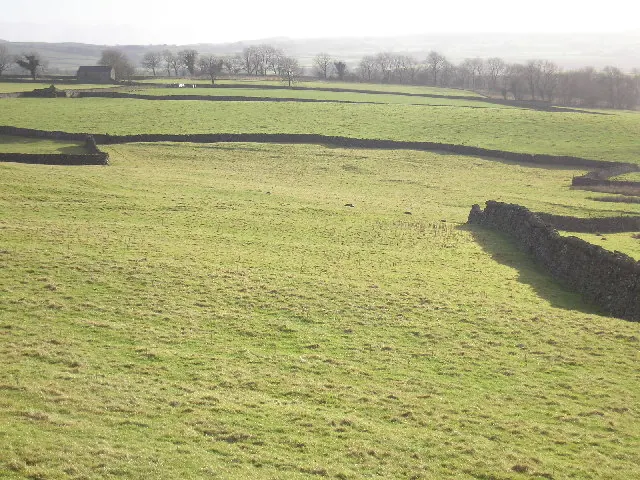
© John Illingworth · Geograph · CC BY-SA 2.0
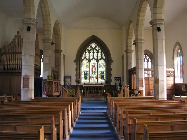
© John Illingworth · Geograph · CC BY-SA 2.0
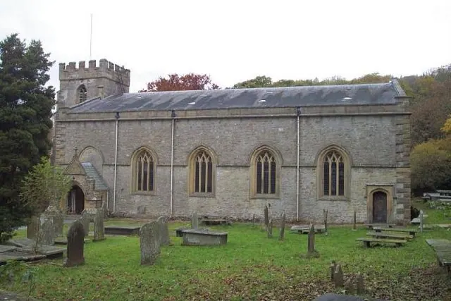
© Geoff Pick · Geograph · CC BY-SA 2.0
Images © their respective photographers, licensed under CC BY-SA 2.0 and reused here with attribution. Photographs depict listed buildings, churches and monuments near this settlement and may show neighbouring villages.
Data derived from the Open Domesday project (opendomesday.org), based on the Domesday Book dataset compiled by Professor J.J.N. Palmer and team. The Domesday Book (1086) is in the public domain.
Found an inaccuracy? [email protected]