Church Lawton and Buglawton in the Domesday Book (1086)
Church Lawton and Buglawton appears in the Domesday Book of 1086, entered under the hundred of Middlewich in Cheshire.
Other Settlements in Middlewich
- Alsager
- Bostock
- Brereton
- Byley
- Clive
- Congleton
- Croxton
- Davenham
- Davenport
- Goostrey
- Hassall
- Kinderton
- Lach [Dennis]
- Leftwich
The Meaning of the Name
The name Church Lawton and Buglawton is of Anglo-Saxon origin. Its final element derives from the Old English word tūn, a farmstead or village. The first element is most likely a personal name or an early descriptive term, now difficult to recover with certainty. Taken together the name probably meant something close to ‘a farmstead’.
Remarkably, the name has changed little since 1086, when the Domesday scribes wrote it as Church Lawton and Buglawton.
Listed Buildings Near Church Lawton and Buglawton
Historic England records 20 listed buildings within about a mile of Church Lawton and Buglawton. Listing protects structures of special architectural or historic interest, graded I (exceptional), II* (particularly important) and II.
Grade II
- Macclesfield Canal Bridge Number 69 at Sj 8780 6358 - 0.3 km
- Canal Milestone Canal Milestone at Sj 8775 6378 - 0.35 km
- Macclesfield Canal Bridge Number 70 at Sj 8795 6321 - 0.44 km
- Holmhurst the Lowe White Gables - 0.48 km
- St John’s School House - 0.58 km
- St Johns School - 0.6 km
- Macclesfield Canal Bridge Number 67 at Sj 8763 6413 - 0.67 km
- Macclesfield Canal Distance Marker at Sj 8762 6418 - 0.71 km
- The Railway Viaduct - 0.75 km
- Beech House - 0.83 km
- Macclesfield Canal Bridge Number 66 at Sj 8756 6435 - 0.88 km
- Throstle’s Nest House - 0.94 km
- Macclesfield Canal Bridge Number 72 at Sj 8809 6266 - 0.94 km
- Macclesfield Canal Biddulph Valley Aqueduct at Sj 8801 6245 - 1.03 km
- Flint Mill (Central Part of Higher Washford Mill) - 1.08 km
- Macclesfield Canal stone fence posts south of Bridge No. 72 - 1.09 km
- Macclesfield Canal Canal Milestone at Sj 8782 6233 - 1.16 km
- St Stephen’s Vicarage - 1.18 km
- Macclesfield Canal Morley Drive, Bridge Number 74 - 1.22 km
- Railway Station Hotel (Public House) - 1.3 km
Church Lawton and Buglawton Today
Today Church Lawton and Buglawton lies within the administrative area of Congleton.
Read more about modern Buglawton on Wikipedia .
Nearby Domesday Settlements
Other places recorded in the 1086 survey within a few miles:
- Congleton - 1.4 km SW
- North Rode - 3.2 km N
- Newbold Astbury - 3.6 km SW
- Somerford Booths - 4.5 km NW
- Bosley - 4.5 km NE
- Marton - 5.8 km NW
Heritage Around [Church] Lawton and [Bug]lawton
Photographs of churches, listed buildings and monuments in the vicinity, contributed by volunteers to the Geograph project and reused here under a Creative Commons licence.
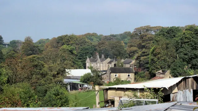
© Jonathan Kington · Geograph · CC BY-SA 2.0
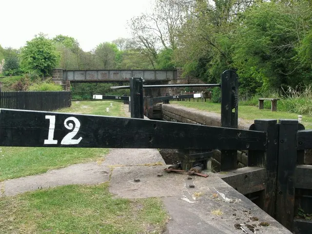
© Raymond Knapman · Geograph · CC BY-SA 2.0
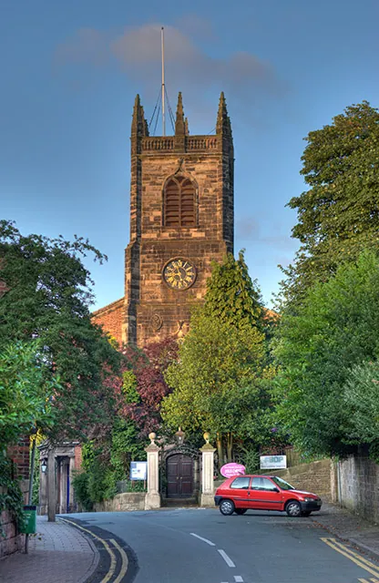
© Chris Sheard · Geograph · CC BY-SA 2.0
Images © their respective photographers, licensed under CC BY-SA 2.0 and reused here with attribution. Photographs depict listed buildings, churches and monuments near this settlement and may show neighbouring villages.
Data derived from the Open Domesday project (opendomesday.org), based on the Domesday Book dataset compiled by Professor J.J.N. Palmer and team. The Domesday Book (1086) is in the public domain.
Found an inaccuracy? [email protected]