Cholmondeley in the Domesday Book (1086)
The 1086 Domesday survey records the settlement of Cholmondeley, entered under the hundred of Duddeston in Cheshire.
Other Settlements in Duddeston
- Bettisfield
- Bickerton
- Bickley
- Boughton
- Broxton
- Burwardestone
- Burwardsley and [Higher] Burwardsley
- Caldecott
- Calvintone
- Cheaveley
- Chowley
- Christleton
- Clutton
- Coddington
The Meaning of the Name
The name Cholmondeley is of Anglo-Saxon origin. Its final element derives from the Old English word lēah, a woodland clearing or glade. The first element is most likely a personal name or an early descriptive term, now difficult to recover with certainty. Taken together the name probably meant something close to ‘a clearing’.
Remarkably, the name has changed little since 1086, when the Domesday scribes wrote it as Cholmondeley.
Listed Buildings Near Cholmondeley
Historic England records 19 listed buildings within about a mile of Cholmondeley. Listing protects structures of special architectural or historic interest, graded I (exceptional), II* (particularly important) and II.
Grade I
- The Chapel of Saint Nicholas - 0.89 km
Grade II*
- Cholmondeley Castle - 0.13 km
- Gates and Screen Across the Main (South West) Approach to Cholmondeley Castle - 0.21 km
Grade II
- Somerset Lodge - 0.15 km
- Scotch Farm - 0.23 km
- Park House Lodge - 0.32 km
- Rotunda in the Temple Gardens - 0.34 km
- Lead Cherub Ornament in Temple Gardens - 0.34 km
- Gated Entrance to Temple Gardens - 0.35 km
- Bridge Over Lily Pond in Temple Gardens - 0.35 km
- Temple in the Temple Gardens - 0.36 km
- Stone Bridge East of Somerset Lodge - 0.37 km
- The Mews - 0.38 km
- Park House - 0.4 km
- Castle Farm House - 0.48 km
- The Chapel North Gates - 0.87 km
- The Chapel South Gates - 0.87 km
- The Old Hall - 1.0 km
- Deer Park Lodge - 1.08 km
Cholmondeley Today
Today Cholmondeley lies within the administrative area of Cheshire East, and the settlement recorded a population of 175 at the 2021 census. Nine and a half centuries separate that figure from the small rural community the Domesday survey recorded here in 1086.
Read more about modern Cholmondeley on Wikipedia .
Nearby Domesday Settlements
Other places recorded in the 1086 survey within a few miles:
Heritage Around Cholmondeley
Photographs of churches, listed buildings and monuments in the vicinity, contributed by volunteers to the Geograph project and reused here under a Creative Commons licence.
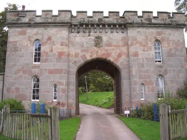
© Peter Craine · Geograph · CC BY-SA 2.0
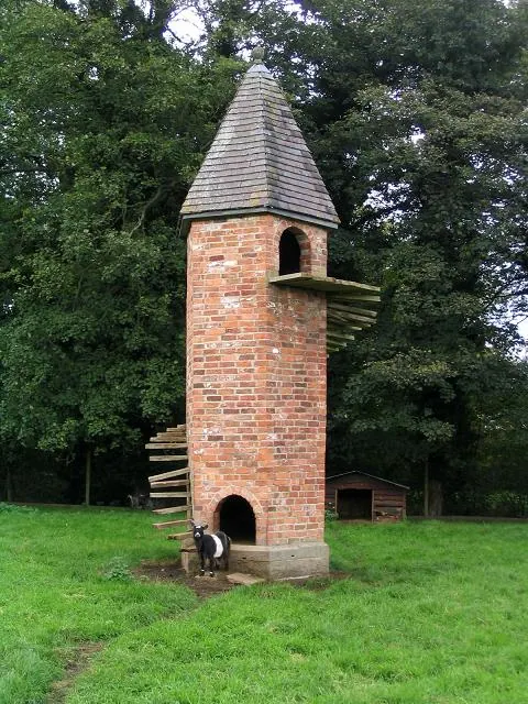
© Peter Craine · Geograph · CC BY-SA 2.0
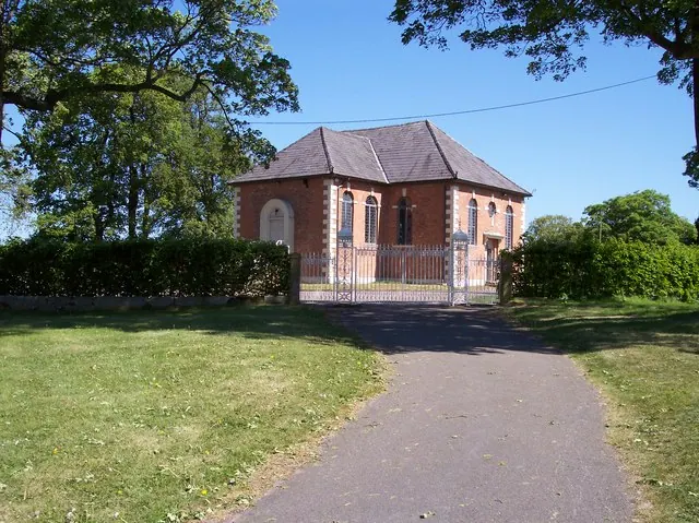
© Raymond Knapman · Geograph · CC BY-SA 2.0
Images © their respective photographers, licensed under CC BY-SA 2.0 and reused here with attribution. Photographs depict listed buildings, churches and monuments near this settlement and may show neighbouring villages.
Data derived from the Open Domesday project (opendomesday.org), based on the Domesday Book dataset compiled by Professor J.J.N. Palmer and team. The Domesday Book (1086) is in the public domain.
Found an inaccuracy? [email protected]