Chesterfield in the Domesday Book (1086)
Chesterfield is named in the Domesday Book, compiled by Norman commissioners in 1086, entered under the hundred of Scarsdale in Derbyshire.
Other Settlements in Scarsdale
- Alfreton
- Ashover
- Barlborough
- Barlow
- Beighton
- Blingsby
- Bolsover
- Boythorpe
- Bramley [Vale]
- Brimington
- Calow
- Clowne
- Dore
- Dronfield
The Meaning of the Name
The name Chesterfield is of Anglo-Saxon origin. Its final element derives from the Old English word feld, open country. The first element is most likely a personal name or an early descriptive term, now difficult to recover with certainty. Taken together the name probably meant something close to ‘a open land’.
Remarkably, the name has changed little since 1086, when the Domesday scribes wrote it as Chesterfield.
Listed Buildings Near Chesterfield
Historic England records 120 listed buildings within about a mile of Chesterfield. Listing protects structures of special architectural or historic interest, graded I (exceptional), II* (particularly important) and II.
Grade I
- Church of St Mary and All Saints - 0.31 km
Grade II*
- 2, St Mary’s Gate - 0.26 km
- Unitarian Chapel - 0.35 km
Grade II
- Former Brewery Street Chapel - 0.07 km
- Engineers Offices at Goods Yard, British Rail Station - 0.17 km
- Winding Wheel - 0.19 km
- Dorset House - 0.2 km
- Garden wall to north-east of Number 1 - 0.2 km
- Holywell Cross Post Office - 0.21 km
- 39 and 41 Holywell Street - 0.21 km
- 39A Holywell Street - 0.21 km
- Holywell House - 0.24 km
- Churchyard Walls and Piers to St Mary’s Church - 0.24 km
- 1, Sheffield Road - 0.25 km
- Chesterfield Saint Helena School - 0.25 km
- Stephenson Memorial Hall - 0.25 km
- War Memorial in Churchyard to North East of St Mary’s Church - 0.26 km
- Entrance Block to Elder Yard Uitarian Chapel - 0.32 km
- Former Williams and Glyn’s Bank and Bank Chambers - 0.32 km
- Western Building to Chesterfield College of Art and Technology - 0.33 km
- 21 and 23, Newbold Road - 0.34 km
- Lamp Post Near South Porch of St Mary’s Church - 0.34 km
- 27, Newbold Road - 0.35 km
- Gatepiers Gates and Street Boundary Wall to Garden of Hurst House - 0.39 km
…and 96 more listed structures in the area.
Scheduled Monuments Near Chesterfield
Scheduled monuments are nationally important archaeological sites given legal protection. 1 lies within roughly a mile of Chesterfield:
- Tapton Castle motte - 0.88 km
Nearby Domesday Settlements
Other places recorded in the 1086 survey within a few miles:
- Tapton - 1.4 km NE
- Calow - 2.0 km E
- Boythorpe - 2.2 km SW
- Brimington - 2.8 km NE
- Old Whittington - 3.0 km N
- Walton - 3.6 km SW
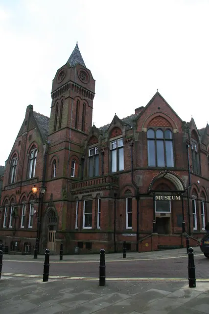
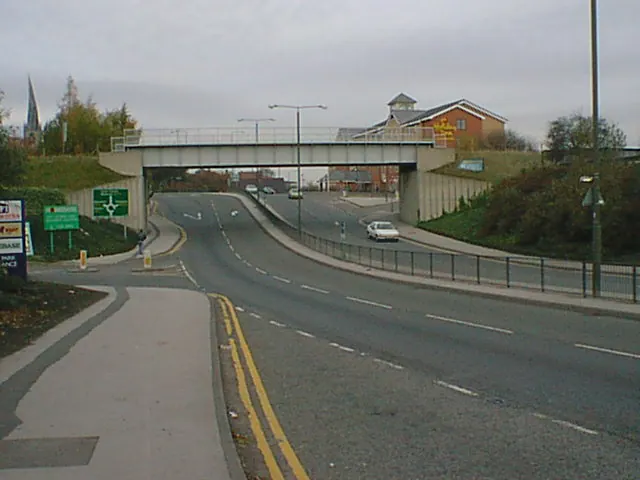
Heritage Around Chesterfield
Photographs of churches, listed buildings and monuments in the vicinity, contributed by volunteers to the Geograph project and reused here under a Creative Commons licence.

© Alan Heardman · Geograph · CC BY-SA 2.0
© Chris Allen · Geograph · CC BY-SA 2.0
© Alan Heardman · Geograph · CC BY-SA 2.0
Images © their respective photographers, licensed under CC BY-SA 2.0 and reused here with attribution. Photographs depict listed buildings, churches and monuments near this settlement and may show neighbouring villages.
Data derived from the Open Domesday project (opendomesday.org), based on the Domesday Book dataset compiled by Professor J.J.N. Palmer and team. The Domesday Book (1086) is in the public domain.
Found an inaccuracy? [email protected]