Cawthorne in the Domesday Book (1086)
The 1086 Domesday survey records the settlement of Cawthorne, entered under the hundred of Staincross in Yorkshire.
Other Settlements in Staincross
- Adlingfleet
- Barnby [Hall]
- Barnsley
- Barugh
- Brierley
- Carlton
- Chevet
- Clactone
- Clayton [West]
- Darton
- Dodworth
- Hemsworth
- Hoyland [Swaine]
- Hunshelf [Hall]
The Meaning of the Name
The origin of the name Cawthorne is not securely established from its modern form alone; like many settlement names in the North it likely combines an Old English or Old Norse personal name with a landscape term.
Remarkably, the name has changed little since 1086, when the Domesday scribes wrote it as Cawthorne.
Listed Buildings Near Cawthorne
Historic England records 47 listed buildings within about a mile of Cawthorne. Listing protects structures of special architectural or historic interest, graded I (exceptional), II* (particularly important) and II.
Grade II*
- Church of All Saints - 0.5 km
Grade II
- Upper Norcroft Cottages - 0.41 km
- Guide Post Opposite East End of Kirkfield Close - 0.47 km
- Parish Rooms on South Side of Church Yard - 0.47 km
- Grave slab (Moxon) approximately 10 metres south of east end of nave of Church of All Saints in line with west end of Parish Rooms - 0.48 km
- Raised Grave Slab (Moakson) Approximately 2.5 Metres South of Parish Rooms in Line With East End of South Chapel of Church of All Saints - 0.48 km
- Group of four raised grave slabs (Rich) approximately 3 metres north of Parish rooms (west end) and 8 metres south of south chapel door of Church of All Saints - 0.48 km
- Pair of Raised Grave Slabs (Turton) Immediately North of Parish Rooms and in Line With East End of South Chapel of Church of All Saints - 0.48 km
- Pair of raised grave slabs (Turton) Immediately north of west end of Parish Rooms in yard of Church of All Saints - 0.48 km
- Group of Three Grave Slabs (Dixon) Approximately 5 Metres South of South Chapel Door of Church of All Saints - 0.48 km
- Grave Slab (Firth) Approximately 15 Metres South of South Church Yard Wall of Church of All Saints - 0.48 km
- Grave Slab (Shyrte) Approximately 5 Metres South of South Porch of Church of All Saints - 0.49 km
- Grave Slab (Hewitt) Approximately 3 Metres South of East End of South Chapel of Church of All Saints - 0.49 km
- Grave Slab (Streete) Approximately 3 Metres South of East End of Nave of Church of All Saints - 0.49 km
- Raised Grave Slab (Swift) Approximately 3 Metres South of South Door of South Chapel of Church of All Saints - 0.49 km
- Tomb Chest (Marshall) Approximately 7 Metres South of East End of Nave of Church of All Saints - 0.49 km
- Pair of Raised Grave Slabs (Clegg) Approximately 5 Metres South of South Chapel of Church of All Saints - 0.49 km
- Raised Grave Slab (Cudworth) Approximately Midway Between Parish Rooms and East End of South Chapel of Church of All Saints - 0.49 km
- Pair of Grave Slabs (Shaw, Longley) Approximately 3 Metres East of South Chapel of Church of All Saints - 0.49 km
- 2 Grave Slabs (Burgon, Robuck) Approximately 5 Metres West of South Porch of Church of All Saints - 0.49 km
- Cross Adjacent to Steps at Western Approach to Church of All Saints - 0.5 km
- Pair of Grave Slabs (Newton Rhoades) Approximately 2 Metres North of Church of All Saints - 0.51 km
- Seven Grave Cover Fragments in North Wall of Church Yard Opposite East End of Church of All Saints - 0.52 km
- Wall With Sculpted Panels and Figures Opposite Numbers 6 and 8 - 0.55 km
…and 23 more listed structures in the area.
Scheduled Monuments Near Cawthorne
Scheduled monuments are nationally important archaeological sites given legal protection. 2 lie within roughly a mile of Cawthorne:
- Anglo-Saxon period cross in churchyard of All Saints - 0.49 km
- Low Mill furnace - 1.24 km
Cawthorne Today
Today Cawthorne lies within the administrative area of Barnsley, and the settlement recorded a population of 1,157 at the 2021 census. Nine and a half centuries separate that figure from the small rural community the Domesday survey recorded here in 1086.
Read more about modern Cawthorne on Wikipedia .
Nearby Domesday Settlements
Other places recorded in the 1086 survey within a few miles:
- Barnby Hall - 1.4 km NE
- Kexbrough - 2.2 km NE
- Silkstone - 2.2 km SE
- Barugh - 3.2 km E
- High Hoyland - 3.2 km N
- Darton - 3.6 km NE
Heritage Around Cawthorne
Photographs of churches, listed buildings and monuments in the vicinity, contributed by volunteers to the Geograph project and reused here under a Creative Commons licence.
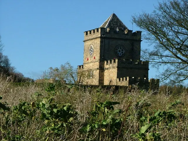
© Nigel Homer · Geograph · CC BY-SA 2.0
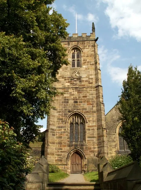
© John Fielding · Geograph · CC BY-SA 2.0
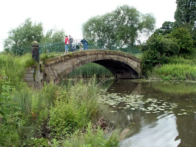
© John Fielding · Geograph · CC BY-SA 2.0
Images © their respective photographers, licensed under CC BY-SA 2.0 and reused here with attribution. Photographs depict listed buildings, churches and monuments near this settlement and may show neighbouring villages.
Data derived from the Open Domesday project (opendomesday.org), based on the Domesday Book dataset compiled by Professor J.J.N. Palmer and team. The Domesday Book (1086) is in the public domain.
Found an inaccuracy? [email protected]