Carsington in the Domesday Book (1086)
The 1086 Domesday survey records the settlement of Carsington, entered under the hundred of Hamston in Derbyshire.
Other Settlements in Hamston
- Alsop [-en-le-Dale]
- Ashbourne
- Atlow
- Ballidon
- Bonsall
- Bradbourne
- Brassington
- Broadlowash
- Callow
- Cowley
- Cromford
- Elton
- Hanson [Grange]
- Hartington
The Meaning of the Name
The name Carsington is of Anglo-Saxon origin. Its final element derives from the Old English word tūn, a farmstead or village. The first element is most likely a personal name or an early descriptive term, now difficult to recover with certainty. Taken together the name probably meant something close to ‘a farmstead’.
Remarkably, the name has changed little since 1086, when the Domesday scribes wrote it as Carsington.
Listed Buildings Near Carsington
Historic England records 35 listed buildings within about a mile of Carsington. Listing protects structures of special architectural or historic interest, graded I (exceptional), II* (particularly important) and II.
Grade II*
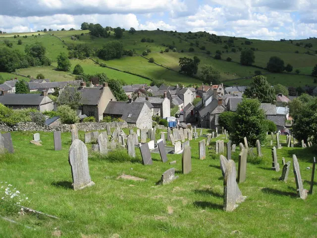
- Church of St Margaret - 0.36 km
Grade II
- Garden Walls and Tower at Hopton Hall - 0.15 km
- Ice House - 0.17 km
- Steps and Gates to Vegetable Garden, Hopton Hall - 0.21 km
- Gate Piers to South West of the Lodge - 0.22 km
- The Lodge - 0.22 km
- Dene Cottage - 0.23 km
- Stable Block to West of Hopton Hall - 0.24 km
- Hopton Hall - 0.24 km
- Cartshed at Home Farm - 0.31 km
- Miner’s Arms Inn - 0.33 km
- Carsington and Hopton Primary School - 0.34 km
- Well to West of Forge Cottage - 0.35 km
- Garden House - 0.38 km
- Wall and Gate Piers to North West of Hopton Manor - 0.38 km
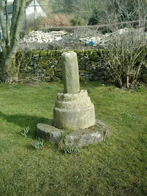
- Village Cross - 0.4 km
- Hopton Manor - 0.4 km
- Swiers Farmhouse - 0.41 km
- Glebe House - 0.43 km
- Kingsford Farmhouse - 0.45 km
- Miners Cottages - 0.45 km
- Hillcrest - 0.46 km
- Mining Low Cottage - 0.46 km
- Townend Cottage - 0.49 km
…and 11 more listed structures in the area.
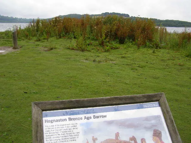
Scheduled Monuments Near Carsington
Scheduled monuments are nationally important archaeological sites given legal protection. 3 lie within roughly a mile of Carsington:
- Ivet Low bowl barrow - 1.0 km
- Carsington Pasture, Nickalum, Perserverance, West Head, Break Hollow and other small mines and medieval field boundaries - 1.24 km
- Bowl barrow on Carsington Pasture, 800m south east of Brassington Brickworks - 1.43 km
Carsington Today
Today Carsington lies within the administrative area of Derbyshire Dales, and the settlement recorded a population of 136 at the 2021 census. Nine and a half centuries separate that figure from the small rural community the Domesday survey recorded here in 1086.
Read more about modern Carsington on Wikipedia .
Nearby Domesday Settlements
Other places recorded in the 1086 survey within a few miles:
- Hopton - 0.0 km N
- Callow - 1.4 km SE
- Brassington - 2.2 km NW
- Wirksworth - 3.2 km E
- Kirk Ireton - 3.2 km S
- Middleton - 3.6 km NE
Heritage Around Carsington
Photographs of churches, listed buildings and monuments in the vicinity, contributed by volunteers to the Geograph project and reused here under a Creative Commons licence.
© Eamon Curry · Geograph · CC BY-SA 2.0
© Brian Green · Geograph · CC BY-SA 2.0
© Alan Heardman · Geograph · CC BY-SA 2.0
Images © their respective photographers, licensed under CC BY-SA 2.0 and reused here with attribution. Photographs depict listed buildings, churches and monuments near this settlement and may show neighbouring villages.
Data derived from the Open Domesday project (opendomesday.org), based on the Domesday Book dataset compiled by Professor J.J.N. Palmer and team. The Domesday Book (1086) is in the public domain.
Found an inaccuracy? [email protected]