Carlton in the Domesday Book (1086)
Carlton appears in the Domesday Book of 1086, entered under the hundred of Langbaurgh in Yorkshire.
Other Settlements in Langbaurgh
- Acklam
- Airy [Holme]
- Aislaby
- Arnodestorp
- Baldebi
- Barnaby
- Barwick
- Battersby
- Bergolbi
- Berguluesbi
- Blaten [Carr]
- Borrowby
- Breck
- Brotton
The Meaning of the Name
The name Carlton is of Anglo-Saxon origin. Its final element derives from the Old English word tūn, a farmstead or village. The first element is most likely a personal name or an early descriptive term, now difficult to recover with certainty. Taken together the name probably meant something close to ‘a farmstead’.
Remarkably, the name has changed little since 1086, when the Domesday scribes wrote it as Carlton.
Listed Buildings Near Carlton
Historic England records 23 listed buildings within about a mile of Carlton. Listing protects structures of special architectural or historic interest, graded I (exceptional), II* (particularly important) and II.
Grade II*
- Busby Hall - 1.01 km
- The Old Nursery Wing at Busby Hall - 1.02 km
- Walled Garden to South East of Busby Hall - 1.09 km
Grade II
- Church of St Botolph - 0.09 km
- Cross Shaft 3 Metres South of Church of St Botolph - 0.1 km
- Numbers 1-3 Manor Cottages and Number 4 Alma Lodge - 0.12 km
- Holly Lodge - 0.12 km
- Manor House - 0.14 km
- Forecourt and Terrace Walls, Gates and Gate Piers to Manor House - 0.16 km
- Yard Wall and Gates to Left of Manor House - 0.17 km
- Carlton House - 0.22 km
- Carlton House Cottage - 0.22 km
- The Elms - 0.23 km
- The Watson Scout Centre - 0.24 km
- Beech Cottage, Beech House and Beech View - 0.3 km
- Manor Farmhouse and Outbuilding Attached - 0.34 km
- Primrose Cottage Rose Cottage - 0.42 km
- The Old Vicarage - 0.45 km
- Hall Farmhouse and Attached Outbuilding - 0.52 km
- Stable Range to North of Busby Hall - 0.98 km
- The Old Dairy at Busby - 1.01 km
- Garden Wall to East of Faceby Manor - 1.09 km
- Faceby Manor, the Cottage West View - 1.11 km
Carlton Today
Today Carlton lies within the administrative area of Hambleton, and the settlement recorded a population of 268 at the 2021 census. Nine and a half centuries separate that figure from the small rural community the Domesday survey recorded here in 1086.
Nearby Domesday Settlements
Other places recorded in the 1086 survey within a few miles:
- Little Busby - 1.0 km E
- Faceby - 1.4 km SW
- Blaten Carr - 2.2 km NE
- Great Busby - 2.2 km NE
- Whorlton - 2.8 km SW
- Goulton Grange - 3.0 km W
Heritage Around Carlton
Photographs of churches, listed buildings and monuments in the vicinity, contributed by volunteers to the Geograph project and reused here under a Creative Commons licence.
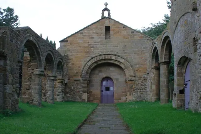
© Mick Garratt · Geograph · CC BY-SA 2.0
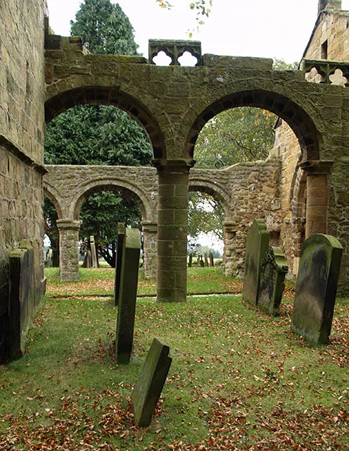
© Stephen McCulloch · Geograph · CC BY-SA 2.0
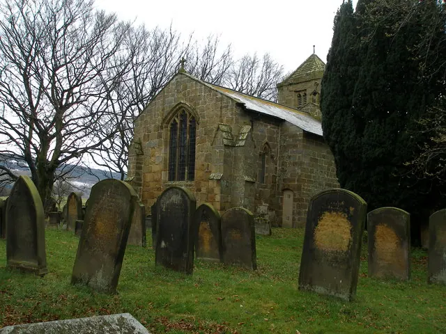
© Carol Rose · Geograph · CC BY-SA 2.0
Images © their respective photographers, licensed under CC BY-SA 2.0 and reused here with attribution. Photographs depict listed buildings, churches and monuments near this settlement and may show neighbouring villages.
Data derived from the Open Domesday project (opendomesday.org), based on the Domesday Book dataset compiled by Professor J.J.N. Palmer and team. The Domesday Book (1086) is in the public domain.
Found an inaccuracy? [email protected]