Carlton in the Domesday Book (1086)
Carlton appears in the Domesday Book of 1086, entered under the hundred of Land of Count Alan in Yorkshire. The survey assessed Carlton at 12.8 carucates of taxable land.
At the time of the survey, Carlton supported a recorded population of 33 villagers, 24 smallholders, 3 slaves, working 19 ploughs between them.
By 1086 Carlton was worth 8.5 shillings, up from 3.5 shillings before the Conquest – one of the few settlements in the area to hold its value through the upheaval.
The survey lists 3 manors at Carlton under different lords. Splitting a single settlement between multiple tenants was common across the North – Saxon estates broken up and handed to William’s followers after 1066.
Resources Recorded at Carlton (1086)
- Mills: 2 mills (valued at 16d)
- Meadow: 20 acres
- Woodland: 0.5 acres
Other Settlements in Land of Count Alan
- Achebi
- Agglethorpe
- Ainderby [Mires]
- Ainderby [Quernhow]
- Aiskew
- Aldbrough
- Allerthorpe [Hall]
- Ascam
- Ascham
- Asebi
- Aske [Hall]
- Askrigg
- Aysgarth
- Baldersby
The Meaning of the Name
The name Carlton is of Anglo-Saxon origin. Its final element derives from the Old English word tūn, a farmstead or village. The first element is most likely a personal name or an early descriptive term, now difficult to recover with certainty. Taken together the name probably meant something close to ‘a farmstead’.
Remarkably, the name has changed little since 1086, when the Domesday scribes wrote it as Carlton.
Listed Buildings Near Carlton
Historic England records 26 listed buildings within about a mile of Carlton. Listing protects structures of special architectural or historic interest, graded I (exceptional), II* (particularly important) and II.
Grade I
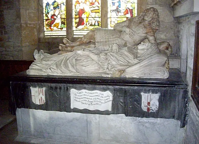
- Church of St John the Baptist - 1.19 km
Grade II
- Carlton Green - 0.18 km
- Former Coachhouse Approximately One Hundred and Fifty Metres to West of Carlton Hall - 0.28 km
- Bridge Over Aldbrough Beck - 0.43 km
- Well Approximately One Hundred and Fifty Metres North North East St John the Baptist* - 1.11 km
- Dilston House - 1.12 km
- Well Approximately One Hundred Metres North East East of Church of St John the Baptist - 1.12 km
- Aldbrough St John Cottage - 1.15 km
- Kirkbridge House, Stanwick Old Hall and Attached Gate Piers - 1.15 km
- West Dilston House and East Dilston House - 1.16 km
- Saxon Cross-shaft Approximately 3 Metres South of Chancel of Church of St John the Baptist - 1.18 km
- Group of Four Tombstones Approximately Two Metres East of Porch of Church of St John Baptist - 1.19 km
- Four Tombstones in A Line Approximately Five Metres South of South West Corner of South Aisle of Church of St John the Baptist - 1.2 km
- Newcomb Memorial Approximately Seven Metres South of Porch of Church of St John the Baptist * - 1.2 km
- Slater Memorial Approximately Six Metres South of Porch of Church of St John the Baptist - 1.2 km
- Pump - 1.21 km
- Manor Farmhouse - 1.22 km
- Farm Buildings to North East of Manor Farmhouse - 1.22 km
- Kirk Bridge - 1.23 km
- Calf House at Manor Farmhouse - 1.24 km
- Brookside - 1.24 km
- Packhorse Bridge Over Aldbrough Beck - 1.24 km
- Gate Piers, Gates and Railings to South West of Packhorse Bridge - 1.25 km
- Pigeoncote at Manor Farm - 1.25 km
…and 2 more listed structures in the area.
Scheduled Monuments Near Carlton
Scheduled monuments are nationally important archaeological sites given legal protection. 2 lie within roughly a mile of Carlton:
- Packhorse bridge across Aldbrough Beck, immediately south west of High Green - 1.25 km
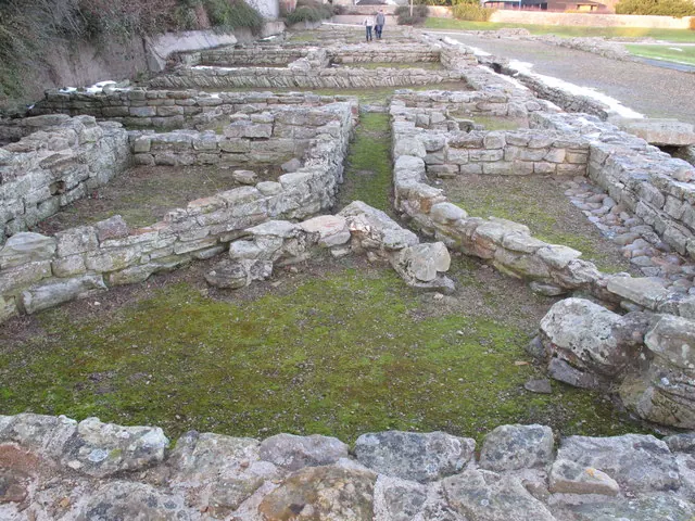
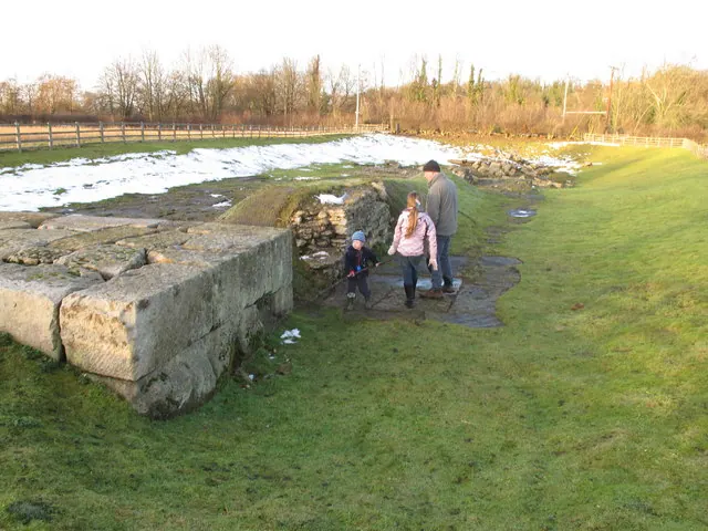
- Stanwick Late Iron Age oppidum, Iron Age and medieval settlement, early Christian church and sculpture and post-medieval emparkment - 1.35 km
Carlton Today
Today Carlton lies within the administrative area of Stanwick St John.
Nearby Domesday Settlements
Other places recorded in the 1086 survey within a few miles:
Heritage Around Carlton
Photographs of churches, listed buildings and monuments in the vicinity, contributed by volunteers to the Geograph project and reused here under a Creative Commons licence.
© David Hawgood · Geograph · CC BY-SA 2.0
© David Hawgood · Geograph · CC BY-SA 2.0
© Stanley Howe · Geograph · CC BY-SA 2.0
Images © their respective photographers, licensed under CC BY-SA 2.0 and reused here with attribution. Photographs depict listed buildings, churches and monuments near this settlement and may show neighbouring villages.
Location
54.5073°N, -1.6988°W · Land of Count Alan hundred, Yorkshire
View larger map on OpenStreetMap →Data derived from the Open Domesday project (opendomesday.org), based on the Domesday Book dataset compiled by Professor J.J.N. Palmer and team. The Domesday Book (1086) is in the public domain.
Found an inaccuracy? [email protected]