Buttercrambe in the Domesday Book (1086)
The settlement of Buttercrambe is recorded in William I’s Domesday survey of 1086, entered under the hundred of Bulford in Yorkshire. The survey assessed Buttercrambe at 1 carucate of taxable land.
At the time of the survey, Buttercrambe supported a recorded population of 5 villagers, 10 smallholders, 12 slaves, working 3 ploughs between them.
By 1086 Buttercrambe was worth 5.25 shillings, up from 4 shillings before the Conquest – a sign this community came through the Conquest without being ruined.
Resources Recorded at Buttercrambe (1086)
- Mills: 1 mill (valued at 7d)
- Meadow: 8 acres
- Woodland: 20 swine render
Other Settlements in Bulford
- Aldwark
- Alne
- Barnby [House]
- Barton [le Willows]
- Beningbrough
- Bossall
- Brafferton
- Brandsby
- Bulmer
- Carlton [Farm]
- Claxton
- Coneysthorpe
- Corburn
- Cornbrough [House]
The Meaning of the Name
The origin of the name Buttercrambe is not securely established from its modern form alone; like many settlement names in the North it likely combines an Old English or Old Norse personal name with a landscape term.
Remarkably, the name has changed little since 1086, when the Domesday scribes wrote it as Buttercrambe.
Listed Buildings Near Buttercrambe
Historic England records 9 listed buildings within about a mile of Buttercrambe. Listing protects structures of special architectural or historic interest, graded I (exceptional), II* (particularly important) and II.
Grade II*
- Aldby Park - 0.37 km
- Church of St John the Evangelist - 0.43 km
Grade II
- Buttercrambe Mill - 0.16 km
- Buttercrambe Bridge - 0.17 km
- Aldby Park Lodge - 0.31 km
- Buttercrambe House - 0.32 km
- Garden Sculpture in Grounds of Aldby Park Approximately 20 Metres South of House - 0.34 km
- Garden Sculpture in Grounds of Aldby Park Approximately 20 Metres South of House - 0.36 km
- Aldby Park Stable Block - 0.39 km
Buttercrambe Today
Today Buttercrambe lies within the administrative area of Buttercrambe with Bossall.
Read more about modern Buttercrambe on Wikipedia .
Nearby Domesday Settlements
Other places recorded in the 1086 survey within a few miles:
- Scardiztorp - 1.4 km SE
- Scradiztorp - 1.4 km SE
- Skirpenbeck - 1.4 km SE
- Scrayingham - 2.0 km N
- Thorpe Hill - 2.2 km NW
- Barnby House - 2.2 km NW
Heritage Around Buttercrambe
Photographs of churches, listed buildings and monuments in the vicinity, contributed by volunteers to the Geograph project and reused here under a Creative Commons licence.
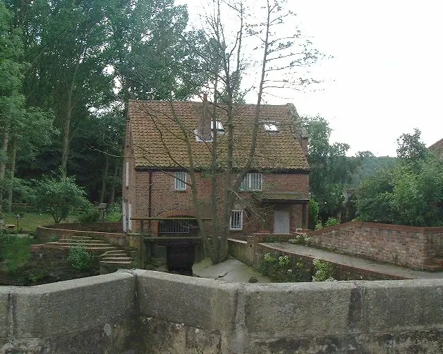
© Andy Kerridge · Geograph · CC BY-SA 2.0
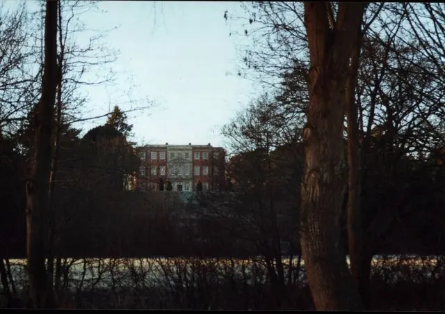
© Andy Kerridge · Geograph · CC BY-SA 2.0
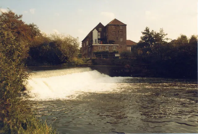
© Kath Bonson · Geograph · CC BY-SA 2.0
Images © their respective photographers, licensed under CC BY-SA 2.0 and reused here with attribution. Photographs depict listed buildings, churches and monuments near this settlement and may show neighbouring villages.
Data derived from the Open Domesday project (opendomesday.org), based on the Domesday Book dataset compiled by Professor J.J.N. Palmer and team. The Domesday Book (1086) is in the public domain.
Found an inaccuracy? [email protected]