Burton in the Domesday Book (1086)
The 1086 Domesday survey records the settlement of Burton, entered under the hundred of Blackwell in Derbyshire.
Other Settlements in Blackwell
- Abney
- Ashford [-in-the-Water]
- Aston
- Bakewell
- Bamford
- Baslow
- Beeley
- Birchills
- Birchover
- Blackwell
- Bradwell
- Bubnell
- Burley
- Calver
The Meaning of the Name
The name Burton is of Anglo-Saxon origin. Its final element derives from the Old English word tūn, a farmstead or village. The first element is most likely a personal name or an early descriptive term, now difficult to recover with certainty. Taken together the name probably meant something close to ‘a farmstead’.
Remarkably, the name has changed little since 1086, when the Domesday scribes wrote it as Burton.
Listed Buildings Near Burton
Historic England records 14 listed buildings within about a mile of Burton. Listing protects structures of special architectural or historic interest, graded I (exceptional), II* (particularly important) and II.
Grade II
- Guide Pillar at Ngr Sk 20315 68254 - 0.84 km
- Manor House Farmhouse - 1.02 km
- K6 Telephone Kiosk - 1.05 km
- Mona View Farmhouse and Attached Outbuildings - 1.05 km
- Vernon Cottage - 1.07 km
- Pinfold Cottage - 1.07 km
- Green Cowden Farmhouse - 1.08 km
- Church of St Anne - 1.12 km
- Mayfield Cottage and Westfield Cottage - 1.21 km
- Steps Railings and Retaining Walls to Mayfield Cottage and Westfield Cottage - 1.21 km
- Two Trees - 1.21 km
- Burton Closes Mews - 1.22 km
- Roadside Wall With Gateways Forming Northern Boundary to the Old Vicarage - 1.26 km
- The Old Vicarage - 1.26 km
Scheduled Monuments Near Burton
Scheduled monuments are nationally important archaeological sites given legal protection. 4 lie within roughly a mile of Burton:
- Burton Moor bowl barrow - 0.56 km
- Grindlow bowl barrow - 0.58 km
- Anglo-Scandinavian high cross from Two Dales, Darley, now in the churchyard of All Saints’ Church - 1.37 km
- Anglian high cross in the churchyard of All Saints’ Church - 1.4 km
Nearby Domesday Settlements
Other places recorded in the 1086 survey within a few miles:
- Nether and Over Haddon - 1.0 km S
- Bakewell - 1.4 km NE
- Holme - 2.2 km NE
- Ashford -in-the-Water - 2.2 km NW
- Conksbury - 2.2 km SE
- Sheldon - 3.2 km W
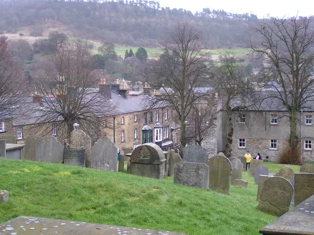
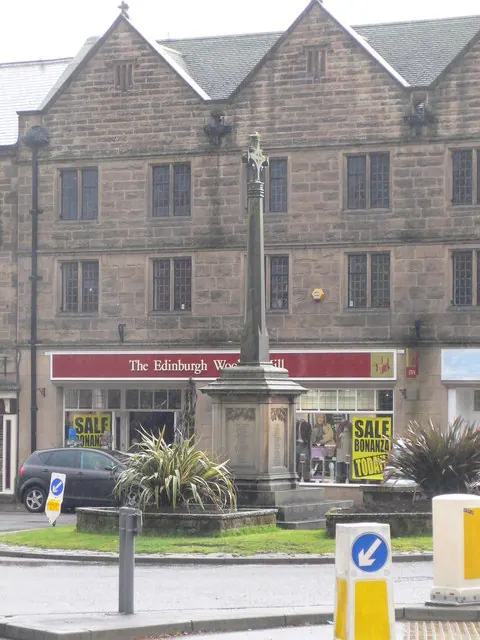
Heritage Around Burton
Photographs of churches, listed buildings and monuments in the vicinity, contributed by volunteers to the Geograph project and reused here under a Creative Commons licence.
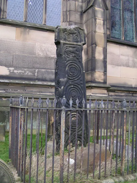
© Dave Dunford · Geograph · CC BY-SA 2.0
© Dave Dunford · Geograph · CC BY-SA 2.0
© Eirian Evans · Geograph · CC BY-SA 2.0
Images © their respective photographers, licensed under CC BY-SA 2.0 and reused here with attribution. Photographs depict listed buildings, churches and monuments near this settlement and may show neighbouring villages.
Data derived from the Open Domesday project (opendomesday.org), based on the Domesday Book dataset compiled by Professor J.J.N. Palmer and team. The Domesday Book (1086) is in the public domain.
Found an inaccuracy? [email protected]