Burrill in the Domesday Book (1086)
The 1086 Domesday survey records the settlement of Burrill, entered under the hundred of Land of Count Alan in Yorkshire. The survey assessed Burrill at 15 carucates of taxable land.
At the time of the survey, Burrill supported a recorded population of 10 villagers, 13 smallholders, 3 slaves, working 9 ploughs between them.
The drop in value is hard to miss. Before 1066, Burrill was worth 10 shillings; by 1086 that had dropped to 9 shillings – a fall of 9%. Most Yorkshire villages that lost value on this scale were swept up in the Harrying of the North – William’s scorched-earth campaign of 1069–70.
Resources Recorded at Burrill (1086)
- Churches: 1
- Woodland: 20 swine render
Other Settlements in Land of Count Alan
- Achebi
- Agglethorpe
- Ainderby [Mires]
- Ainderby [Quernhow]
- Aiskew
- Aldbrough
- Allerthorpe [Hall]
- Ascam
- Ascham
- Asebi
- Aske [Hall]
- Askrigg
- Aysgarth
- Baldersby
The Meaning of the Name
The origin of the name Burrill is not securely established from its modern form alone; like many settlement names in the North it likely combines an Old English or Old Norse personal name with a landscape term.
Remarkably, the name has changed little since 1086, when the Domesday scribes wrote it as Burrill.
Listed Buildings Near Burrill
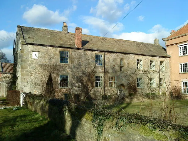
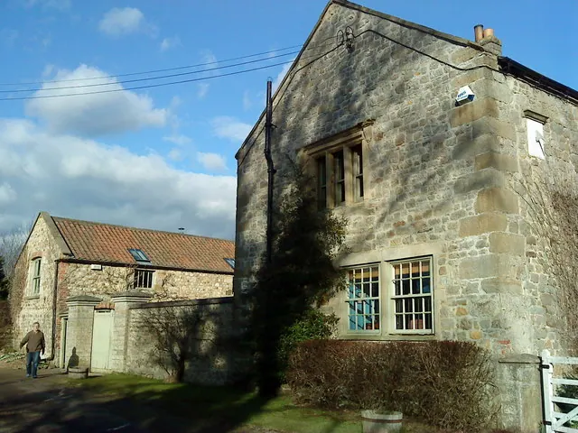
Historic England records 10 listed buildings within about a mile of Burrill. Listing protects structures of special architectural or historic interest, graded I (exceptional), II* (particularly important) and II.
Grade I
- Cowling Hall and Wing - 0.27 km
Grade II
- Low Cowling - 0.15 km
- Dovecote Approximately 100 Metres to South East of Cowling Hall - 0.24 km
- Wall in Front of Cowling Hall Next to Road - 0.25 km
- Wall With Doorway and Window (Approximately 5 Metres to South of Cowling Hall) - 0.25 km
- Garden Walls, 2 Walls Forming North and South Boundaries to East of Cowling Hall - 0.26 km
- The Mount (Approximately 100 Metres to West of Cowling Hall) - 0.32 km
- Ivy Cottage - 0.44 km
- Manor House - 0.49 km
- Piers Approximately 1,000 Metres to North of Thornton Watlass Hall - 0.83 km
Scheduled Monuments Near Burrill
Scheduled monuments are nationally important archaeological sites given legal protection. 2 lie within roughly a mile of Burrill:
- Round barrow 1/3 mile (540m) SW of Black Horse Inn - 1.13 km
- Round barrow known as Gospel Hill, 80m south west of Pasture House - 1.51 km
Burrill Today
Today Burrill lies within the administrative area of Burrill with Cowling.
Read more about modern Burrill on Wikipedia .
Nearby Domesday Settlements
Other places recorded in the 1086 survey within a few miles:
- Cowling - 0.0 km N
- Thornton Watlass - 2.0 km S
- Great Crakehall - 2.2 km NE
- Thirn - 2.8 km SW
- Newton le Willows - 2.8 km NW
- Bedale - 3.2 km E
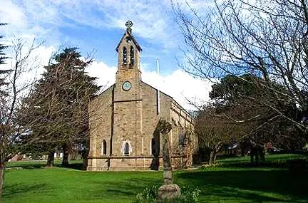
Heritage Around Burrill
Photographs of churches, listed buildings and monuments in the vicinity, contributed by volunteers to the Geograph project and reused here under a Creative Commons licence.
© Matthew Hatton · Geograph · CC BY-SA 2.0
© Matthew Hatton · Geograph · CC BY-SA 2.0
© Bill Henderson · Geograph · CC BY-SA 2.0
Images © their respective photographers, licensed under CC BY-SA 2.0 and reused here with attribution. Photographs depict listed buildings, churches and monuments near this settlement and may show neighbouring villages.
Location
54.2824°N, -1.6390°W · Land of Count Alan hundred, Yorkshire
View larger map on OpenStreetMap →Data derived from the Open Domesday project (opendomesday.org), based on the Domesday Book dataset compiled by Professor J.J.N. Palmer and team. The Domesday Book (1086) is in the public domain.
Found an inaccuracy? [email protected]