Brailsford in the Domesday Book (1086)
The settlement of Brailsford is recorded in William I’s Domesday survey of 1086, entered under the hundred of Appletree in Derbyshire.
Other Settlements in Appletree
- Alkmonton
- Ashe
- Aston
- Barton [Blount]
- Bentley
- Boylestone
- Bradley
- Bupton
- Clifton
- Doveridge
- Eaton [Dovedale]
- Edlaston
- Ednaston
- Fenton
The Meaning of the Name
The name Brailsford is of Anglo-Saxon origin. Its final element derives from the Old English word ford, a river crossing. The first element is most likely a personal name or an early descriptive term, now difficult to recover with certainty. Taken together the name probably meant something close to ‘a ford’.
Remarkably, the name has changed little since 1086, when the Domesday scribes wrote it as Brailsford.
Listed Buildings Near Brailsford
Historic England records 18 listed buildings within about a mile of Brailsford. Listing protects structures of special architectural or historic interest, graded I (exceptional), II* (particularly important) and II.
Grade I
- Church of All Saints - 1.12 km
Grade II
- Towns Well - 0.08 km
- The Bakery - 0.09 km
- School House - 0.11 km
- School - 0.12 km
- Coach House at Brailsford House - 0.19 km
- Brailsford House - 0.19 km
- Green Farmhouse - 0.27 km
- Barn to South of Green Farmhouse - 0.3 km
- Garage Cottages and Garage Shop - 0.32 km
- Coach House at the Oaklands - 0.32 km
- Hall Farmhouse - 0.32 km
- Oaklands - 0.33 km
- Old Rectory - 0.36 km
- Pools Head Farmhouse - 1.05 km
- Church Stable - 1.1 km
- Churchyard Cross - 1.12 km
- Top Wildpark Farmhouse - 1.22 km
Scheduled Monuments Near Brailsford
Scheduled monuments are nationally important archaeological sites given legal protection. 1 lies within roughly a mile of Brailsford:
- Anglo-Scandinavian high cross shaft and medieval cross base in the churchyard of All Saints’ Church - 1.12 km
Brailsford Today
Today Brailsford lies within the administrative area of Derbyshire Dales, and the settlement recorded a population of 1,320 at the 2021 census. Nine and a half centuries separate that figure from the small rural community the Domesday survey recorded here in 1086.
Read more about modern Brailsford on Wikipedia .
Nearby Domesday Settlements
Other places recorded in the 1086 survey within a few miles:
- Ednaston - 2.0 km W
- Mercaston - 2.2 km NE
- Mugginton - 3.2 km E
- Hollington - 3.6 km SW
- Shirley - 4.0 km W
- Weston Underwood - 4.1 km E
Heritage Around Brailsford
Photographs of churches, listed buildings and monuments in the vicinity, contributed by volunteers to the Geograph project and reused here under a Creative Commons licence.
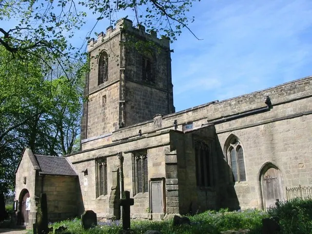
© Clive Woolliscroft · Geograph · CC BY-SA 2.0
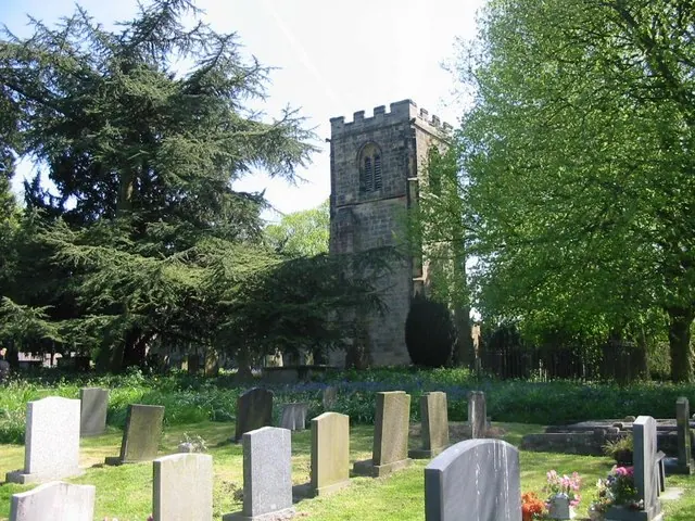
© Clive Woolliscroft · Geograph · CC BY-SA 2.0
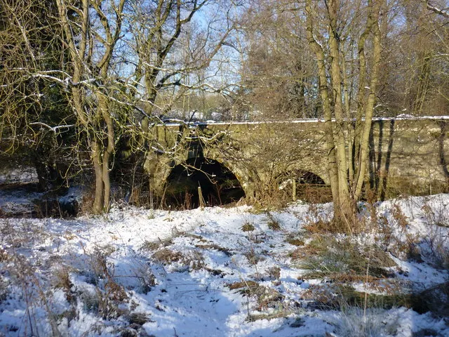
© Martyn Glover · Geograph · CC BY-SA 2.0
Images © their respective photographers, licensed under CC BY-SA 2.0 and reused here with attribution. Photographs depict listed buildings, churches and monuments near this settlement and may show neighbouring villages.
Data derived from the Open Domesday project (opendomesday.org), based on the Domesday Book dataset compiled by Professor J.J.N. Palmer and team. The Domesday Book (1086) is in the public domain.
Found an inaccuracy? [email protected]