Bothelford in the Domesday Book (1086)
Bothelford is named in the Domesday Book, compiled by Norman commissioners in 1086, entered under the hundred of Amounderness in Yorkshire.
Other Settlements in Amounderness
- Aighton
- Aldcliffe
- Aldingham
- Arkholme
- Aschebi
- Ashton [Hall]
- Ashton [on Ribble]
- Austwick
- Barbon
- Bardsea
- Bare
- Barnoldswick
- Barton
- Beetham
The Meaning of the Name
The name Bothelford is of Anglo-Saxon origin. Its final element derives from the Old English word ford, a river crossing. The first element is most likely a personal name or an early descriptive term, now difficult to recover with certainty. Taken together the name probably meant something close to ‘a ford’.
Remarkably, the name has changed little since 1086, when the Domesday scribes wrote it as Bothelford.
Listed Buildings Near Bothelford
Historic England records 14 listed buildings within about a mile of Bothelford. Listing protects structures of special architectural or historic interest, graded I (exceptional), II* (particularly important) and II.
Grade II*
- Church of St Mark - 0.58 km
Grade II
- Lancaster Kendal canal, Natland Hall Bridge over Lancaster/Kendal canal - 0.09 km
- Cowhouse, Stables Used As Henhouse and Stable With Hayloft to West of Natland Hall - 0.41 km
- Lancaster Kendal Canal, Crowpark Bridge over Lancaster/Kendal Canal - 0.44 km
- Natland Hall and Attached Outbuildings - 0.45 km
- Natland War Memorial - 0.57 km
- Hawes Bridge Over the River Kent - 0.59 km
- The Abbey - 0.66 km
- High House Farmhouse - 0.91 km
- Helsington Laithes Mill - 0.92 km
- Barn to East of High House Farmhouse - 0.93 km
- Helme Lodge - 1.09 km
- Larkrigg Hall Bridge over Lancaster/Kendal Canal - 1.25 km
- Hawes Farmhouse - 1.29 km
Scheduled Monuments Near Bothelford
Scheduled monuments are nationally important archaeological sites given legal protection. 2 lie within roughly a mile of Bothelford:
- Watercrook Roman fort and civil settlement - 1.23 km
- New Sedgwick gunpowder works, 580m north of Gate House - 1.57 km
Nearby Domesday Settlements
Other places recorded in the 1086 survey within a few miles:
- Helsington - 1.0 km W
- Kendal - 3.0 km N
- Stainton - 4.1 km S
- Levens - 4.2 km SW
- Old Hutton - 5.1 km E
- Mint House - 5.1 km N
Heritage Around Bothelford
Photographs of churches, listed buildings and monuments in the vicinity, contributed by volunteers to the Geograph project and reused here under a Creative Commons licence.
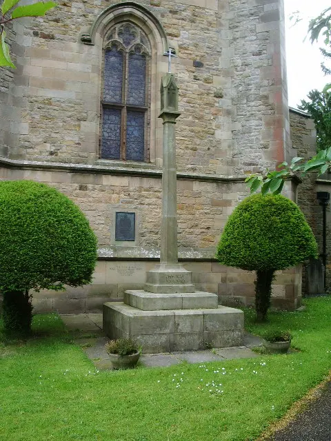
© Alexander P Kapp · Geograph · CC BY-SA 2.0
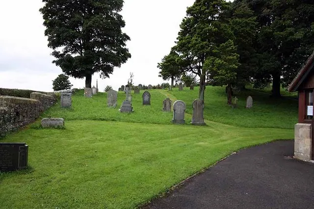
© John Salmon · Geograph · CC BY-SA 2.0
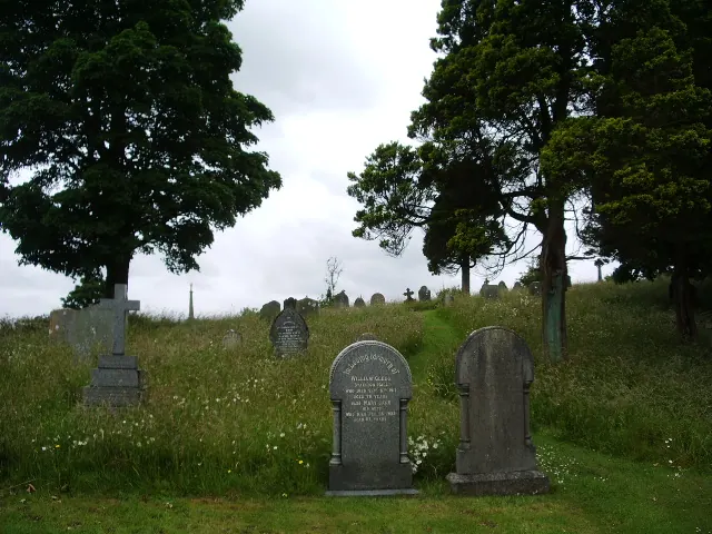
© Alexander P Kapp · Geograph · CC BY-SA 2.0
Images © their respective photographers, licensed under CC BY-SA 2.0 and reused here with attribution. Photographs depict listed buildings, churches and monuments near this settlement and may show neighbouring villages.
Data derived from the Open Domesday project (opendomesday.org), based on the Domesday Book dataset compiled by Professor J.J.N. Palmer and team. The Domesday Book (1086) is in the public domain.
Found an inaccuracy? [email protected]