Bosley in the Domesday Book (1086)
Bosley is named in the Domesday Book, compiled by Norman commissioners in 1086, entered under the hundred of Hamestan in Cheshire.
Other Settlements in Hamestan
- Adlington
- Bramhall
- Bredbury
- Butley
- Capesthorne
- Cheadle
- Chelford
- Cranage
- Gawsworth
- Henbury
- Hollingworth
- Hungrewenitune
- Kermincham
- Leighton
The Meaning of the Name
The name Bosley is of Anglo-Saxon origin. Its final element derives from the Old English word lēah, a woodland clearing or glade. The first element is most likely a personal name or an early descriptive term, now difficult to recover with certainty. Taken together the name probably meant something close to ‘a clearing’.
Remarkably, the name has changed little since 1086, when the Domesday scribes wrote it as Bosley.
Listed Buildings Near Bosley
Historic England records 18 listed buildings within about a mile of Bosley. Listing protects structures of special architectural or historic interest, graded I (exceptional), II* (particularly important) and II.
Grade II*
- Church of St Mary the Virgin - 0.23 km
Grade II
- Sundial and Shaft South of Nave in St Mary the Virgin Churchyard - 0.23 km
- Queen’s Arms Inn - 0.28 km
- School and Former Schoolmaster’s House (Now Forming Part of School) - 0.33 km
- Lymford Bridge - 0.53 km
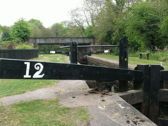
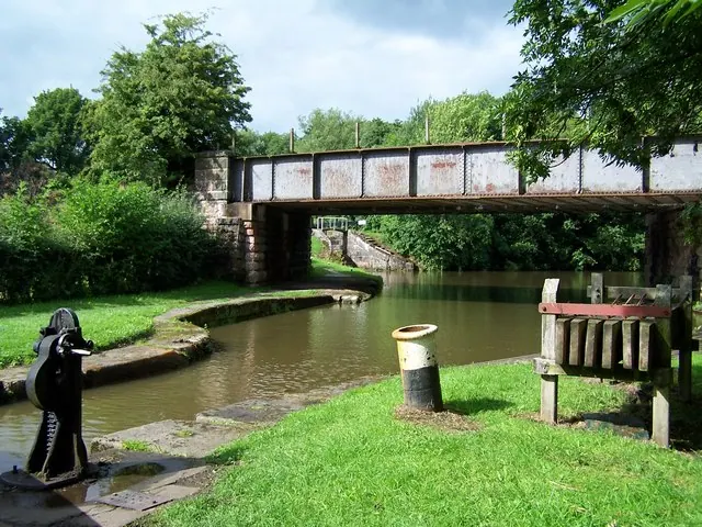
- Macclesfield Canal Bosley Lock Number 12 and Lock Pound - 0.76 km
- Macclesfield Canal Bosley Lock Number 11 and Lock Pound - 0.77 km
- Macclesfield Canal Bosley Lock Number 10 and Lock Pound - 0.83 km
- Valve House in Reservoir Dam - 0.89 km
- Mill House Farmhouse - 0.9 km
- Macclesfield Canal Bosley Lock Number 9 and Lock Pound - 0.93 km
- Macclesfield Canal Dane Aqueduct - 0.97 km
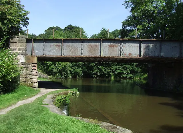
- Macclesfield Canal Bridge Number 56 - 1.0 km
- Macclesfield Canal Bosley Lock Number 8 and Lock Pound - 1.02 km
- Road Bridge Opposite East End of Reservoir Dam - 1.04 km
- Macclesfield Canal Bosley Lock Number 7 and Lock Pound - 1.11 km
- Macclesfield Canal Bridge Number 57 at Sj 9051 6518 - 1.12 km
- Macclesfield Canal, Bosley Lock Number 6 and Lock Pound at Sj 9049 6607 - 1.26 km
Bosley Today
Today Bosley lies within the administrative area of Cheshire East, and the settlement recorded a population of 449 at the 2021 census. Nine and a half centuries separate that figure from the small rural community the Domesday survey recorded here in 1086.
Read more about modern Bosley on Wikipedia .
Nearby Domesday Settlements
Other places recorded in the 1086 survey within a few miles:
- North Rode - 3.2 km W
- Church Lawton and Buglawton - 4.5 km SW
- Gawsworth - 5.0 km NW
- Congleton - 5.8 km SW
- Marton - 7.6 km NW
- Somerford Booths - 8.0 km W
Heritage Around Bosley
Photographs of churches, listed buildings and monuments in the vicinity, contributed by volunteers to the Geograph project and reused here under a Creative Commons licence.
© Raymond Knapman · Geograph · CC BY-SA 2.0
© Roger D Kidd · Geograph · CC BY-SA 2.0
© David Martin · Geograph · CC BY-SA 2.0
Images © their respective photographers, licensed under CC BY-SA 2.0 and reused here with attribution. Photographs depict listed buildings, churches and monuments near this settlement and may show neighbouring villages.
Data derived from the Open Domesday project (opendomesday.org), based on the Domesday Book dataset compiled by Professor J.J.N. Palmer and team. The Domesday Book (1086) is in the public domain.
Found an inaccuracy? [email protected]