Borwick in the Domesday Book (1086)
The settlement of Borwick is recorded in William I’s Domesday survey of 1086, entered under the hundred of Amounderness in Yorkshire. The survey assessed Borwick at 7 carucates of taxable land.
At the time of the survey, Borwick supported a recorded population of 7 villagers, 7 smallholders, 7 freemanmen, working 4 ploughs between them.
The survey puts Borwick’s value at 1 shilling, the same as before the Conquest. Unchanged valuations are relatively rare in the North, where disruption was widespread.
The survey lists 2 manors at Borwick under different lords. Splitting a single settlement between multiple tenants was common across the North – Saxon estates broken up and handed to William’s followers after 1066.
Resources Recorded at Borwick (1086)
- Mills: 2 mills (valued at 2d)
- Meadow: 1 None
- Woodland: 120 acres
Other Settlements in Amounderness
- Aighton
- Aldcliffe
- Aldingham
- Arkholme
- Aschebi
- Ashton [Hall]
- Ashton [on Ribble]
- Austwick
- Barbon
- Bardsea
- Bare
- Barnoldswick
- Barton
- Beetham
The Meaning of the Name
The name Borwick is of Anglo-Saxon origin. Its final element derives from the Old English word wīc, a dwelling, dairy farm or trading settlement. The first element is most likely a personal name or an early descriptive term, now difficult to recover with certainty. Taken together the name probably meant something close to ‘a specialised farm’.
Remarkably, the name has changed little since 1086, when the Domesday scribes wrote it as Borwick.
Listed Buildings Near Borwick
Historic England records 36 listed buildings within about a mile of Borwick. Listing protects structures of special architectural or historic interest, graded I (exceptional), II* (particularly important) and II.
Grade I
- Borwick Hall - 0.45 km
- Borwick Hall Gatehouse - 0.46 km
- Borwick Hall Stables - 0.48 km
Grade II
- Lancaster Canal Taylor’s Bridge (Number 137) - 0.28 km
- The Cottage, 25 Metres North of Sanders Farmhouse - 0.3 km
- The Green, the Eastern House of A Pair 15 Metres West of Borwick Lodge - 0.3 km
- Borwick Lodge - 0.3 km
- Sanders Farmhouse - 0.33 km
- Mansergh House - 0.35 km
- Pear Tree Cottage - 0.36 km
- Lancaster Canal Sanders Bridge (Number 136) - 0.37 km
- K6 Telephone Kiosk - 0.39 km
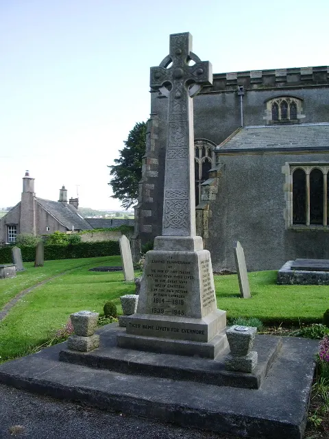
- Church of St Mary - 0.39 km
- Milestone on South Bank of Lancaster Canal, 130 Metres East of Tewitfield Old Turnpike Bridge at Ngr Sd 522 733 - 0.4 km
- Garden Walls and Entrance Gate to North-east and North-west of Borwick Hall - 0.4 km
- Watson House - 0.4 km
- Bankfield House - 0.41 km
- Balustrade to Terrace at South-west Front of Borwick Hall - 0.46 km
- Rockery Cottage - 0.46 km
- Beck House Farmhouse - 0.47 km
- Garden Wall Running South-west From Southern End of House and Turning North-west to Gatehouse - 0.48 km
- Barn Adjoining to South-west of the Stables at Borwick Hall, and Nos 1 and 2 Borwick Hall Cottages - 0.52 km
- Rose Lea - 0.52 km
- Lancaster Canal Tewitfield Old Turnpike Bridge (Number 138) - 0.53 km
…and 12 more listed structures in the area.
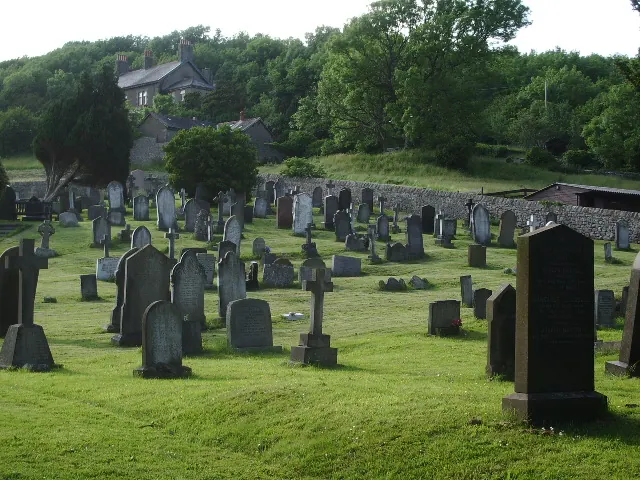
Scheduled Monuments Near Borwick
Scheduled monuments are nationally important archaeological sites given legal protection. 2 lie within roughly a mile of Borwick:
- Round cairn 230m east of Manor Farm - 0.66 km
- Moated site and fishponds E of Upp Hall Farm. - 1.21 km
Borwick Today
Today Borwick lies within the administrative area of Lancaster, and the settlement recorded a population of 181 at the 2021 census. Nine and a half centuries separate that figure from the small rural community the Domesday survey recorded here in 1086.
Read more about modern Borwick on Wikipedia .
Nearby Domesday Settlements
Other places recorded in the 1086 survey within a few miles:
- Priest Hutton - 1.0 km E
- Yealand Conyers and Redmayne - 2.8 km NW
- Nether and Over Kellet - 3.0 km S
- Warton - 3.2 km W
- Burton - 3.2 km N
- Dalton - 3.6 km NE
Heritage Around Borwick
Photographs of churches, listed buildings and monuments in the vicinity, contributed by volunteers to the Geograph project and reused here under a Creative Commons licence.
© Alexander P Kapp · Geograph · CC BY-SA 2.0
© Alexander P Kapp · Geograph · CC BY-SA 2.0
© David Brown · Geograph · CC BY-SA 2.0
Images © their respective photographers, licensed under CC BY-SA 2.0 and reused here with attribution. Photographs depict listed buildings, churches and monuments near this settlement and may show neighbouring villages.
Data derived from the Open Domesday project (opendomesday.org), based on the Domesday Book dataset compiled by Professor J.J.N. Palmer and team. The Domesday Book (1086) is in the public domain.
Found an inaccuracy? [email protected]