Bootle in the Domesday Book (1086)
Bootle appears in the Domesday Book of 1086, entered under the hundred of [West] Derby in Cheshire.
Other Settlements in [West] Derby
- Ainsdale
- Allerton
- Argarmeles
- Aughton
- Barton
- Childwall
- Dalton
- Downholland
- Formby
- Halsall
- Hurlston
- Huyton
- Ince [Blundell]
- Kirkby
The Meaning of the Name
The origin of the name Bootle is not securely established from its modern form alone; like many settlement names in the North it likely combines an Old English or Old Norse personal name with a landscape term.
Remarkably, the name has changed little since 1086, when the Domesday scribes wrote it as Bootle.
Listed Buildings Near Bootle
Historic England records 26 listed buildings within about a mile of Bootle. Listing protects structures of special architectural or historic interest, graded I (exceptional), II* (particularly important) and II.
Grade II*
- Bootle War Memorial, including flight of steps and flanking stone tablets - 0.23 km
- Sugar Silo - 1.19 km
Grade II
- Statue of Edward Vii South of Balliol Road Junction - 0.2 km
- Public Baths - 0.53 km
- Kings Centre - 0.54 km
- Former Post Office Maple Leaf Boxing Club - 0.57 km
- Juvenile Court and front wall - 0.58 km
- Education Department and front wall - 0.59 km
- Town Hall and Front Wall - 0.62 km
- 1, Merton Road - 0.7 km
- Old Hall - 0.7 km
- Christ Church - 0.7 km
- Canal Warehouse - 0.75 km
- Warehouse at 12 Effingham Street - 0.87 km
- Warehouse at 6 Effingham Street - 0.93 km
- Former Bootle Borough Hospital, including mortuary chapel, nurses’ home, outpatients’ department, boundary walls, railings and gates - 0.96 km
- Gordon Working Lads Institute Now Kirkdale Community Centre - 1.01 km
- Rainbow House - 1.04 km
- 59-73, Barlow Lane - 1.05 km
- Arnot St Mary Primary School - 1.1 km
- Westminster Road Former Fire/police Station - 1.11 km
- Church of St John the Evangelist - 1.15 km
- Glebe Hotel - 1.15 km
- Former Fire Station - 1.26 km
…and 2 more listed structures in the area.
Bootle Today
Today Bootle lies within the administrative area of Sefton, and the settlement recorded a population of 51,394 at the 2011 census. Nine and a half centuries separate that figure from the small rural community the Domesday survey recorded here in 1086.
Read more about modern Bootle on Wikipedia .
Nearby Domesday Settlements
Other places recorded in the 1086 survey within a few miles:
- Kirkdale - 1.0 km E
- Walton on the Hill - 2.2 km NE
- Down Litherland - 3.2 km N
- Wallasey - 3.6 km SW
- Smithdown - 4.5 km SE
- West Derby - 5.0 km E
Heritage Around Bootle
Photographs of churches, listed buildings and monuments in the vicinity, contributed by volunteers to the Geograph project and reused here under a Creative Commons licence.
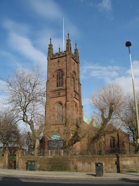
© Sue Adair · Geograph · CC BY-SA 2.0
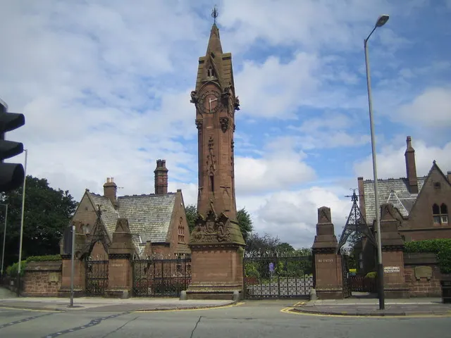
© Nigel Cox · Geograph · CC BY-SA 2.0
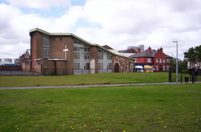
© S Parish · Geograph · CC BY-SA 2.0
Images © their respective photographers, licensed under CC BY-SA 2.0 and reused here with attribution. Photographs depict listed buildings, churches and monuments near this settlement and may show neighbouring villages.
Data derived from the Open Domesday project (opendomesday.org), based on the Domesday Book dataset compiled by Professor J.J.N. Palmer and team. The Domesday Book (1086) is in the public domain.
Found an inaccuracy? [email protected]