Bolton by Bowland in the Domesday Book (1086)
The 1086 Domesday survey records the settlement of Bolton by Bowland, entered under the hundred of Craven in Yorkshire.
Other Settlements in Craven
- Addingham
- Airton
- Anley
- Appletreewick
- Arncliffe
- Arnford
- Barnoldswick
- Bashall [Eaves]
- Battersby [Barn]
- Beamsley
- Birkby [Hall]
- Bogeuurde
- Bolton [Abbey]
- Bordley
The Meaning of the Name
The name Bolton by Bowland is of Anglo-Saxon origin. Its final element derives from the Old English word tūn, a farmstead or village. The first element is most likely a personal name or an early descriptive term, now difficult to recover with certainty. Taken together the name probably meant something close to ‘a farmstead’.
Remarkably, the name has changed little since 1086, when the Domesday scribes wrote it as Bolton by Bowland.
Listed Buildings Near Bolton by Bowland
Historic England records 33 listed buildings within about a mile of Bolton by Bowland. Listing protects structures of special architectural or historic interest, graded I (exceptional), II* (particularly important) and II.
Grade I
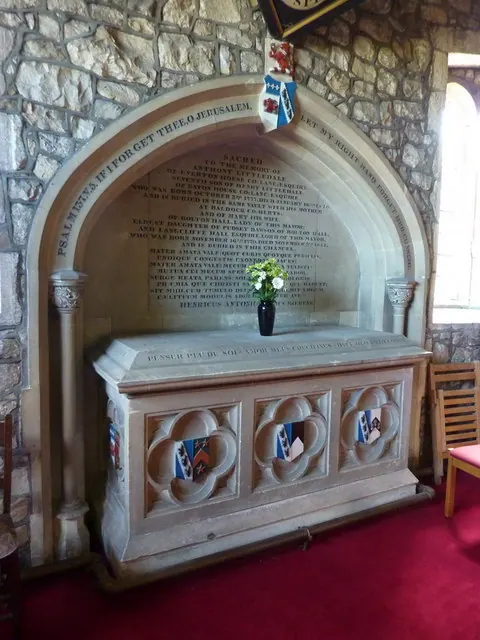
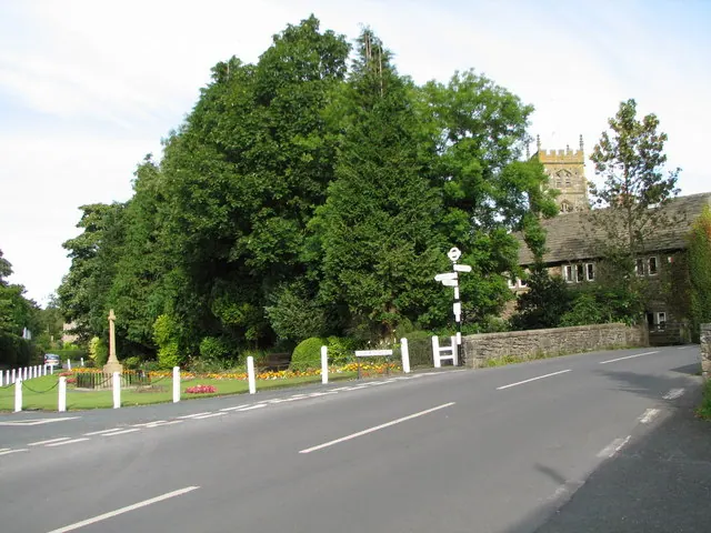
- Church of St Peter and St Paul - 0.1 km
Grade II
- Fernside - 0.04 km
- 13 and 15, Hellifield Road - 0.06 km
- Stocks Adjacent to the West of Village Cross - 0.09 km
- Village Cross - 0.09 km
- Church Gates - 0.1 km
- 23, Main Street - 0.11 km
- Wall, Steps and Gatepiers South of Church of St Peter and St Paul - 0.12 km
- Number 21 and Barn Adjoining to East - 0.12 km
- Sundial Base in South West Corner of Churchyard, Church of St Peter and St Paul - 0.12 km
- The Coach and Horses Public House - 0.13 km
- 5,7,9,11 and 13, Gisburn Road - 0.14 km
- 14, Main Street - 0.16 km
- The Old Rectory - 0.16 km
- 2 Pairs of Gatepiers South East of Church, at Entrance to Bolton Hall Drive - 0.16 km
- 9 and 11, Main Street - 0.17 km
- 10 and 12, Main Street - 0.17 km
- 8 and 8A, Main Street - 0.19 km
- Old Courthouse - 0.19 km
- Primrose Cottage and Keys Cottage - 0.2 km
- Skirden Bridge - 0.26 km
- Bolton by Bowland Church of England School and School House - 0.27 km
- Barn Adjoining to South West of Howgills House - 0.38 km
- Fox Ghyll - 0.51 km
…and 9 more listed structures in the area.
Scheduled Monuments Near Bolton by Bowland
Scheduled monuments are nationally important archaeological sites given legal protection. 1 lies within roughly a mile of Bolton by Bowland:
- Moated site 50m NE of Holden Green Farm. - 1.29 km
Bolton by Bowland Today
Today Bolton by Bowland lies within the administrative area of Ribble Valley, and the settlement recorded a population of 534 at the 2021 census. Nine and a half centuries separate that figure from the small rural community the Domesday survey recorded here in 1086.
Read more about modern Bolton-by-Bowland on Wikipedia .
Nearby Domesday Settlements
Other places recorded in the 1086 survey within a few miles:
- Raygill Moss - 2.0 km E
- Ellenthorpe - 3.0 km E
- Holme - 3.2 km N
- Gisburn - 4.1 km E
- Paythorne - 4.5 km NE
- Rimington - 4.5 km SE
Heritage Around Bolton [by Bowland]
Photographs of churches, listed buildings and monuments in the vicinity, contributed by volunteers to the Geograph project and reused here under a Creative Commons licence.
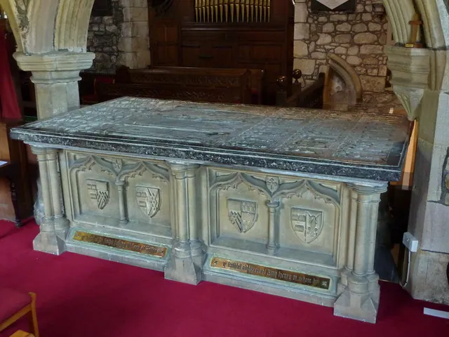
© Alexander P Kapp · Geograph · CC BY-SA 2.0
© Alexander P Kapp · Geograph · CC BY-SA 2.0
© K A · Geograph · CC BY-SA 2.0
Images © their respective photographers, licensed under CC BY-SA 2.0 and reused here with attribution. Photographs depict listed buildings, churches and monuments near this settlement and may show neighbouring villages.
Data derived from the Open Domesday project (opendomesday.org), based on the Domesday Book dataset compiled by Professor J.J.N. Palmer and team. The Domesday Book (1086) is in the public domain.
Found an inaccuracy? [email protected]