Birkby Hill in the Domesday Book (1086)
The settlement of Birkby Hill is recorded in William I’s Domesday survey of 1086, entered under the hundred of Skyrack in Yorkshire. The survey assessed Birkby Hill at 9 carucates of taxable land.
At the time of the survey, Birkby Hill supported a recorded population of 17 villagers, 3 smallholders, working 9 ploughs between them.
The valuation dropped between 1066 and 1086. Before 1066, Birkby Hill was worth 8 shillings; by 1086 that had dropped to 6 shillings – a fall of 25%. Most Yorkshire villages that lost value on this scale were swept up in the Harrying of the North – William’s scorched-earth campaign of 1069–70.
The survey lists 2 manors at Birkby Hill under different lords. Splitting a single settlement between multiple tenants was common across the North – Saxon estates broken up and handed to William’s followers after 1066.
Resources Recorded at Birkby Hill (1086)
- Churches: 1
- Meadow: 20 acres
Other Settlements in Skyrack
- Adel
- Allerton [Bywater]
- Alwoodley
- Arthington
- Austhorpe
- Baildon
- Bardsey
- Barwick [in Elmet]
- Bichertun
- Bicherun
- Bingley
- Bramhope
- Burden [Head]
- Burley [in Wharfedale]
The Meaning of the Name
The name Birkby Hill is of Scandinavian origin. Its final element derives from the Old Norse word bý, a farmstead or village, while the first element appears to represent birch (ON birki). Taken together the name probably meant something close to ’the birch farmstead’.
Names of this type are a fingerprint of Scandinavian settlement: they cluster across the old Danelaw, where Norse-speaking settlers renamed or founded villages from the late 9th century onward.
Remarkably, the name has changed little since 1086, when the Domesday scribes wrote it as Birkby Hill.
Listed Buildings Near Birkby Hill
Historic England records 14 listed buildings within about a mile of Birkby Hill. Listing protects structures of special architectural or historic interest, graded I (exceptional), II* (particularly important) and II.
Grade II
- Milestone Approximately 20 Metres North of Junction With Carr Lane - 0.46 km
- 1-8, Crofton Terrace - 0.6 km
- 197-205, Main Street - 0.82 km
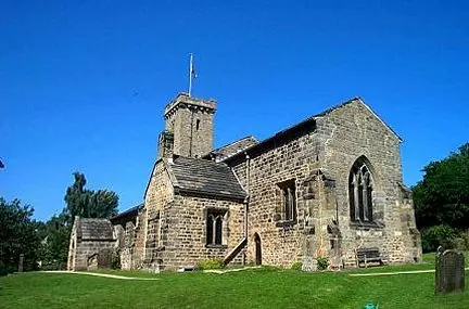
- Church of St Paul - 0.95 km
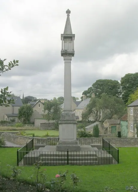
- War Memorial in St Pauls Churchyard - 0.95 km
- The Bishop’s House - 1.03 km
- L Shaped Coach House Approximately 15 Metres East of Bishops House - 1.05 km
- Manor Farmhouse, Outbuildings, Mounting Steps to North East and Garden Wall to South West - 1.16 km
- Barn and Byre Range North of Manor Farmhouse - 1.18 km
- Farm Buildings West of Manor Farmhouse - 1.19 km
- 133-139, Main Street - 1.23 km
- Pigeon House Approximately 150 Metres North West of Redhall House - 1.29 km
- 125, Main Street - 1.29 km
- Redhall House - 1.29 km
Nearby Domesday Settlements
Other places recorded in the 1086 survey within a few miles:
- Shadwell - 1.0 km W
- Thorner - 2.2 km NE
- Wheatcroft - 2.2 km NE
- Wike - 3.6 km NW
- Kiddal Hall - 4.0 km E
- Seacroft - 4.0 km S
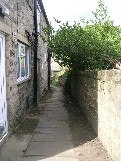
Heritage Around Birkby [Hill]
Photographs of churches, listed buildings and monuments in the vicinity, contributed by volunteers to the Geograph project and reused here under a Creative Commons licence.
© Betty Longbottom · Geograph · CC BY-SA 2.0
© Betty Longbottom · Geograph · CC BY-SA 2.0
© Bill Henderson · Geograph · CC BY-SA 2.0
Images © their respective photographers, licensed under CC BY-SA 2.0 and reused here with attribution. Photographs depict listed buildings, churches and monuments near this settlement and may show neighbouring villages.
Data derived from the Open Domesday project (opendomesday.org), based on the Domesday Book dataset compiled by Professor J.J.N. Palmer and team. The Domesday Book (1086) is in the public domain.
Found an inaccuracy? [email protected]