Birdsall in the Domesday Book (1086)
Birdsall is named in the Domesday Book, compiled by Norman commissioners in 1086, entered under the hundred of Scard in Yorkshire.
Other Settlements in Scard
- Buckton [Holms]
- Burdale
- Duggleby
- Kennythorpe
- Langton
- Linton
- Norton
- Rillington
- Scagglethorpe
- Scampston
- Settrington
- Sutton [Grange]
- Thorpe [Bassett]
- Towthorpe
The Meaning of the Name
The origin of the name Birdsall is not securely established from its modern form alone; like many settlement names in the North it likely combines an Old English or Old Norse personal name with a landscape term.
Remarkably, the name has changed little since 1086, when the Domesday scribes wrote it as Birdsall.
Listed Buildings Near Birdsall
Historic England records 14 listed buildings within about a mile of Birdsall. Listing protects structures of special architectural or historic interest, graded I (exceptional), II* (particularly important) and II.
Grade II*
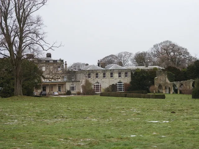
- Birdsall House - 0.37 km
Grade II
- The Huntsmans House - 0.31 km
- Old Ruined Church of All Hallows and Cross - 0.37 km
- Laundry 10 Metres North of Birdsall House - 0.4 km
- Brewery 20 Metres North of Birdsall House - 0.4 km
- Middleton Hunt Kennels - 0.45 km
- Birdsall House Stables - 0.45 km
- Wall of Kitchen Garden Approximately 50 Metres North of Birdsall House - 0.49 km
- Langar Cottages - 0.73 km
- The Estate Office - 0.74 km
- Home Farm Buildings - 0.78 km
- Home Farm Poultry Houses - 0.8 km
- Church of Saint Mary - 0.94 km
- Birdsall Grange Granary - 1.19 km
Scheduled Monuments Near Birdsall
Scheduled monuments are nationally important archaeological sites given legal protection. 11 lie within roughly a mile of Birdsall:
- Old church - 0.37 km
- A bowl barrow on Birdsall Brow, 100m west of Swinham Wood - 1.0 km
- Aldro earthworks: a bowl barrow and part of a linear boundary on Birdsall Wold, 200m north-east of Aldro Farm - 1.49 km
- Aldro earthworks: a cross-dyke on Birdsall Wold, 400m east of Aldro Farm - 1.51 km
- A cross-dyke on Birdsall Brow - 1.51 km
- A bowl barrow on Birdsall Wold, 600m east of Aldro Farm - 1.52 km
- Two bowl barrows on Birdsall Wold, 850m east of Aldro Farm - 1.54 km
- A bowl barrow on Birdsall Wold, 700m east of Aldro Farm - 1.54 km
- Aldro earthworks: seven bowl barrows and part of a linear boundary on Birdsall Wold, 220m east-north-east of Aldro Farm - 1.56 km
- A bowl barrow on Birdsall Wold, 530m east of Aldro Farm - 1.59 km
…and 1 more.
Birdsall Today
Today Birdsall lies within the administrative area of Ryedale, and the settlement recorded a population of 207 at the 2021 census. Nine and a half centuries separate that figure from the small rural community the Domesday survey recorded here in 1086.
Read more about modern Birdsall on Wikipedia .
Nearby Domesday Settlements
Other places recorded in the 1086 survey within a few miles:
- Burythorpe - 2.0 km W
- Leavening - 3.2 km W
- Leavening - 3.2 km W
- Kennythorpe - 3.6 km NW
- Langton - 3.6 km NW
- Wharram Percy - 4.0 km E
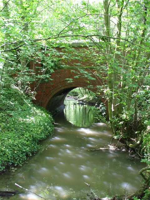
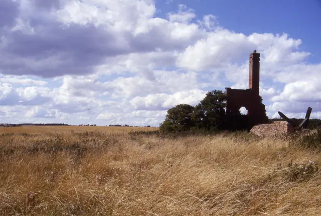
Heritage Around Birdsall
Photographs of churches, listed buildings and monuments in the vicinity, contributed by volunteers to the Geograph project and reused here under a Creative Commons licence.
© SMJ · Geograph · CC BY-SA 2.0
© Matthew Hatton · Geograph · CC BY-SA 2.0
© Chris Heaton · Geograph · CC BY-SA 2.0
Images © their respective photographers, licensed under CC BY-SA 2.0 and reused here with attribution. Photographs depict listed buildings, churches and monuments near this settlement and may show neighbouring villages.
Data derived from the Open Domesday project (opendomesday.org), based on the Domesday Book dataset compiled by Professor J.J.N. Palmer and team. The Domesday Book (1086) is in the public domain.
Found an inaccuracy? [email protected]