Beetham in the Domesday Book (1086)
Beetham is named in the Domesday Book, compiled by Norman commissioners in 1086, entered under the hundred of Amounderness in Yorkshire.
Other Settlements in Amounderness
- Aighton
- Aldcliffe
- Aldingham
- Arkholme
- Aschebi
- Ashton [Hall]
- Ashton [on Ribble]
- Austwick
- Barbon
- Bardsea
- Bare
- Barnoldswick
- Barton
- Bispham
The Meaning of the Name
The name Beetham is of Anglo-Saxon origin. Its final element derives from the Old English word hām, a homestead or village. The first element is most likely a personal name or an early descriptive term, now difficult to recover with certainty. Taken together the name probably meant something close to ‘a homestead’.
Remarkably, the name has changed little since 1086, when the Domesday scribes wrote it as Beetham.
Listed Buildings Near Beetham
Historic England records 17 listed buildings within about a mile of Beetham. Listing protects structures of special architectural or historic interest, graded I (exceptional), II* (particularly important) and II.
Grade I
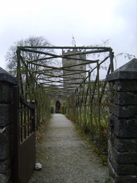
- Church of St Michael - 0.09 km
Grade II*
- Ashton House - 0.01 km
- Heron Corn Mill and Attached Mill Race - 0.49 km
- Curtain Wall Approximately 30 Metres North of Beetham Hall - 0.5 km
- Beetham Hall and Attached Outbuildings - 0.54 km
Grade II
- Coach House Approximately 10 Metres North West of Ashton House - 0.02 km
- Gazebo Approximately 20 Metres North of Ashton House - 0.03 km
- Yew Tree House Yew Tree Post Office Yew Trees - 0.06 km
- Dovecote Approximatley 50 Metres West South West of Parsonage Farmhouse - 0.12 km
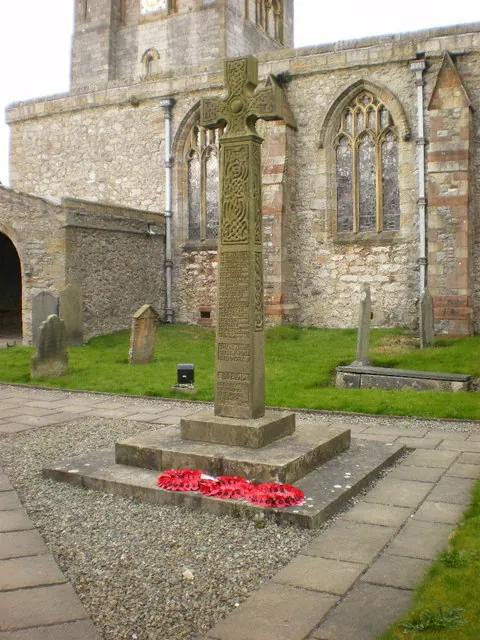
- War Memorial, Cross and Enclosing Walls Approximately 40 Metres North of Church of St Michael - 0.13 km
- Parsonage Farmhouse and Attached Stores to North - 0.14 km
- Gate piers approximately 12 metres east of Parsonage Farmhouse - 0.14 km
- Old School - 0.2 km
- Barn Approximately 20 Metres North East of Beetham Hall - 0.55 km
- Milestone Approximately 150 Meters North North West of Junction With Paradise Lane North of Beetham - 0.72 km
- Milestone Approximately 350 Metres North West of Junction With Pye’s Bridge Lane - 0.92 km
- Deer Shed Approximately 600 Metres South East of Dallam Tower - 1.1 km
Scheduled Monuments Near Beetham
Scheduled monuments are nationally important archaeological sites given legal protection. 3 lie within roughly a mile of Beetham:
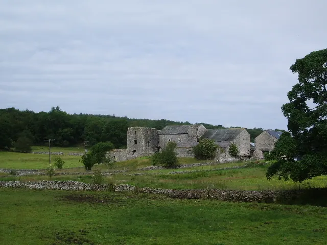
- Beetham Hall (curtain wall and uninhabited portion) - 0.56 km
- Cappleside Hall medieval lordly residence 600m north east of Beetham House - 0.91 km
- Ringwork in Dallam Park 380m south east of Dallam Tower - 1.36 km
Beetham Today
Today Beetham lies within the administrative area of Westmorland and Furness, and the settlement recorded a population of 1,763 at the 2021 census. Nine and a half centuries separate that figure from the small rural community the Domesday survey recorded here in 1086.
Read more about modern Beetham on Wikipedia .
Nearby Domesday Settlements
Other places recorded in the 1086 survey within a few miles:
- Holme - 3.2 km E
- Yealand Conyers and Redmayne - 4.1 km S
- Heversham Head - 4.1 km N
- Farleton - 4.5 km NE
- Burton - 5.0 km SE
- Hincaster - 5.1 km N
Heritage Around Beetham
Photographs of churches, listed buildings and monuments in the vicinity, contributed by volunteers to the Geograph project and reused here under a Creative Commons licence.
© Alexander P Kapp · Geograph · CC BY-SA 2.0
© Michael Graham · Geograph · CC BY-SA 2.0
© Alexander P Kapp · Geograph · CC BY-SA 2.0
Images © their respective photographers, licensed under CC BY-SA 2.0 and reused here with attribution. Photographs depict listed buildings, churches and monuments near this settlement and may show neighbouring villages.
Data derived from the Open Domesday project (opendomesday.org), based on the Domesday Book dataset compiled by Professor J.J.N. Palmer and team. The Domesday Book (1086) is in the public domain.
Found an inaccuracy? [email protected]