Batley in the Domesday Book (1086)
The 1086 Domesday survey records the settlement of Batley, entered under the hundred of Morley in Yorkshire.
Other Settlements in Morley
- Allerton
- Armley
- Beeston
- Bolton
- Bowling
- Bradford
- Bramley
- Calverley
- Carlton
- Chellow [Grange]
- Clayton
- Clifton
- Cruttonstall
- Dewsbury
The Meaning of the Name
The name Batley is of Anglo-Saxon origin. Its final element derives from the Old English word lēah, a woodland clearing or glade. The first element is most likely a personal name or an early descriptive term, now difficult to recover with certainty. Taken together the name probably meant something close to ‘a clearing’.
Remarkably, the name has changed little since 1086, when the Domesday scribes wrote it as Batley.
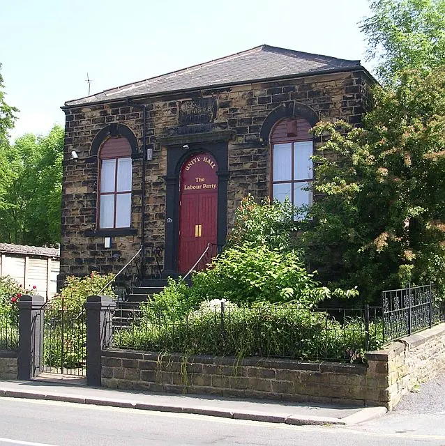
Listed Buildings Near Batley
Historic England records 45 listed buildings within about a mile of Batley. Listing protects structures of special architectural or historic interest, graded I (exceptional), II* (particularly important) and II.
Grade I
- Church of All Saints - 0.47 km
Grade II
- Park Road School and Attached Boundary Walls and Gates - 0.1 km
- Church of St Thomas - 0.19 km
- Zion Methodist Chapel - 0.35 km
- Town Hall - 0.37 km
- Barclays Bank Building, Boundary Wall and Gate Piers - 0.38 km
- Railway subway MDL1/31, Lady Ann Road Subway - 0.39 km
- 1-12, MARKET PLACE (See details for further address information) - 0.4 km
- Methodist Church - 0.43 km
- Pair of Telephone Kiosks on North Side of Public Library - 0.43 km
- Methodist Sunday School - 0.44 km
- Public Library - 0.45 km
- Boundary Stone Number 4 on the North Corner of Blenheim Drive and Batley Field Road - 0.46 km
- Batley Barless Fire Company - 0.47 km
- Effigy East of Porch to All Saints’ Church - 0.47 km
- War Memorial - 0.48 km
- Midland Bank - 0.48 km
- Railway subway MDL1/30, West Street Subway - 0.48 km
- The National Westminster Bank - 0.5 km
- Public Baths - 0.52 km
- Former Technical School - 0.55 km
- 2, 4, 6 and 8, Station Road - 0.56 km
- Numbers 13, 15, 17, 19, 21 and 23 and Including Boundary Wall, Piers, Steps and Railings - 0.58 km
- Number 25 and the Two Adjoining Warehouses - 0.59 km
…and 21 more listed structures in the area.
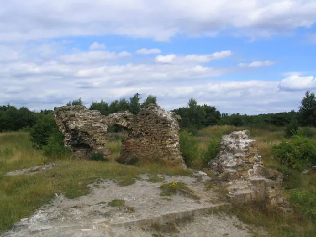
Scheduled Monuments Near Batley
Scheduled monuments are nationally important archaeological sites given legal protection. 1 lies within roughly a mile of Batley:
Batley Today
Today Batley lies within the administrative area of Kirklees, and the settlement recorded a population of 80,485 at the 2011 census. Nine and a half centuries separate that figure from the small rural community the Domesday survey recorded here in 1086.
Read more about modern Batley on Wikipedia .
Nearby Domesday Settlements
Other places recorded in the 1086 survey within a few miles:
- Hanging Heaton - 1.4 km SE
- Dewsbury - 3.0 km S
- Earlsheaton - 3.2 km S
- West Ardsley - 4.1 km E
- Gomersal - 4.5 km NW
- Morley - 4.5 km NE
Heritage Around Batley
Photographs of churches, listed buildings and monuments in the vicinity, contributed by volunteers to the Geograph project and reused here under a Creative Commons licence.
© Mick Melvin · Geograph · CC BY-SA 2.0

© Steve Partridge · Geograph · CC BY-SA 2.0
© Betty Longbottom · Geograph · CC BY-SA 2.0
Images © their respective photographers, licensed under CC BY-SA 2.0 and reused here with attribution. Photographs depict listed buildings, churches and monuments near this settlement and may show neighbouring villages.
Data derived from the Open Domesday project (opendomesday.org), based on the Domesday Book dataset compiled by Professor J.J.N. Palmer and team. The Domesday Book (1086) is in the public domain.
Found an inaccuracy? [email protected]