Barwick in Elmet in the Domesday Book (1086)
The 1086 Domesday survey records the settlement of Barwick in Elmet, entered under the hundred of Skyrack in Yorkshire.
Other Settlements in Skyrack
- Adel
- Allerton [Bywater]
- Alwoodley
- Arthington
- Austhorpe
- Baildon
- Bardsey
- Bichertun
- Bicherun
- Bingley
- Birkby [Hill]
- Bramhope
- Burden [Head]
- Burley [in Wharfedale]
The Meaning of the Name
The name Barwick in Elmet is of Anglo-Saxon origin. Its final element derives from the Old English word wīc, a dwelling, dairy farm or trading settlement. The first element is most likely a personal name or an early descriptive term, now difficult to recover with certainty. Taken together the name probably meant something close to ‘a specialised farm’.
Remarkably, the name has changed little since 1086, when the Domesday scribes wrote it as Barwick in Elmet.
Listed Buildings Near Barwick in Elmet
Historic England records 6 listed buildings within about a mile of Barwick in Elmet. Listing protects structures of special architectural or historic interest, graded I (exceptional), II* (particularly important) and II.
Grade II*
- Church of All Saints - 0.48 km
Grade II
- Elmwood House, including the righthand bay of No 46 - 0.36 km
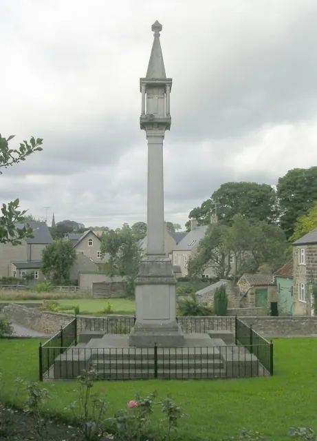
- Medieval Crossbase and War Memorial - 0.38 km
- The Old Rectory - 0.39 km
- Lime Trees Farmhouse - 0.48 km
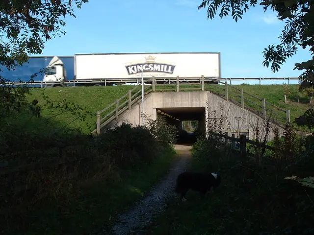
- Potterton Bridge - 0.98 km
Scheduled Monuments Near Barwick in Elmet
Scheduled monuments are nationally important archaeological sites given legal protection. 3 lie within roughly a mile of Barwick in Elmet:
- Barwick in Elmet large univallate hillfort and motte and bailey castle - 0.33 km
- Length of linear earthwork known as The Ridge, part of the Aberford Dyke system, 560m east of Potterton Bridge - 1.33 km
- Deserted medieval village of Potterton - 1.59 km
Barwick in Elmet Today
Today Barwick in Elmet lies within the administrative area of Barwick in Elmet and Scholes.
Read more about modern Barwick in Elmet on Wikipedia .
Nearby Domesday Settlements
Other places recorded in the 1086 survey within a few miles:
- Potterton - 1.4 km NE
- Kiddal Hall - 2.0 km N
- Parlington - 3.2 km E
- Shippen House - 3.2 km S
- Cowthwaite - 3.6 km NE
- Manston - 3.6 km SW
Heritage Around Barwick [in Elmet]
Photographs of churches, listed buildings and monuments in the vicinity, contributed by volunteers to the Geograph project and reused here under a Creative Commons licence.
© Betty Longbottom · Geograph · CC BY-SA 2.0
© vernon wood · Geograph · CC BY-SA 2.0
© Darren Haddock · Geograph · CC BY-SA 2.0
Images © their respective photographers, licensed under CC BY-SA 2.0 and reused here with attribution. Photographs depict listed buildings, churches and monuments near this settlement and may show neighbouring villages.
Data derived from the Open Domesday project (opendomesday.org), based on the Domesday Book dataset compiled by Professor J.J.N. Palmer and team. The Domesday Book (1086) is in the public domain.
Found an inaccuracy? [email protected]