Barningham in the Domesday Book (1086)
Barningham appears in the Domesday Book of 1086, entered under the hundred of Land of Count Alan in Yorkshire. The survey assessed Barningham at 2 carucates of taxable land.
At the time of the survey, Barningham supported a recorded population of 3 villagers, 5 slaves, 2 freemanmen, working 4 ploughs between them.
The survey puts Barningham’s value at 2 shillings, the same as before the Conquest. Unchanged valuations are relatively rare in the North, where disruption was widespread.
Resources Recorded at Barningham (1086)
- Meadow: 12 acres
Other Settlements in Land of Count Alan
- Achebi
- Agglethorpe
- Ainderby [Mires]
- Ainderby [Quernhow]
- Aiskew
- Aldbrough
- Allerthorpe [Hall]
- Ascam
- Ascham
- Asebi
- Aske [Hall]
- Askrigg
- Aysgarth
- Baldersby
The Meaning of the Name
The name Barningham is of Anglo-Saxon origin. Its final element derives from the Old English word hām, a homestead or village. The first element is most likely a personal name or an early descriptive term, now difficult to recover with certainty. Taken together the name probably meant something close to ‘a homestead’.
Remarkably, the name has changed little since 1086, when the Domesday scribes wrote it as Barningham.
Listed Buildings Near Barningham
Historic England records 49 listed buildings within about a mile of Barningham. Listing protects structures of special architectural or historic interest, graded I (exceptional), II* (particularly important) and II.
Grade II*
- Stable Block to North West of Barningham Park - 0.23 km
- Barningham Park - 0.27 km
Grade II
- Barningham House - 0.02 km
- The Hollies - 0.06 km
- Cross Socket by South East Entrance of St Michael’s Churchyard - 0.07 km
- Church of St. Michael - 0.08 km
- Virginia Cottage - 0.09 km
- Message Grave Slab 17 Metres South of Church of St Michael - 0.09 km
- Church View - 0.1 km
- Group of 3 Grave Slabs 15 Metres North West of St Michael’s Churchyard Entry - 0.11 km
- Hawden Headstone 5 Metres North West of St Michael’s Churchyard Entry - 0.11 km
- Kipling Headstone 12 Metres West of St Michael’s Churchyard Entry - 0.12 km
- The Milbank Arms - 0.12 km
- Coach House to North of the Old Rectory, With Attached Walls - 0.14 km
- Garden Walls and Attached Outbuilding to West of Glebe Farmhouse - 0.15 km
- Gateway, Approach Walls and South Wall to St Michael’s Churchyard - 0.15 km
- Glebe Farmhouse - 0.15 km
- The Old Rectory - 0.16 km
- Gate Piers at Main Entrance to Barningham Park - 0.18 km
- Manor House Farmhouse - 0.21 km
- Garden Wall and Attached Outbuildings to West of Barningham Park - 0.26 km
- Park Cottage, With Yard Walls to Rear - 0.26 km
- Front Wall and Gatepiers to Barningham Village School - 0.27 km
- Ha Ha Wall and Gates to East and South East of Barningham Park - 0.28 km
…and 25 more listed structures in the area.
Scheduled Monuments Near Barningham
Scheduled monuments are nationally important archaeological sites given legal protection. 4 lie within roughly a mile of Barningham:
- Medieval church site and churchyard cross, 10m south and 40m south east of St Michael’s Church - 0.08 km
- Carved rock 380m ENE of Bragg House, Barningham Moor - 1.23 km
- Cairn, 545m ESE of Bragg House, Barningham Moor - 1.25 km
- Cairnfield and associated remains, 250m south east of Bragg House, Barningham Moor - 1.34 km
Barningham Today
Today Barningham lies within the administrative area of County Durham, and the settlement recorded a population of 155 at the 2021 census. Nine and a half centuries separate that figure from the small rural community the Domesday survey recorded here in 1086.
Read more about modern Barningham on Wikipedia .
Nearby Domesday Settlements
Other places recorded in the 1086 survey within a few miles:
Heritage Around Barningham
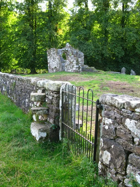
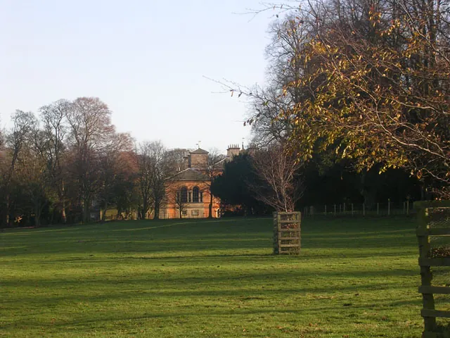
Photographs of churches, listed buildings and monuments in the vicinity, contributed by volunteers to the Geograph project and reused here under a Creative Commons licence.

© Stanley Howe · Geograph · CC BY-SA 2.0
© David Rogers · Geograph · CC BY-SA 2.0
© Oliver Dixon · Geograph · CC BY-SA 2.0
Images © their respective photographers, licensed under CC BY-SA 2.0 and reused here with attribution. Photographs depict listed buildings, churches and monuments near this settlement and may show neighbouring villages.
Location
54.4896°N, -1.8688°W · Land of Count Alan hundred, Yorkshire
View larger map on OpenStreetMap →Data derived from the Open Domesday project (opendomesday.org), based on the Domesday Book dataset compiled by Professor J.J.N. Palmer and team. The Domesday Book (1086) is in the public domain.
Found an inaccuracy? [email protected]