Barnhill Hall in the Domesday Book (1086)
Barnhill Hall is named in the Domesday Book, compiled by Norman commissioners in 1086, entered under the hundred of Howden in Yorkshire.
Other Settlements in Howden
- Asselby
- Babthorpe
- Barlby
- Barmby [on the Marsh]
- Belby [House]
- Bowthorpe
- Brackenholme
- Burland [House]
- Cavil
- Cliffe
- Cotness [Hall]
- Eastrington
- Hagthorpe
- Hemingbrough
The Meaning of the Name
The origin of the name Barnhill Hall is not securely established from its modern form alone; like many settlement names in the North it likely combines an Old English or Old Norse personal name with a landscape term.
Remarkably, the name has changed little since 1086, when the Domesday scribes wrote it as Barnhill Hall.
Listed Buildings Near Barnhill Hall
Historic England records 41 listed buildings within about a mile of Barnhill Hall. Listing protects structures of special architectural or historic interest, graded I (exceptional), II* (particularly important) and II.
Grade I
Grade II*
- Knedlington Old Hall - 0.62 km
Grade II
- Barnhill Hall - 0.43 km
- Knedlington House and Garden Wall and Gates - 0.46 km
- Loose Boxes, Hayloft and Pigeoncote to North of Knedlington Hall - 0.62 km
- Gate piers at Knedlington Old Hall - 0.64 km
- The Round House - 0.66 km
- Catholic Church of the Sacred Heart - 1.07 km
- 14, Saint John’s Street - 1.08 km
- The Chestnuts - 1.11 km
- 20, Treeton Road - 1.11 km
- Coach House Approximately 10 Metres East of Number 16 - 1.13 km
- 3, Saint John’s Street - 1.13 km
- 2 and 4, Pinfold Street - 1.14 km
- 4, Parson’s Lane - 1.15 km
- 87, BRIDGEGATE (See details for further address information) - 1.15 km
- 64, Bridgegate - 1.17 km
- 60-62, Bridgegate - 1.18 km
- 58, Bridgegate - 1.18 km
- War Memorial - 1.19 km
- K6 Telephone Kiosk - 1.2 km
- 2, Churchside - 1.23 km
- The Old Courthouse - 1.25 km
- 3, Vicar Lane - 1.25 km
…and 17 more listed structures in the area.
Scheduled Monuments Near Barnhill Hall
Scheduled monuments are nationally important archaeological sites given legal protection. 2 lie within roughly a mile of Barnhill Hall:
- Howden Church, ruined portions - 1.23 km
- Bishop’s Manor House - 1.3 km
Barnhill Hall Today
Today Barnhill Hall lies within the administrative area of Asselby.
Read more about modern Knedlington on Wikipedia .
Nearby Domesday Settlements
Other places recorded in the 1086 survey within a few miles:
- Knedlington - 0.0 km N
- Howden - 1.0 km E
- Asselby - 2.0 km W
- Newsholme - 2.2 km NW
- Thorpe Lidget - 3.2 km E
- Little Airmyn - 3.2 km S
Heritage Around Barnhill [Hall]
Photographs of churches, listed buildings and monuments in the vicinity, contributed by volunteers to the Geograph project and reused here under a Creative Commons licence.
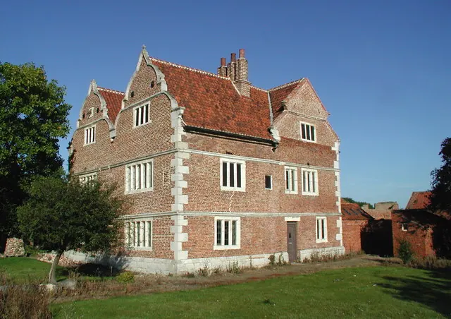
© Paul Glazzard · Geograph · CC BY-SA 2.0
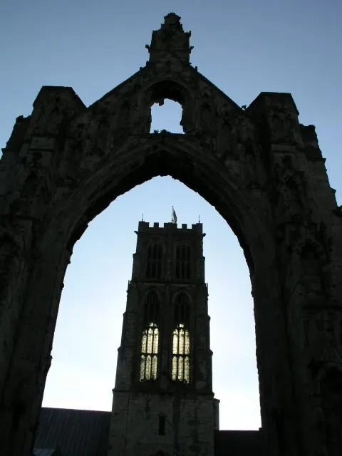
© mym · Geograph · CC BY-SA 2.0
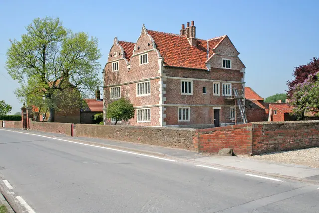
© Gordon Kneale Brooke · Geograph · CC BY-SA 2.0
Images © their respective photographers, licensed under CC BY-SA 2.0 and reused here with attribution. Photographs depict listed buildings, churches and monuments near this settlement and may show neighbouring villages.
Data derived from the Open Domesday project (opendomesday.org), based on the Domesday Book dataset compiled by Professor J.J.N. Palmer and team. The Domesday Book (1086) is in the public domain.
Found an inaccuracy? [email protected]