Barforth Hall in the Domesday Book (1086)
Barforth Hall is named in the Domesday Book, compiled by Norman commissioners in 1086, entered under the hundred of Land of Count Alan in Yorkshire.
Other Settlements in Land of Count Alan
- Achebi
- Agglethorpe
- Ainderby [Mires]
- Ainderby [Quernhow]
- Aiskew
- Aldbrough
- Allerthorpe [Hall]
- Ascam
- Ascham
- Asebi
- Aske [Hall]
- Askrigg
- Aysgarth
- Baldersby
The Meaning of the Name
The name Barforth Hall is of Anglo-Saxon origin. Its final element derives from the Old English word ford, a river crossing. The first element is most likely a personal name or an early descriptive term, now difficult to recover with certainty. Taken together the name probably meant something close to ‘a ford’.
Remarkably, the name has changed little since 1086, when the Domesday scribes wrote it as Barforth Hall.
Listed Buildings Near Barforth Hall
Historic England records 44 listed buildings within about a mile of Barforth Hall. Listing protects structures of special architectural or historic interest, graded I (exceptional), II* (particularly important) and II.
Grade I
- Church of St Mary - 0.42 km
- Gainford Hall - 0.43 km
Grade II*
- Dovecote 100 Metres North of St Lawrence’s Chapel - 0.29 km
- Barforth Hall With Attached Outbuilding to North East - 0.3 km
- Ruins of St Lawrence’s Chapel - 0.37 km
- Dovecote, 45 metres south of Gainford Hall - 0.4 km
- Chapel Bridge Over Black Beck - 0.44 km
Grade II
- Farmbuilding Group to North of Barnforth Hall - 0.34 km
- Garden Walls to West of Barforth Hall - 0.34 km
- Column,35 Metres East of Edleston House - 0.35 km
- Garden Wall, 20 Metres South-east of Gainford Hall - 0.41 km
- Headstone to Thomas Williamson, 5 Metres South of Church of St. Mary - 0.42 km
- Tomb to Sir William Pudsey, 1 Metre South of the Church of St. Mary - 0.43 km
- Garden Wall, 20 Metres South West of Gainford Hall - 0.43 km
- Gainford War Memorial - 0.44 km
- 27 and 28, Low Green - 0.47 km
- Labarnum Cottage - 0.48 km
- Durham House - 0.49 km
- Airy Croft - 0.49 km
- Garden Walls and Piers to Nos. 8 to 15 - 0.49 km
- Village Cross - 0.52 km
- 10, High Row - 0.52 km
- Mayfield House - 0.52 km
- White House - 0.53 km
…and 20 more listed structures in the area.
Scheduled Monuments Near Barforth Hall
Scheduled monuments are nationally important archaeological sites given legal protection. 2 lie within roughly a mile of Barforth Hall:
- St Lawrence’s Chapel, manorial settlement remains and dovecote - 0.31 km
- Barforth Bridge - 0.44 km
Barforth Hall Today
Today Barforth Hall lies within the administrative area of County Durham, and the settlement recorded a population of 63 at the 2021 census. Nine and a half centuries separate that figure from the small rural community the Domesday survey recorded here in 1086.
Read more about modern Barforth on Wikipedia .
Nearby Domesday Settlements
Other places recorded in the 1086 survey within a few miles:
- Caldwell - 3.0 km S
- Eppleby - 3.2 km S
- Ovington - 3.6 km SW
- Cliffe Hall - 4.1 km E
- Forcett - 4.1 km S
- Girlington Hall - 5.0 km SW
Heritage Around Barforth [Hall]
Photographs of churches, listed buildings and monuments in the vicinity, contributed by volunteers to the Geograph project and reused here under a Creative Commons licence.
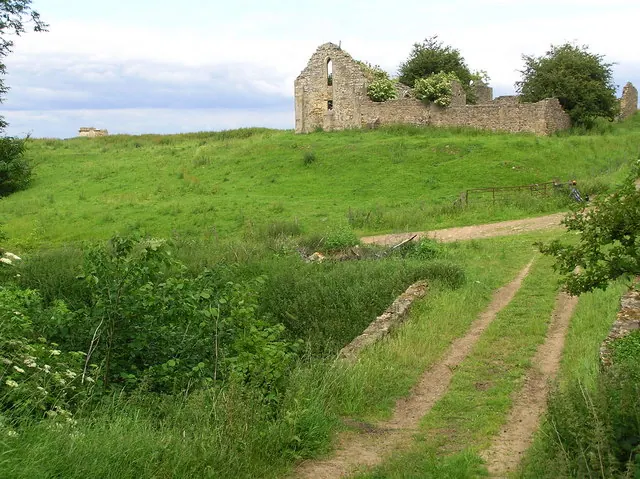
© Hugh Mortimer · Geograph · CC BY-SA 2.0
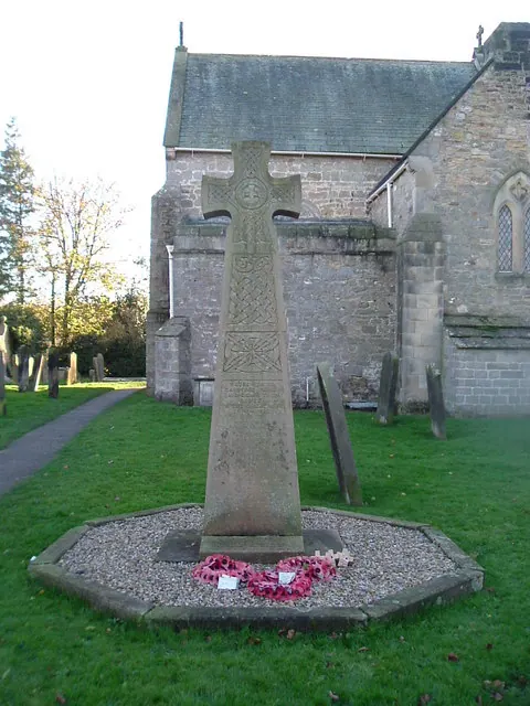
© Stanley Howe · Geograph · CC BY-SA 2.0
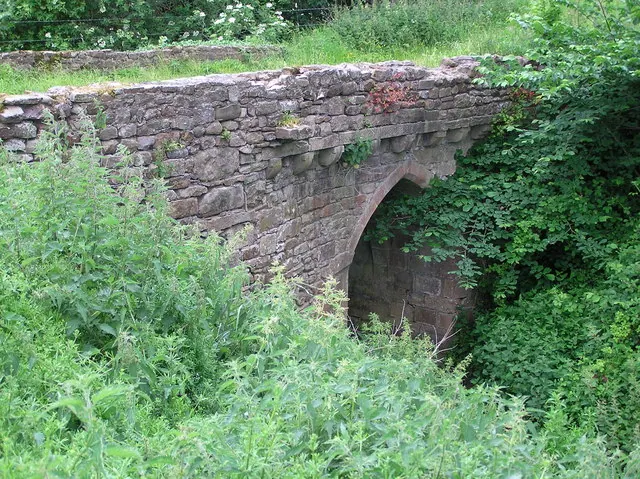
© Hugh Mortimer · Geograph · CC BY-SA 2.0
Images © their respective photographers, licensed under CC BY-SA 2.0 and reused here with attribution. Photographs depict listed buildings, churches and monuments near this settlement and may show neighbouring villages.
Location
54.5433°N, -1.7449°W · Land of Count Alan hundred, Yorkshire
View larger map on OpenStreetMap →Data derived from the Open Domesday project (opendomesday.org), based on the Domesday Book dataset compiled by Professor J.J.N. Palmer and team. The Domesday Book (1086) is in the public domain.
Found an inaccuracy? [email protected]