Baldebi in the Domesday Book (1086)
The settlement of Baldebi is recorded in William I’s Domesday survey of 1086, entered under the hundred of Langbaurgh in Yorkshire.
Other Settlements in Langbaurgh
- Acklam
- Airy [Holme]
- Aislaby
- Arnodestorp
- Barnaby
- Barwick
- Battersby
- Bergolbi
- Berguluesbi
- Blaten [Carr]
- Borrowby
- Breck
- Brotton
- Caldenesche
The Meaning of the Name
The origin of the name Baldebi is not securely established from its modern form alone; like many settlement names in the North it likely combines an Old English or Old Norse personal name with a landscape term.
Remarkably, the name has changed little since 1086, when the Domesday scribes wrote it as Baldebi.
Listed Buildings Near Baldebi
Historic England records 405 listed buildings within about a mile of Baldebi. Listing protects structures of special architectural or historic interest, graded I (exceptional), II* (particularly important) and II.
Grade I
- Whitby Abbey (Ruins) - 0.38 km
- Whitby Abbey Cross - 0.41 km
- Garden Walls and Gatepiers to the Abbey House - 0.45 km
- Parish Church of St Mary - 0.5 km
- Youth Hostel - 0.51 km
- The Abbey House - 0.52 km
- Donkey Road - 0.59 km
- The Church Stairs - 0.59 km
Grade II
- 28 and 30, Henrietta Street - 0.5 km
- 26, Henrietta Street - 0.51 km
- Fortunes Whitby Kippers - 0.52 km
- 20, Henrietta Street - 0.53 km
- 37, Henrietta Street - 0.53 km
- 35, Henrietta Street - 0.54 km
- Morland Cottage - 0.55 km
- 12 and 14, Henrietta Street - 0.55 km
- 16 and 18, Henrietta Street - 0.55 km
- 6-10, Henrietta Street - 0.56 km
- 23-29, Henrietta Street - 0.57 km
- 4, Henrietta Street - 0.58 km
- Workshop Owned by Number 14 Blackburn’s Yard - 0.59 km
- No 14 Blackburn’s Yard - 0.59 km
- 1, Church Lane - 0.6 km
- East Pier - 0.6 km
…and 381 more listed structures in the area.
Scheduled Monuments Near Baldebi
Scheduled monuments are nationally important archaeological sites given legal protection. 2 lie within roughly a mile of Baldebi:
- Whitby Abbey: Saxon double-house, post-Conquest Benedictine monastery, C17 manor house and C14 cross. - 0.42 km
- Saltwick Nab alum quarries - 0.87 km
Nearby Domesday Settlements
Other places recorded in the 1086 survey within a few miles:
- Breck - 0.0 km N
- Prestby - 0.0 km N
- Sowerby - 0.0 km N
- Whitby - 0.0 km N
- Flowergate - 1.0 km W
- High Stakesby - 2.2 km SW
Heritage Around Baldebi
Photographs of churches, listed buildings and monuments in the vicinity, contributed by volunteers to the Geograph project and reused here under a Creative Commons licence.
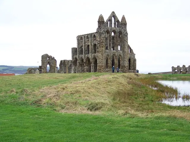
© Maigheach-gheal · Geograph · CC BY-SA 2.0
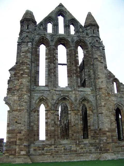
© Maigheach-gheal · Geograph · CC BY-SA 2.0
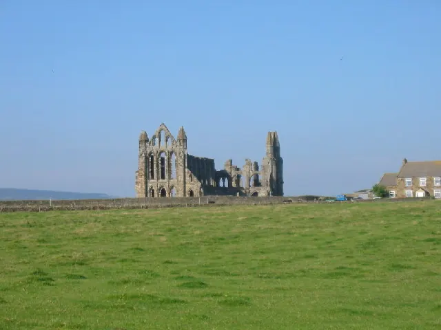
© Colin Westley · Geograph · CC BY-SA 2.0
Images © their respective photographers, licensed under CC BY-SA 2.0 and reused here with attribution. Photographs depict listed buildings, churches and monuments near this settlement and may show neighbouring villages.
Data derived from the Open Domesday project (opendomesday.org), based on the Domesday Book dataset compiled by Professor J.J.N. Palmer and team. The Domesday Book (1086) is in the public domain.
Found an inaccuracy? [email protected]