Bakewell in the Domesday Book (1086)
The settlement of Bakewell is recorded in William I’s Domesday survey of 1086, entered under the hundred of Blackwell in Derbyshire. The survey assessed Bakewell at 4 carucates of taxable land.
At the time of the survey, Bakewell supported a recorded population of 12 villagers, 7 smallholders, 3 slaves, working 8 ploughs between them.
By 1086 Bakewell was worth 2.5 shillings, up from 2 shillings before the Conquest – a sign this community came through the Conquest without being ruined.
Resources Recorded at Bakewell (1086)
- Meadow: 16 acres
- Woodland: 0.5 * 0.5 leagues
Other Settlements in Blackwell
- Abney
- Ashford [-in-the-Water]
- Aston
- Bamford
- Baslow
- Beeley
- Birchills
- Birchover
- Blackwell
- Bradwell
- Bubnell
- Burley
- Burton
- Calver
The Meaning of the Name
The name Bakewell is of Anglo-Saxon origin. Its final element derives from the Old English word wella, a spring or stream. The first element is most likely a personal name or an early descriptive term, now difficult to recover with certainty. Taken together the name probably meant something close to ‘a spring’.
Remarkably, the name has changed little since 1086, when the Domesday scribes wrote it as Bakewell.
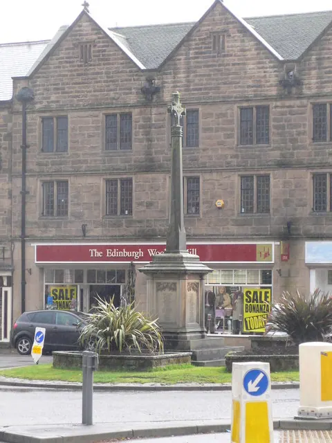
Listed Buildings Near Bakewell
Historic England records 178 listed buildings within about a mile of Bakewell. Listing protects structures of special architectural or historic interest, graded I (exceptional), II* (particularly important) and II.
Grade I
- The Great Cross and Railed Enclosure - 0.03 km
- Church of All Saints - 0.05 km
- Cross Situated 12 Metres to South of Porch of Church of All Saints - 0.06 km
Grade II
- Church of All Saints Walls and Steps Including Entrances and Wall Facing Church Lane Entrance and Wall to Churchyard of All Saints - 0.03 km
- The Old Cottage - 0.03 km
- Church of All Saints Walls and Entrances Including Attached Railings at West End - 0.04 km
- Saxon Cottage and Dial Cottage - 0.04 km
- Church View (Number 9) - 0.04 km
- Numbers 25 and 26 Including Attached Front Garden Walls - 0.05 km
- Jasmine Cottage, Green Lea, Bryn Cott, Claverley House and Front Garden Wall - 0.05 km
- Number 1 and Butts Cottage - 0.05 km
- Ivy House - 0.05 km
- Church Cottage - 0.06 km
- Imsworth Cottage Gritston Cottage and Wainstones - 0.06 km
- The Limes - 0.06 km
- Garden Wall and Gate Posts at the Limes - 0.06 km
- Wall Along South Side of Little Hill Wall to Rear of St Johns Hospital - 0.06 km
- Front Railings and Garden Wall to East Side of Ivy House - 0.06 km
- Butts View - 0.07 km
- 1820 Cottage Spire and Hillside Cottage and Railings to Hillside Cottage - 0.07 km
- Church House Including Attached House to Rear and Railings - 0.07 km
- Little Hill Cottage - 0.07 km
- Holly Cottage Holly House - 0.07 km
- St Johns Hospital and Attached Front Wall - 0.07 km
…and 154 more listed structures in the area.
Scheduled Monuments Near Bakewell
Scheduled monuments are nationally important archaeological sites given legal protection. 7 lie within roughly a mile of Bakewell:
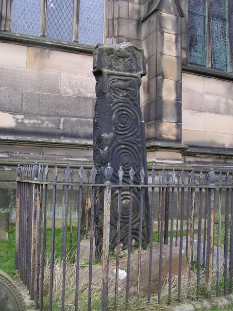
- Anglian high cross in the churchyard of All Saints’ Church - 0.02 km
- Anglo-Scandinavian high cross from Two Dales, Darley, now in the churchyard of All Saints’ Church - 0.05 km
- Bakewell Bridge - 0.38 km
- Holm Bridge - 0.53 km
- Motte and bailey castle on Castle Hill - 0.61 km
- Lumford Mill, Bakewell - 1.12 km
- Promontory fort south of Ballcross Farm - 1.35 km
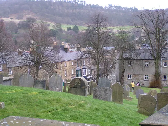
Bakewell Today
Today Bakewell lies within the administrative area of Derbyshire Dales, and the settlement recorded a population of 3,496 at the 2021 census. Nine and a half centuries separate that figure from the small rural community the Domesday survey recorded here in 1086.
Read more about modern Bakewell on Wikipedia .
Nearby Domesday Settlements
Other places recorded in the 1086 survey within a few miles:
- Holme - 1.0 km N
- Burton - 1.4 km SW
- Ashford -in-the-Water - 2.2 km NW
- Birchills - 2.2 km NE
- Nether and Over Haddon - 2.2 km SW
- Conksbury - 3.0 km S
Heritage Around Bakewell
Photographs of churches, listed buildings and monuments in the vicinity, contributed by volunteers to the Geograph project and reused here under a Creative Commons licence.
© Dave Dunford · Geograph · CC BY-SA 2.0
© Dave Dunford · Geograph · CC BY-SA 2.0
© Eirian Evans · Geograph · CC BY-SA 2.0
Images © their respective photographers, licensed under CC BY-SA 2.0 and reused here with attribution. Photographs depict listed buildings, churches and monuments near this settlement and may show neighbouring villages.
Data derived from the Open Domesday project (opendomesday.org), based on the Domesday Book dataset compiled by Professor J.J.N. Palmer and team. The Domesday Book (1086) is in the public domain.
Found an inaccuracy? [email protected]