Baildon in the Domesday Book (1086)
Baildon is named in the Domesday Book, compiled by Norman commissioners in 1086, entered under the hundred of Skyrack in Yorkshire.
Other Settlements in Skyrack
- Adel
- Allerton [Bywater]
- Alwoodley
- Arthington
- Austhorpe
- Bardsey
- Barwick [in Elmet]
- Bichertun
- Bicherun
- Bingley
- Birkby [Hill]
- Bramhope
- Burden [Head]
- Burley [in Wharfedale]
The Meaning of the Name
The name Baildon is of Anglo-Saxon origin. Its final element derives from the Old English word dūn, a hill. The first element is most likely a personal name or an early descriptive term, now difficult to recover with certainty. Taken together the name probably meant something close to ‘a hill’.
Remarkably, the name has changed little since 1086, when the Domesday scribes wrote it as Baildon.
Listed Buildings Near Baildon
Historic England records 34 listed buildings within about a mile of Baildon. Listing protects structures of special architectural or historic interest, graded I (exceptional), II* (particularly important) and II.
Grade II*
- Baildon Hall - 0.14 km
Grade II
- Butler House - 0.11 km
- Butler Cottage and Butler Farmhouse - 0.12 km
- Church of St John the Evangelist - 0.18 km
- Baildon Moravian Church - 0.2 km
- Wesley House - 0.21 km
- Crowtree - 0.24 km
- Old Hall - 0.25 km
- The Old Mill Restaurant - 0.26 km
- Barn Attached to the Rear of the Angel Public House - 0.27 km
- 27 and 27A, Station Road - 0.27 km
- 2 and 4, Brook Hill - 0.28 km
- Bank Walk House - 0.28 km
- Brookhill Stores - 0.28 km
- Stocks - 0.3 km
- Cross Base and Shaft of Cross - 0.31 km
- 22, 24 and 26, Brook Hill - 0.32 km
- Malt Shovel Public House - 0.32 km
- Baildon House - 0.33 km
- 24, 26, 28 and 30, Northgate - 0.36 km
- 4-Storey Mill Warehouse Forming Part of the Premises of John Peel and Son Limited - 0.4 km
- Moorfield - 0.45 km
- Sandal First School - 0.45 km
- 14, Low Fold - 0.46 km
…and 10 more listed structures in the area.
Scheduled Monuments Near Baildon
Scheduled monuments are nationally important archaeological sites given legal protection. 5 lie within roughly a mile of Baildon:
- Cup and ring marked rock at Hoyle Court Drive, Charlestown - 0.84 km
- Cup and ring marked rock east of Eaves Crag, Baildon Moor - 1.1 km
- Cup marked rock 180m north of the covered reservoir at Baildon - 1.2 km
- Rock with one cup mark north east of the Cricketers’ Arms, Baildon Green - 1.2 km
- Round cairn on east flank of Baildon Hill - 1.5 km
Baildon Today
Today Baildon lies within the administrative area of Bradford, and the settlement recorded a population of 17,053 at the 2021 census. Nine and a half centuries separate that figure from the small rural community the Domesday survey recorded here in 1086.
Read more about modern Baildon on Wikipedia .
Nearby Domesday Settlements
Other places recorded in the 1086 survey within a few miles:
- Hawksworth - 2.2 km NE
- Shipley - 2.2 km SW
- Eldwick - 3.2 km W
- Little Hawksworth - 3.6 km NE
- Menston - 4.1 km N
- Bolton - 4.1 km S
Heritage Around Baildon
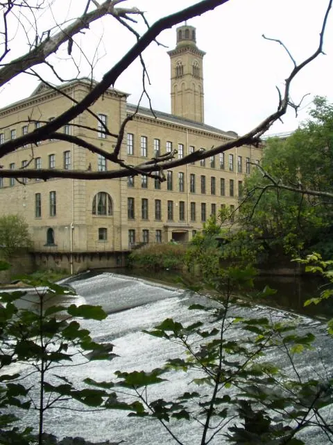
Photographs of churches, listed buildings and monuments in the vicinity, contributed by volunteers to the Geograph project and reused here under a Creative Commons licence.
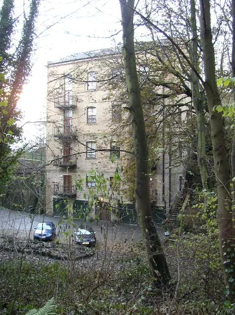
© Humphrey Bolton · Geograph · CC BY-SA 2.0

© David Spencer · Geograph · CC BY-SA 2.0
© Ian Rutson · Geograph · CC BY-SA 2.0
Images © their respective photographers, licensed under CC BY-SA 2.0 and reused here with attribution. Photographs depict listed buildings, churches and monuments near this settlement and may show neighbouring villages.
Data derived from the Open Domesday project (opendomesday.org), based on the Domesday Book dataset compiled by Professor J.J.N. Palmer and team. The Domesday Book (1086) is in the public domain.
Found an inaccuracy? [email protected]