Aston -on-Trent in the Domesday Book (1086)
Aston -on-Trent appears in the Domesday Book of 1086, entered under the hundred of Litchurch in Derbyshire. The survey assessed Aston -on-Trent at 5.1 carucates of taxable land.
At the time of the survey, Aston -on-Trent supported a recorded population of 8 villagers, 21 smallholders, 3 slaves, working 10 ploughs between them.
By 1086 Aston -on-Trent was worth 10 shillings, up from 8 shillings before the Conquest – one of the few settlements in the area to hold its value through the upheaval.
Resources Recorded at Aston -on-Trent (1086)
- Mills: 1 mill
- Meadow: 20 acres
- Woodland: 60 pigs
Other Settlements in Litchurch
- Allestree
- Alvaston
- Ambaston
- Arleston
- Barrow [-upon-Trent]
- Bearwardcote
- Boulton
- Burnaston
- Chellaston
- Cottons
- Dalbury
- Egginton
- Elvaston
- Etwall
The Meaning of the Name
The name Aston -on-Trent is of Anglo-Saxon origin. Its final element derives from the Old English word tūn, a farmstead or village. The first element is most likely a personal name or an early descriptive term, now difficult to recover with certainty. Taken together the name probably meant something close to ‘a farmstead’.
Remarkably, the name has changed little since 1086, when the Domesday scribes wrote it as Aston -on-Trent.
Listed Buildings Near Aston -on-Trent
Historic England records 14 listed buildings within about a mile of Aston -on-Trent. Listing protects structures of special architectural or historic interest, graded I (exceptional), II* (particularly important) and II.
Grade I
- Church of All Saints - 0.16 km
Grade II*
- Aston Hall - 0.31 km
Grade II
- 6, the Green - 0.06 km
- 16, the Green - 0.08 km
- Bus Shelter - 0.11 km
- 2 and 4, Weston Road - 0.12 km
- Lychgate and Attached Churchyard Walls to All Saints Church - 0.13 km
- Chest Tomb 20 metres south of Lychgate to All Saints Church - 0.13 km
- Chest Tomb 5 metres north of south porch to All Saints Church - 0.15 km
- 16 Weston Road - 0.15 km
- Ledmore - 0.19 km
- Longcroft Farmhouse - 0.19 km
- Trent and Mersey Canal Aston Lock and Aston Lock Bridge - 0.9 km
- Trent and Mersey Canal, Canal Milepost to East of Weston Grange at Sk 420 286 - 0.94 km
Scheduled Monuments Near Aston -on-Trent
Scheduled monuments are nationally important archaeological sites given legal protection. 2 lie within roughly a mile of Aston -on-Trent:
- Iron Age settlement and cursus, with other air photographic marks, SE of Aston-on-Trent - 0.62 km
- Henge complex NW of Hickens Bridge - 1.3 km
Aston -on-Trent Today
Today Aston -on-Trent lies within the administrative area of Aston upon Trent, and the settlement recorded a population of 1,682 at recent figures. Nine and a half centuries separate that figure from the small rural community the Domesday survey recorded here in 1086.
Read more about modern Aston-on-Trent on Wikipedia .
Nearby Domesday Settlements
Other places recorded in the 1086 survey within a few miles:
- Weston -on-Trent - 1.4 km SW
- Shardlow - 2.2 km NE
- Marsh? - 2.2 km NW
- Thulston - 2.2 km NW
- Elvaston - 3.0 km N
- Chellaston - 3.2 km W
Heritage Around Aston [-on-Trent]
Photographs of churches, listed buildings and monuments in the vicinity, contributed by volunteers to the Geograph project and reused here under a Creative Commons licence.
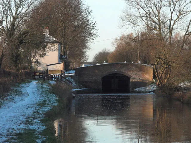
© Jerry Evans · Geograph · CC BY-SA 2.0
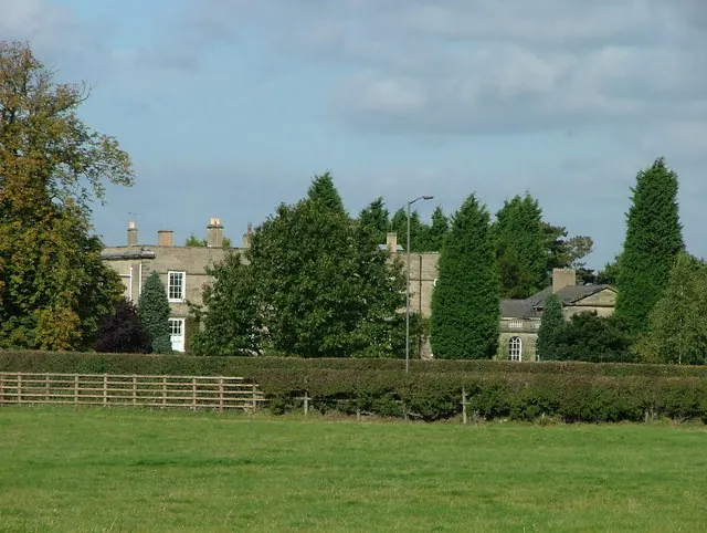
© J147 · Geograph · CC BY-SA 2.0
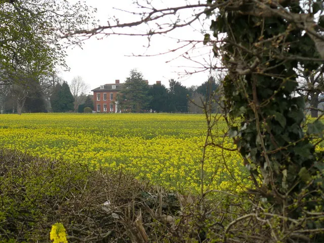
© Andy Jamieson · Geograph · CC BY-SA 2.0
Images © their respective photographers, licensed under CC BY-SA 2.0 and reused here with attribution. Photographs depict listed buildings, churches and monuments near this settlement and may show neighbouring villages.
Data derived from the Open Domesday project (opendomesday.org), based on the Domesday Book dataset compiled by Professor J.J.N. Palmer and team. The Domesday Book (1086) is in the public domain.
Found an inaccuracy? [email protected]