Askwith in the Domesday Book (1086)
Askwith appears in the Domesday Book of 1086, entered under the hundred of Burghshire in Yorkshire.
Other Settlements in Burghshire
- Addlethorpe
- Aismunderby
- Aldfield
- Allerton [Mauleverer]
- Arkendale
- Azerley
- Barrowby [Grange]
- Beckwith [House]
- Besthaim
- Bestham
- Bewerley
- Bilton
- Birstwith
- Bramley [Grange]
The Meaning of the Name
The name Askwith is of Scandinavian origin. Its final element derives from the Old Norse word viðr, a wood. The first element is most likely a personal name or an early descriptive term, now difficult to recover with certainty. Taken together the name probably meant something close to ‘a wood’.
Names of this type are a fingerprint of Scandinavian settlement: they cluster across the old Danelaw, where Norse-speaking settlers renamed or founded villages from the late 9th century onward.
Remarkably, the name has changed little since 1086, when the Domesday scribes wrote it as Askwith.
Listed Buildings Near Askwith
Historic England records 11 listed buildings within about a mile of Askwith. Listing protects structures of special architectural or historic interest, graded I (exceptional), II* (particularly important) and II.
Grade II
- Sundial Farmhouse and Attached Barn - 0.13 km
- Manor House - 0.3 km
- Ibbotson Farmhouse and Attached Barn - 0.65 km
- Quaker Cottage - 0.69 km
- Old Vicarage - 0.78 km
- Scales House and Attached Outbuilding - 0.88 km
- Carr Farmhouse - 0.98 km
- Pump and Trough Approximately 10 Metres East of Quarry House - 1.0 km
- Quarry House and Attached Farm Buildings - 1.02 km
- East Lodges to Denton Park With Walls Flanking Drive to East - 1.05 km
- Bridge Over Hundwith Gill - 1.27 km
Scheduled Monuments Near Askwith
Scheduled monuments are nationally important archaeological sites given legal protection. 2 lie within roughly a mile of Askwith:
- Cup and groove marked rock east of New Close Quarry, 300m south west of Whitbeck Manor - 0.7 km
- Cup and grooved marked rock in tree line between New Close Quarry and Poppling Well Beck, 280m south west of Whitbeck Manor - 0.73 km
Askwith Today
Today Askwith lies within the administrative area of Harrogate, and the settlement recorded a population of 251 at the 2021 census. Nine and a half centuries separate that figure from the small rural community the Domesday survey recorded here in 1086.
Read more about modern Askwith on Wikipedia .
Nearby Domesday Settlements
Other places recorded in the 1086 survey within a few miles:
Heritage Around Askwith
Photographs of churches, listed buildings and monuments in the vicinity, contributed by volunteers to the Geograph project and reused here under a Creative Commons licence.
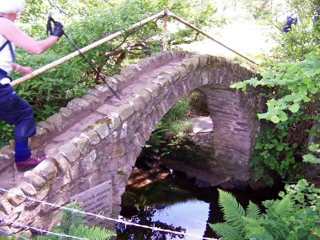
© Joe Regan · Geograph · CC BY-SA 2.0
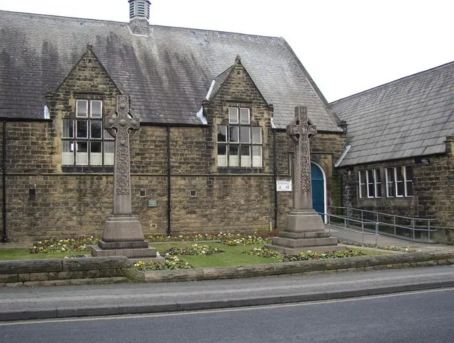
© Humphrey Bolton · Geograph · CC BY-SA 2.0
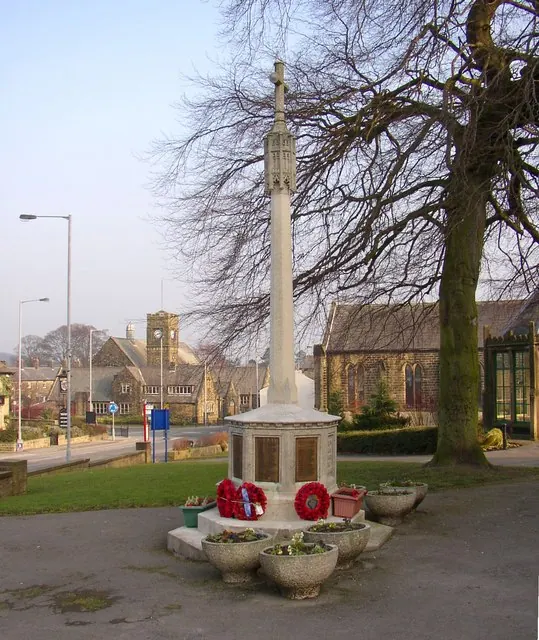
© Humphrey Bolton · Geograph · CC BY-SA 2.0
Images © their respective photographers, licensed under CC BY-SA 2.0 and reused here with attribution. Photographs depict listed buildings, churches and monuments near this settlement and may show neighbouring villages.
Data derived from the Open Domesday project (opendomesday.org), based on the Domesday Book dataset compiled by Professor J.J.N. Palmer and team. The Domesday Book (1086) is in the public domain.
Found an inaccuracy? [email protected]