Ashton in the Domesday Book (1086)
The 1086 Domesday survey records the settlement of Ashton, entered under the hundred of Rushton in Cheshire.
Other Settlements in Rushton
- Alpraham
- Alretone
- Beeston
- Bunbury and [Lower] Bunbury
- Burton
- Clotton
- Cocle
- Iddinshall
- Opetone
- Oulton
- Over
- Peckforton
- Rushton
- Spurstow
The Meaning of the Name
The name Ashton is of Anglo-Saxon origin. Its final element derives from the Old English word tūn, a farmstead or village, while the first element appears to represent ash-trees (OE æsc). Taken together the name probably meant something close to ’the ash-trees farmstead’.
Remarkably, the name has changed little since 1086, when the Domesday scribes wrote it as Ashton.
Listed Buildings Near Ashton
Historic England records 14 listed buildings within about a mile of Ashton. Listing protects structures of special architectural or historic interest, graded I (exceptional), II* (particularly important) and II.
Grade II*
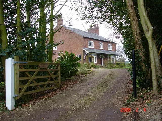
- Ashton Hall Farmhouse - 0.47 km
- Peel Hall - 0.8 km
Grade II
- April Cottage - 0.18 km
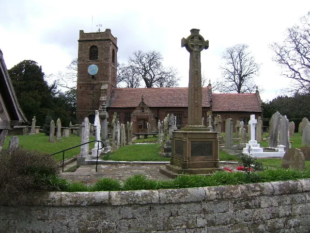
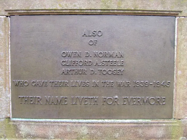
- Ashton Hayes War Memorial - 0.33 km
- Church of St John Evangelist - 0.37 km
- Ashton Village Hall - 0.39 km
- Farmbuilding Attached to North End of Ashton Hall - 0.46 km
- Garden Wall on East Side of Paddock South of Peel Hall - 0.75 km
- Garden Wall on West Side of Paddock South of Peel Hall - 0.79 km
- Garden Walls Around Garden to West Side of Peel Hall - 0.83 km
- Stonehouse Farmhouse - 1.02 km
- Poplargrove Farmhouse - 1.09 km
- Mouldsworth Hall - 1.26 km
- Roman Catholic Church of St Cuthbert by the Forest, including detached campanile - 1.29 km
Scheduled Monuments Near Ashton
Scheduled monuments are nationally important archaeological sites given legal protection. 1 lies within roughly a mile of Ashton:
- 14th century kiln - 0.24 km
Ashton Today
Today Ashton lies within the administrative area of Ashton Hayes and Horton-cum-Peel, and the settlement recorded a population of 936 at the 2011 census. Nine and a half centuries separate that figure from the small rural community the Domesday survey recorded here in 1086.
Read more about modern Ashton Hayes on Wikipedia .
Nearby Domesday Settlements
Other places recorded in the 1086 survey within a few miles:
- Manley - 2.0 km N
- Cocle - 2.2 km SE
- Tarvin - 2.8 km SW
- Willington - 3.6 km SE
- Great and Little Barrow - 4.0 km W
- Alvanley - 4.1 km N
Heritage Around Ashton
Photographs of churches, listed buildings and monuments in the vicinity, contributed by volunteers to the Geograph project and reused here under a Creative Commons licence.
© BrianPritchard · Geograph · CC BY-SA 2.0
© BrianPritchard · Geograph · CC BY-SA 2.0
© Mike Harris · Geograph · CC BY-SA 2.0
Images © their respective photographers, licensed under CC BY-SA 2.0 and reused here with attribution. Photographs depict listed buildings, churches and monuments near this settlement and may show neighbouring villages.
Data derived from the Open Domesday project (opendomesday.org), based on the Domesday Book dataset compiled by Professor J.J.N. Palmer and team. The Domesday Book (1086) is in the public domain.
Found an inaccuracy? [email protected]