Arncliffe in the Domesday Book (1086)
The 1086 Domesday survey records the settlement of Arncliffe, entered under the hundred of Craven in Yorkshire. The survey assessed Arncliffe at 6 carucates of taxable land.
At the time of the survey, Arncliffe supported a recorded population of 30 villagers, 23 freemanmen, working 12 ploughs between them.
The drop in value is hard to miss. Before 1066, Arncliffe was worth 8.5 shillings; by 1086 that had dropped to 8 shillings – a fall of 5%. Most Yorkshire villages that lost value on this scale were swept up in the Harrying of the North – William’s scorched-earth campaign of 1069–70.
The survey lists 2 manors at Arncliffe under different lords. Splitting a single settlement between multiple tenants was common across the North – Saxon estates broken up and handed to William’s followers after 1066.
Resources Recorded at Arncliffe (1086)
- Churches: 1
- Salthouses: 7
- Meadow: 60 acres
Other Settlements in Craven
- Addingham
- Airton
- Anley
- Appletreewick
- Arnford
- Barnoldswick
- Bashall [Eaves]
- Battersby [Barn]
- Beamsley
- Birkby [Hall]
- Bogeuurde
- Bolton [Abbey]
- Bolton [by Bowland]
- Bordley
The Meaning of the Name
The name Arncliffe is of Anglo-Saxon origin. Its final element derives from the Old English word clif, a cliff or steep slope. The first element is most likely a personal name or an early descriptive term, now difficult to recover with certainty. Taken together the name probably meant something close to ‘a slope’.
Remarkably, the name has changed little since 1086, when the Domesday scribes wrote it as Arncliffe.
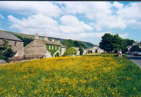
Listed Buildings Near Arncliffe
Historic England records 29 listed buildings within about a mile of Arncliffe. Listing protects structures of special architectural or historic interest, graded I (exceptional), II* (particularly important) and II.
Grade II
- Barn Approximately 10 Metres Southwest of Carr Farmhouse - 0.45 km
- Carr Farmhouse - 0.46 km
- Outbuilding Approximately 5 Metres West of Carr Farmhouse - 0.47 km
- Plane Tree Cottage - 0.48 km
- Elm House - 0.48 km
- Post Office Cottage - 0.49 km
- K6 Telephone Kiosk in Front of Post Office Cottage - 0.49 km
- Castle Farmhouse - 0.5 km
- Barn Southeast of Lane Top Farmhouse - 0.51 km
- The Old Vicarage - 0.51 km
- Lane Top Farmhouse - 0.53 km
- Lane Top Cottage - 0.54 km
- 1 and 2 Castle Yard - 0.54 km
- Pump Housing and Trough - 0.55 km
- Low Ryelands Farmhouse - 0.55 km
- The Falcon Public House - 0.58 km
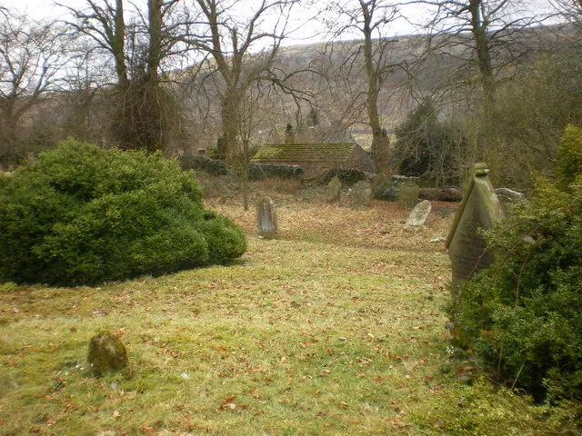
- Church of St Oswald - 0.58 km
- High Ryelands - 0.58 km
- Rose Cottage - 0.6 km
- High Green Cottage - 0.61 km
- Arncliffe Bridge Over River Skirfare - 0.61 km
- Prospect House - 0.63 km
- Green Farmhouse - 0.65 km
- Green Cottage - 0.67 km
…and 5 more listed structures in the area.
Scheduled Monuments Near Arncliffe
Scheduled monuments are nationally important archaeological sites given legal protection. 2 lie within roughly a mile of Arncliffe:
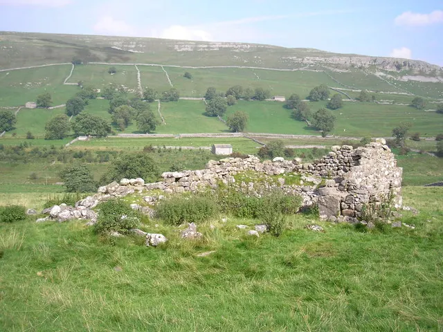
- Settlement on Blue Scar - 0.6 km
- Cairn on Blue Scar 460m NW of Springs Cave - 0.77 km
Arncliffe Today
Today Arncliffe lies within the administrative area of Craven, and the settlement recorded a population of 66 at the 2021 census. Nine and a half centuries separate that figure from the small rural community the Domesday survey recorded here in 1086.
Read more about modern Arncliffe on Wikipedia .
Nearby Domesday Settlements
Other places recorded in the 1086 survey within a few miles:
- Hawkswick - 2.2 km SE
- Starbotton - 3.6 km NE
- Kettlewell - 4.1 km E
- Litton - 4.2 km NW
- Kilnsey - 5.6 km SE
- Conistone - 6.4 km SE
Heritage Around Arncliffe
Photographs of churches, listed buildings and monuments in the vicinity, contributed by volunteers to the Geograph project and reused here under a Creative Commons licence.
© John Illingworth · Geograph · CC BY-SA 2.0
© Alexander P Kapp · Geograph · CC BY-SA 2.0
© Gordon Hatton · Geograph · CC BY-SA 2.0
Images © their respective photographers, licensed under CC BY-SA 2.0 and reused here with attribution. Photographs depict listed buildings, churches and monuments near this settlement and may show neighbouring villages.
Data derived from the Open Domesday project (opendomesday.org), based on the Domesday Book dataset compiled by Professor J.J.N. Palmer and team. The Domesday Book (1086) is in the public domain.
Found an inaccuracy? [email protected]