Arkholme in the Domesday Book (1086)
Arkholme is named in the Domesday Book, compiled by Norman commissioners in 1086, entered under the hundred of Amounderness in Yorkshire.
Other Settlements in Amounderness
- Aighton
- Aldcliffe
- Aldingham
- Aschebi
- Ashton [Hall]
- Ashton [on Ribble]
- Austwick
- Barbon
- Bardsea
- Bare
- Barnoldswick
- Barton
- Beetham
- Bispham
The Meaning of the Name
The name Arkholme is of Scandinavian origin. Its final element derives from the Old Norse word holmr, an island or patch of raised ground in marsh. The first element is most likely a personal name or an early descriptive term, now difficult to recover with certainty. Taken together the name probably meant something close to ‘a island’.
Names of this type are a fingerprint of Scandinavian settlement: they cluster across the old Danelaw, where Norse-speaking settlers renamed or founded villages from the late 9th century onward.
Remarkably, the name has changed little since 1086, when the Domesday scribes wrote it as Arkholme.
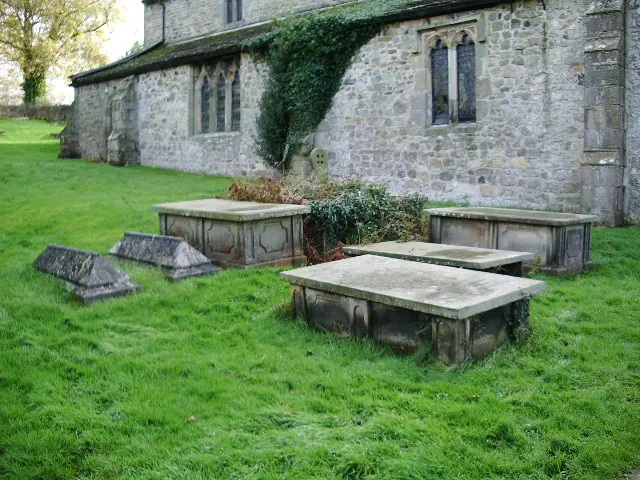
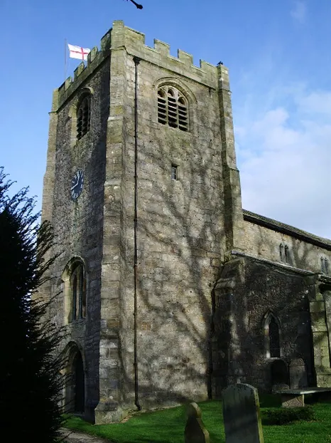
Listed Buildings Near Arkholme
Historic England records 22 listed buildings within about a mile of Arkholme. Listing protects structures of special architectural or historic interest, graded I (exceptional), II* (particularly important) and II.
Grade II*
- Church of St John the Baptist - 0.72 km
Grade II
- Milestone - 0.31 km
- Bay Horse Hotel - 0.41 km
- Smithy Cottage, the Forge, and Former Smithy Adjoining to North - 0.42 km
- Arkholme Church of England Primary School and House Adjoining to South-east - 0.44 km
- The Caulking House and Garage Adjoining to East - 0.48 km
- Goss House - 0.5 km
- Undercroft - 0.5 km
- Willow Cottage - 0.51 km
- Green Bank Cottage - 0.53 km
- Poole House - 0.53 km
- Reading Room Cottage - 0.53 km
- Rose Cottage and Glen Cross - 0.54 km
- Brunt Hill - 0.57 km
- Cort House - 0.58 km
- Cawood House - 0.61 km
- Chapel House - 0.66 km
- Cross House - 0.69 km
- Village Pound - 0.71 km
- Cross Base, Approximately 2 Metres South of Church of St John the Baptist - 0.74 km
- Lune Cottage - 0.82 km
- Higher Broomfield Farmhouse - 1.06 km
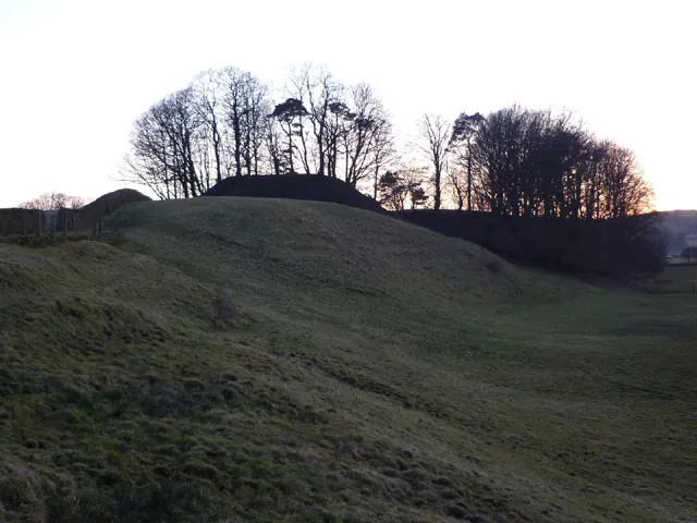
Scheduled Monuments Near Arkholme
Scheduled monuments are nationally important archaeological sites given legal protection. 1 lies within roughly a mile of Arkholme:
- Chapel Hill Motte, Arkholme - 0.72 km
Arkholme Today
Today Arkholme lies within the administrative area of Arkholme-with-Cawood.
Read more about modern Arkholme on Wikipedia .
Nearby Domesday Settlements
Other places recorded in the 1086 survey within a few miles:
- Melling - 1.4 km SE
- Tunstall - 2.2 km NE
- Newton - 2.2 km NE
- Gressingham - 3.2 km S
- Wennington - 3.6 km SE
- Tatham - 3.6 km SE
Heritage Around Arkholme
Photographs of churches, listed buildings and monuments in the vicinity, contributed by volunteers to the Geograph project and reused here under a Creative Commons licence.
© Karl and Ali · Geograph · CC BY-SA 2.0
© Alexander P Kapp · Geograph · CC BY-SA 2.0
© Alexander P Kapp · Geograph · CC BY-SA 2.0
Images © their respective photographers, licensed under CC BY-SA 2.0 and reused here with attribution. Photographs depict listed buildings, churches and monuments near this settlement and may show neighbouring villages.
Data derived from the Open Domesday project (opendomesday.org), based on the Domesday Book dataset compiled by Professor J.J.N. Palmer and team. The Domesday Book (1086) is in the public domain.
Found an inaccuracy? [email protected]