Stanwick in the Domesday Book (1086)
Stanwick is named in the Domesday Book, compiled by Norman commissioners in 1086, entered under the hundred of Land of Count Alan in Yorkshire.
Other Settlements in Land of Count Alan
- Achebi
- Agglethorpe
- Ainderby [Mires]
- Ainderby [Quernhow]
- Aiskew
- Aldbrough
- Allerthorpe [Hall]
- Ascam
- Ascham
- Asebi
- Aske [Hall]
- Askrigg
- Aysgarth
- Baldersby
The Meaning of the Name
The name Stanwick is of Anglo-Saxon origin. Its final element derives from the Old English word wīc, a dwelling, dairy farm or trading settlement, while the first element appears to represent stone (OE stān). Taken together the name probably meant something close to ’the stone specialised farm’.
The Domesday commissioners of 1086 recorded the place as another Stanwick - the spelling has shifted over the nine centuries since, as the name passed from Norman scribes through Middle English into its modern form.
Listed Buildings Near Stanwick
Historic England records 21 listed buildings within about a mile of Stanwick. Listing protects structures of special architectural or historic interest, graded I (exceptional), II* (particularly important) and II.
Grade I
- Church of St John the Baptist - 0.51 km
Grade II
- Gate Piers and Quadrant Walls Formerly Torear Entrance to Stanwick Hall - 0.14 km
- Clock House and Attached Gate Piers - 0.17 km
- Kirk Bridge - 0.42 km
- Kirkbridge House, Stanwick Old Hall and Attached Gate Piers - 0.45 km
- Deer Shelter - 0.46 km
- Newcomb Memorial Approximately Seven Metres South of Porch of Church of St John the Baptist * - 0.49 km
- Group of Four Tombstones Approximately Two Metres East of Porch of Church of St John Baptist - 0.49 km
- Slater Memorial Approximately Six Metres South of Porch of Church of St John the Baptist - 0.49 km
- Four Tombstones in A Line Approximately Five Metres South of South West Corner of South Aisle of Church of St John the Baptist - 0.5 km
- Saxon Cross-shaft Approximately 3 Metres South of Chancel of Church of St John the Baptist - 0.5 km
- Well Approximately One Hundred Metres North East East of Church of St John the Baptist - 0.52 km
- Well Approximately One Hundred and Fifty Metres North North East St John the Baptist* - 0.66 km
- The Kennels - 0.99 km
- Park House - 1.03 km
- Former Coachhouse Approximately One Hundred and Fifty Metres to West of Carlton Hall - 1.14 km
- Bridge Over Aldbrough Beck - 1.2 km
- Two Panelled Chest Tombs Approximately Three Metres South of East End of Chancel of Church of St Cuthbert - 1.27 km
- Walker tombstone approximately 4 metres south-east of south-east corner of nave of Church of St Cuthbert - 1.28 km
- Ambrose Pierson Panelled Chest Tomb Approximately Six Metres South of Nave of Church of St Cuthbert - 1.28 km
- Church of St Cuthbert - 1.29 km
Scheduled Monuments Near Stanwick
Scheduled monuments are nationally important archaeological sites given legal protection. 3 lie within roughly a mile of Stanwick:
- Stanwick Late Iron Age oppidum, Iron Age and medieval settlement, early Christian church and sculpture and post-medieval emparkment - 0.37 km
- Section of Scots Dyke linear boundary, 650m ENE of Park House - 1.35 km
- Section of Scots Dyke linear boundary 600m south east of Park House - 1.48 km
Stanwick Today
Today Stanwick lies within the administrative area of Richmondshire, and the settlement recorded a population of 130 at the 2021 census. Nine and a half centuries separate that figure from the small rural community the Domesday survey recorded here in 1086.
Read more about modern Stanwick St John on Wikipedia .
Nearby Domesday Settlements
Other places recorded in the 1086 survey within a few miles:
Heritage Around another Stanwick
Photographs of churches, listed buildings and monuments in the vicinity, contributed by volunteers to the Geograph project and reused here under a Creative Commons licence.
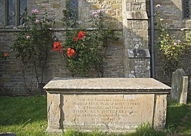
© Stanley Howe · Geograph · CC BY-SA 2.0
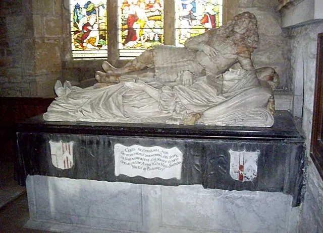
© Stanley Howe · Geograph · CC BY-SA 2.0
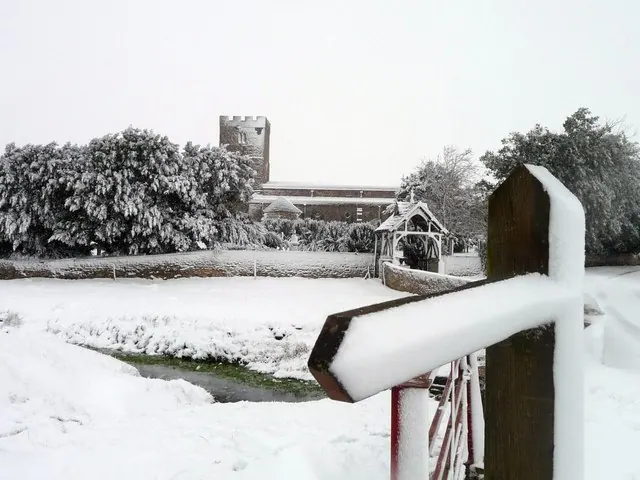
© RMeacher · Geograph · CC BY-SA 2.0
Images © their respective photographers, licensed under CC BY-SA 2.0 and reused here with attribution. Photographs depict listed buildings, churches and monuments near this settlement and may show neighbouring villages.
Location
54.4983°N, -1.7143°W · Land of Count Alan hundred, Yorkshire
View larger map on OpenStreetMap →Data derived from the Open Domesday project (opendomesday.org), based on the Domesday Book dataset compiled by Professor J.J.N. Palmer and team. The Domesday Book (1086) is in the public domain.
Found an inaccuracy? [email protected]