Alvaston in the Domesday Book (1086)
The 1086 Domesday survey records the settlement of Alvaston, entered under the hundred of Litchurch in Derbyshire.
Other Settlements in Litchurch
- Allestree
- Ambaston
- Arleston
- Aston [-on-Trent]
- Barrow [-upon-Trent]
- Bearwardcote
- Boulton
- Burnaston
- Chellaston
- Cottons
- Dalbury
- Egginton
- Elvaston
- Etwall
The Meaning of the Name
The name Alvaston is of Anglo-Saxon origin. Its final element derives from the Old English word tūn, a farmstead or village. The first element is most likely a personal name or an early descriptive term, now difficult to recover with certainty. Taken together the name probably meant something close to ‘a farmstead’.
Remarkably, the name has changed little since 1086, when the Domesday scribes wrote it as Alvaston.
Listed Buildings Near Alvaston
Historic England records 21 listed buildings within about a mile of Alvaston. Listing protects structures of special architectural or historic interest, graded I (exceptional), II* (particularly important) and II.
Grade I
- Church of St Bartholomew - 1.2 km
Grade II*
- Church of St Mary - 1.23 km
- Elvaston Castle - 1.26 km
Grade II
- St Michael And All Angels Church - 0.38 km
- Church Farmhouse - 0.48 km
- 3 Church Street - 0.48 km
- 1 Church Street - 0.5 km
- Elm Cottage - 0.5 km
- The Poplars - 0.82 km
- The Kennels - 1.04 km
- Nunsfield House - 1.09 km
- Gate Piers and Attached Walls to West of Service Court at Elvaston Castle - 1.09 km
- Stable Block to East of the Kennels at Elvaston Castle - 1.09 km
- Springthorpe Cottage at Stableyard Entrance to Elvaston Castle - 1.1 km
- Farmbuildings to West of St Bartholomew’s Church at Elvaston Castle - 1.13 km
- Stables to West of Elvaston Castle Coach House - 1.15 km
- Sheep Dip in Service Court at Elvaston Castle - 1.17 km
- Information Centre and Shop at Elvaston Castle - 1.18 km
- Coach House and Attached Buildings at Elvaston Castle - 1.2 km
- Churchyard Walls and Attached Curtain Wall Between Coach House and Elvaston Castle - 1.22 km
- Moorish Temple and Attached Terrace in Elvaston Castle Gardens - 1.28 km
Alvaston Today
Today Alvaston lies within the administrative area of Derby, and the settlement recorded a population of 16,255 at recent figures. Nine and a half centuries separate that figure from the small rural community the Domesday survey recorded here in 1086.
Read more about modern Alvaston on Wikipedia .
Nearby Domesday Settlements
Other places recorded in the 1086 survey within a few miles:
Heritage Around Alvaston
Photographs of churches, listed buildings and monuments in the vicinity, contributed by volunteers to the Geograph project and reused here under a Creative Commons licence.
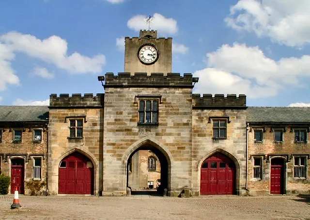
© Chris J Dixon · Geograph · CC BY-SA 2.0
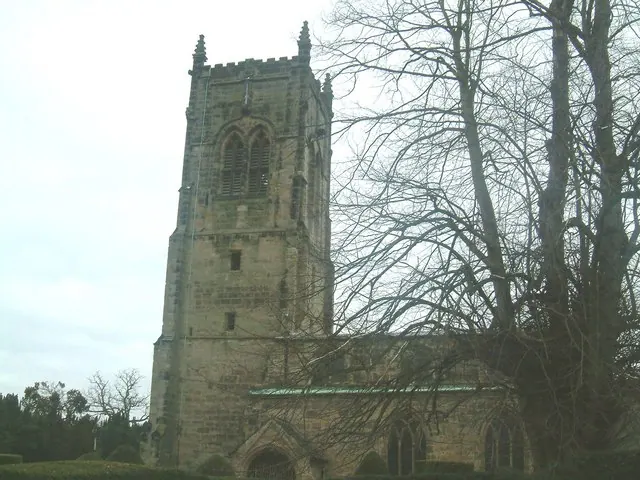
© Tom Wosik · Geograph · CC BY-SA 2.0
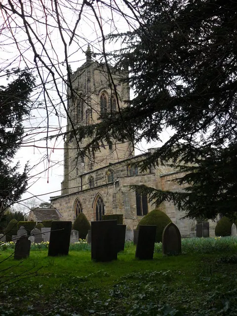
© Andy Jamieson · Geograph · CC BY-SA 2.0
Images © their respective photographers, licensed under CC BY-SA 2.0 and reused here with attribution. Photographs depict listed buildings, churches and monuments near this settlement and may show neighbouring villages.
Data derived from the Open Domesday project (opendomesday.org), based on the Domesday Book dataset compiled by Professor J.J.N. Palmer and team. The Domesday Book (1086) is in the public domain.
Found an inaccuracy? [email protected]